File:Awhum Water Fall Enugu, Nigeria.jpg
Jump to navigation
Jump to search
Size of this preview: 800 × 450 pixels. Other resolutions: 320 × 180 pixels | 640 × 360 pixels | 1,024 × 576 pixels | 1,280 × 720 pixels | 2,730 × 1,536 pixels.
Original file (2,730 × 1,536 pixels, file size: 538 KB, MIME type: image/jpeg)
Captions
Captions
Add a one-line explanation of what this file represents
Summary
[edit]
| Description |
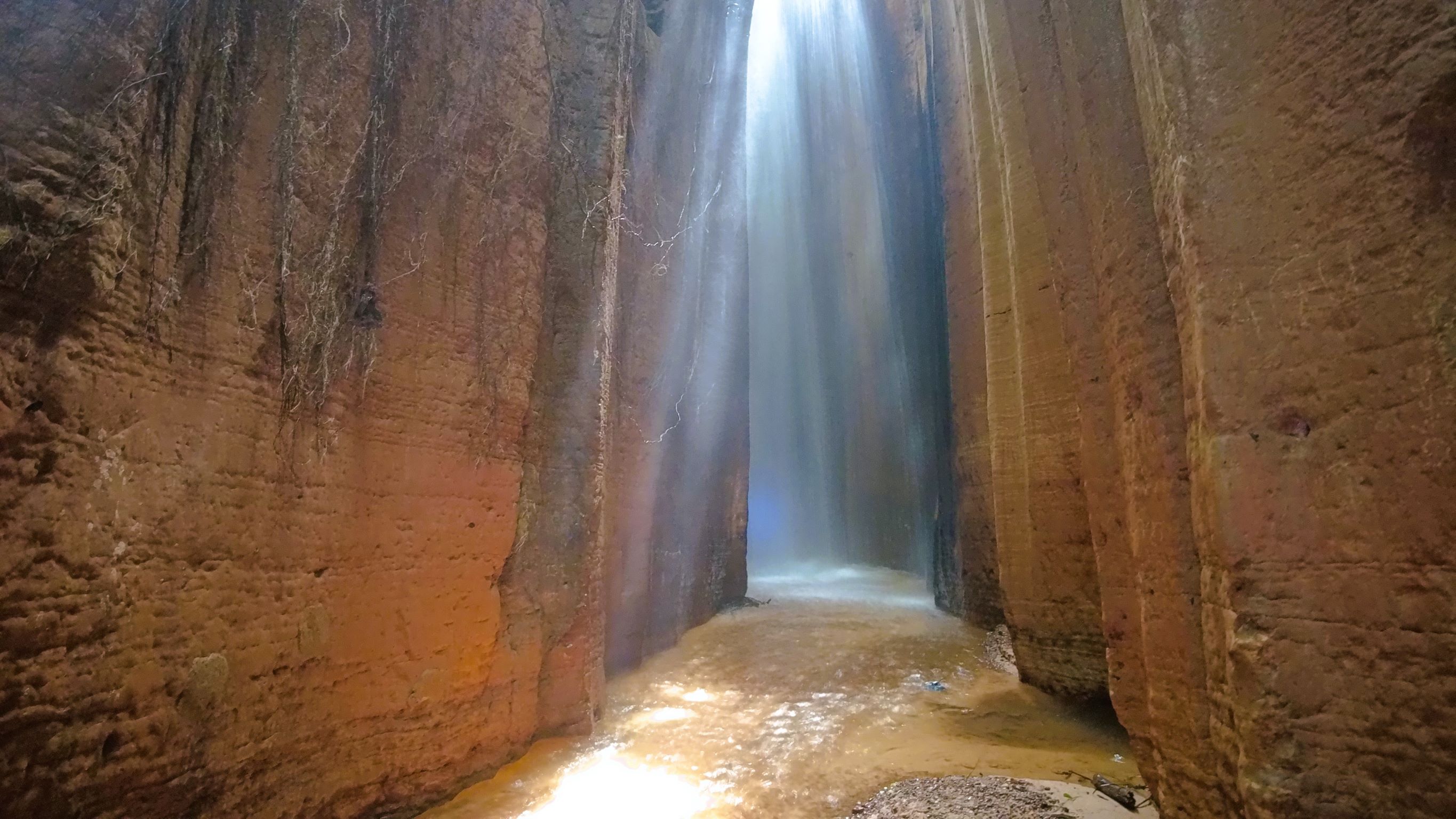
English: The Awhum Waterfall is located at Amaugwe village of Awhum town in Udi Local Government Area, Enugu State, Nigeria. The Awhum Waterfall is formed out of a massive outcrop of granite rock with water flow at the top forming a stream. Some part of the waterfall is usually warm through the seasons. |
| Date | |
| Source | Own work |
| Author | David Nkwa (Nkwafilms) |
| Camera location | | View this and other nearby images on: OpenStreetMap |
|---|
This image was uploaded as part of Wiki Loves Earth 2022.
|
 |
Assessment
[edit]

|
This image won the 12th prize in the national contest of Nigeria in Wiki Loves Earth 2022 Other languages:
|
Licensing
[edit]
I, the copyright holder of this work, hereby publish it under the following license:
This file is licensed under the Creative Commons Attribution-Share Alike 4.0 International license.
- You are free:
- to share – to copy, distribute and transmit the work
- to remix – to adapt the work
- Under the following conditions:
- attribution – You must give appropriate credit, provide a link to the license, and indicate if changes were made. You may do so in any reasonable manner, but not in any way that suggests the licensor endorses you or your use.
- share alike – If you remix, transform, or build upon the material, you must distribute your contributions under the same or compatible license as the original.
File history
Click on a date/time to view the file as it appeared at that time.
| Date/Time | Thumbnail | Dimensions | User | Comment | |
|---|---|---|---|---|---|
| current | 13:34, 18 June 2022 | | 2,730 × 1,536 (538 KB) | Nkwafilms (talk | contribs) | Uploaded own work with UploadWizard |
You cannot overwrite this file.
File usage on Commons
The following 2 pages use this file:
File usage on other wikis
The following other wikis use this file:
- Usage on en.wikipedia.org
- Usage on fa.wikipedia.org
- Usage on fr.wikipedia.org
- Usage on th.wikipedia.org