File:Greater London UK location map 2.svg
Vai alla navigazione
Vai alla ricerca

Dimensioni di questa anteprima PNG per questo file SVG: 750 × 600 pixel. Altre risoluzioni: 300 × 240 pixel | 600 × 480 pixel | 960 × 768 pixel | 1 280 × 1 024 pixel | 2 560 × 2 048 pixel | 1 425 × 1 140 pixel.
File originale (file in formato SVG, dimensioni nominali 1 425 × 1 140 pixel, dimensione del file: 2,18 MB)
Didascalie
Didascalie
Aggiungi una brevissima spiegazione di ciò che questo file rappresenta
| Descrizione |
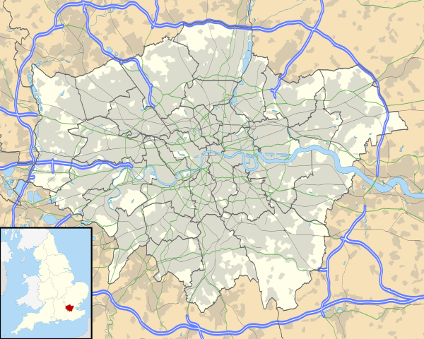
Map of Greater London, UK with the following information shown:
The data includes both primary routes and railway lines. Equirectangular map projection on WGS 84 datum, with N/S stretched 160% Geographic limits:
|
| Data | |
| Fonte |
|
| Autore | Nilfanion, created using Ordnance Survey data |
| Licenza (Riusare questo file) |
Questo file è disponibile in base alla licenza Creative Commons Attribuzione-Condividi allo stesso modo 3.0 Unported Attribuzione: Contains Ordnance Survey data © Crown copyright and database right
|
| Altre versioni | File:Greater London UK district map (blank).svg - Blank map, File:Greater London UK location map.svg - excluding primary routes and railways |
.svg)
Cronologia del file
Fare clic su un gruppo data/ora per vedere il file come si presentava nel momento indicato.
| Data/Ora | Miniatura | Dimensioni | Utente | Commento | |
|---|---|---|---|---|---|
| attuale | 17:43, 5 ott 2010 | | 1 425 × 1 140 (2,18 MB) | Nilfanion (discussione | contributi) | {{Information |Description=Map of Greater London, UK with the following information shown: *Administrative borders *Coastline, lakes and rivers *Roads and railways *Urban areas The data includes both primary routes and railway lines. |
Impossibile sovrascrivere questo file.
Utilizzo del file
Le seguenti 41 pagine usano questo file:
- File:BLANK in Greater London.svg
- File:Barking and Dagenham in Greater London.svg
- File:Barnet in Greater London.svg
- File:Bexley in Greater London.svg
- File:Brent in Greater London.svg
- File:Bromley in Greater London.svg
- File:Camden in Greater London.svg
- File:City of London (ceremonial county) in its region.svg
- File:City of London in Greater London.svg
- File:City of Westminster in Greater London.svg
- File:Croydon in Greater London.svg
- File:Ealing in Greater London.svg
- File:Enfield in Greater London.svg
- File:Great North Wood map.png
- File:Greater London (ceremonial county) in its region.svg
- File:Greater London in Greater London (-City of London).svg
- File:Greater london outline map bw.png
- File:Greenwich in Greater London.svg
- File:Hackney in Greater London.svg
- File:Hammersmith and Fulham in Greater London.svg
- File:Haringey in Greater London.svg
- File:Harrow in Greater London.svg
- File:Havering in Greater London.svg
- File:Hillingdon in Greater London.svg
- File:Hounslow in Greater London.svg
- File:Islington in Greater London.svg
- File:Kensington and Chelsea in Greater London.svg
- File:Kingston upon Thames in Greater London.svg
- File:Lambeth in Greater London.svg
- File:Lewisham in Greater London.svg
- File:M25 cat killer map.png
- File:Map of Network Rail Strategic Routes in England and Wales 2014.svg
- File:Merton in Greater London.svg
- File:Newham in Greater London.svg
- File:Redbridge in Greater London.svg
- File:Richmond in Greater London.svg
- File:Southwark in Greater London.svg
- File:Sutton in Greater London.svg
- File:Tower Hamlets in Greater London.svg
- File:Waltham Forest in Greater London.svg
- File:Wandsworth in Greater London.svg
_in_its_region.svg)
_in_its_region.svg)
.svg)
Utilizzo globale del file
Anche i seguenti wiki usano questo file:
- Usato nelle seguenti pagine di af.wikipedia.org:
- Londense Tower
- Westminster-abdy
- Twickenham
- Greenwich (Londen)
- Penge (Londen)
- Paleis van Westminster
- Canary Wharf
- St John's Wood
- Marylebone
- Stratford, Londen
- Queen Elizabeth Olympic Park
- Sjabloon:Liggingkaart Groter Londen
- Leyton
- Charing Cross
- Lughawe Londen-Heathrow
- Strand, Londen
- Muswell Hill
- London City-lughawe
- Dulwich Village
- Hampstead
- Silvertown
- Shoreditch
- Islington
- Clerkenwell
- Holland Park
- Soho
- Chelsea, Londen
- Southwark
- Hackney Central
- Notting Hill
- Paddington
- Crouch End
- Highgate
- Primrose Hill
- Bloomsbury
- Camden Town
- Spitalfields
- Vauxhall
- Holborn
- Kensington
- Battersea
- Belgravia
- Limehouse
- Bishopsgate
- Usato nelle seguenti pagine di ar.wikipedia.org:
Visualizza l'utilizzo globale di questo file.