File:LakeChadBolaerialphoto.jpg
Jump to navigation
Jump to search
No higher resolution available.
LakeChadBolaerialphoto.jpg (450 × 324 pixels, file size: 104 KB, MIME type: image/jpeg)
Captions
Captions
Add a one-line explanation of what this file represents
Summary[edit]
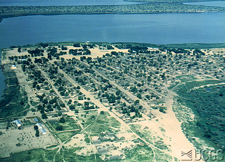
Aerial photo of Bol, Chad, in 1971. From U.S. Geological Survey.
Licensing[edit]
This image is in the public domain in the United States because it only contains materials that originally came from the United States Geological Survey, an agency of the United States Department of the Interior. For more information, see the official USGS copyright policy.
|
File history
Click on a date/time to view the file as it appeared at that time.
| Date/Time | Thumbnail | Dimensions | User | Comment | |
|---|---|---|---|---|---|
| current | 09:15, 29 May 2007 | | 450 × 324 (104 KB) | Amcaja (talk | contribs) | Aerial photo of Bol, Chad, in 1971. From [http://edc.usgs.gov/earthshots/slow/LakeChad/LakeChadBolaerialphoto U.S. Geological Survey]. Category:Geography of Chad |
You cannot overwrite this file.
File usage on Commons
There are no pages that use this file.
File usage on other wikis
The following other wikis use this file:
- Usage on ar.wikipedia.org
- Usage on arz.wikipedia.org
- Usage on ca.wikipedia.org
- Usage on ceb.wikipedia.org
- Usage on da.wikipedia.org
- Usage on de.wikipedia.org
- Usage on en.wikipedia.org
- Usage on en.wikivoyage.org
- Usage on es.wikipedia.org
- Usage on eu.wikipedia.org
- Usage on fi.wikipedia.org
- Usage on frr.wikipedia.org
- Usage on fr.wikipedia.org
- Usage on hi.wikipedia.org
- Usage on hy.wikipedia.org
- Usage on it.wikipedia.org
- Usage on ja.wikipedia.org
- Usage on mrj.wikipedia.org
- Usage on nl.wikipedia.org
- Usage on no.wikipedia.org
- Usage on pa.wikipedia.org
- Usage on pl.wikipedia.org
- Usage on ro.wikipedia.org
- Usage on ru.wikipedia.org
- Usage on sh.wikipedia.org
- Usage on su.wikipedia.org
- Usage on sv.wikipedia.org
- Usage on uk.wikipedia.org
- Usage on www.wikidata.org
- Usage on zh.wikipedia.org
- Usage on zh.wikivoyage.org