File:NGA-Atlantic Loran.png
Bước tới điều hướng
Bước tới tìm kiếm
Kích thước hình xem trước: 800×589 điểm ảnh. Độ phân giải khác: 320×235 điểm ảnh | 640×471 điểm ảnh | 1.024×753 điểm ảnh | 1.280×942 điểm ảnh | 2.044×1.504 điểm ảnh.
Tập tin gốc (2.044×1.504 điểm ảnh, kích thước tập tin: 241 kB, kiểu MIME: image/png)
Chú thích
Chú thích
Ghi một dòng giải thích những gì có trong tập tin này
Miêu tả[sửa]
| Miêu tả |
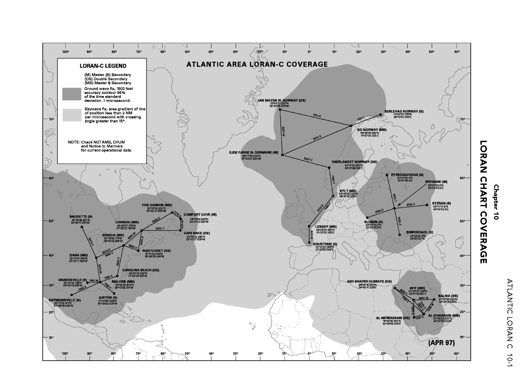
English: Coverage of Atlantic Ocean LORAN-C chains as in 2006. |
| Ngày | (first publication of chart April 1997) |
| Nguồn gốc | From DoD General Planning, 6 July 2006, NGA ref PLANXGP, page 10-1. |
| Tác giả | unlisted - collective work |
| Phiên bản khác |
This picture is part of a set: LORAN-C World coverage (2006)
|


Giấy phép[sửa]
This image is a work of the United States National Geospatial-Intelligence Agency or one of its predecessor agencies. As a work of the U.S. federal government, the image is in the public domain.
|
 |
This file was reviewed on 28 May 2009 by the administrator or trusted user Jappalang (talk), who confirmed the Public Domain status on that date.
See talk page for why this image's PD status was endorsed by PD reviewers. |
Lịch sử tập tin
Nhấn vào ngày/giờ để xem nội dung tập tin tại thời điểm đó.
| Ngày/Giờ | Hình xem trước | Kích cỡ | Thành viên | Miêu tả | |
|---|---|---|---|---|---|
| hiện tại | 04:52, ngày 4 tháng 5 năm 2009 | | 2.044×1.504 (241 kB) | Sv1xv (thảo luận | đóng góp) | Larger size. |
| 06:58, ngày 26 tháng 4 năm 2009 |  | 1.087×799 (176 kB) | Sv1xv (thảo luận | đóng góp) | {{Information |Description={{en|1=Coverage of Atlantic Ocean LORAN-C chains as in 2006.}} |Source= From DoD ''General Planning, 6 July 2006'', NGA ref ''PLANXGP''. |Author=unlisted - collective work |Date=2006-07-06 |Permission= |other_versions= }} ==Lice |
Bạn không được phép ghi đè tập tin này.
Trang sử dụng tập tin
3 trang sau sử dụng tập tin này:
Sử dụng tập tin toàn cục
Những wiki sau đang sử dụng tập tin này: