File:OR-districts-108.JPG
Bước tới điều hướng
Bước tới tìm kiếm
Không có độ phân giải cao hơn.
OR-districts-108.JPG (186×151 điểm ảnh, kích thước tập tin: 5 kB, kiểu MIME: image/jpeg)
Chú thích
Chú thích
Ghi một dòng giải thích những gì có trong tập tin này
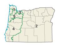
| Miêu tả | Image adapted from US fed gov't source nationalatlas.gov en:Category:Oregon maps | |||
| Nguồn gốc | National Atlas of the United States | |||
| Tác giả | United States Department of the Interior | |||
| Giấy phép (Dùng lại tập tin) |
|
Nhật trình tải lên đầu tiên
[sửa]
Trang miêu tả gốc từng tồn tại ở đây. Tất cả các tên người dùng sau là tên người dùng tại en.wikipedia.
- 2004-02-29 02:15 Seth Ilys 186×151×8 (5367 bytes) {{msg:PD}} Image adapted from US fed gov't source nationalatlas.gov
Lịch sử tập tin
Nhấn vào ngày/giờ để xem nội dung tập tin tại thời điểm đó.
| Ngày/Giờ | Hình xem trước | Kích cỡ | Thành viên | Miêu tả | |
|---|---|---|---|---|---|
| hiện tại | 17:06, ngày 4 tháng 12 năm 2006 | | 186×151 (5 kB) | Shyam (thảo luận | đóng góp) | {{Information |Description=Image adapted from US fed gov't source nationalatlas.gov en:Category:Oregon maps |Source=Originally from [http://en.wikipedia.org en.wikipedia]; description page is/was [http://en.wikipedia.org/w/index.php?title=Image%3AOR- |
Bạn không được phép ghi đè tập tin này.
Trang sử dụng tập tin
Không có trang nào sử dụng tập tin này.
Sử dụng tập tin toàn cục
Những wiki sau đang sử dụng tập tin này:
- Trang sử dụng tại ca.wikipedia.org
- Trang sử dụng tại de.wikipedia.org
- Trang sử dụng tại en.wikipedia.org
- Trang sử dụng tại es.wikipedia.org
- Trang sử dụng tại fr.wikipedia.org
- Trang sử dụng tại nl.wikipedia.org
- Trang sử dụng tại vi.wikipedia.org