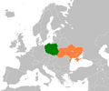
File:Poland Ukraine Locator.png
From Wikimedia Commons, the free media repository
Jump to navigation
Jump to search

Size of this preview: 720 × 600 pixels. Other resolutions: 288 × 240 pixels | 576 × 480 pixels | 922 × 768 pixels | 1,200 × 1,000 pixels.
Original file (1,200 × 1,000 pixels, file size: 65 KB, MIME type: image/png)
File information
Structured data
Captions
Captions
Add a one-line explanation of what this file represents
Summary
[edit]| DescriptionPoland Ukraine Locator.png | |
| Date | |
| Source |
Self made using :Image:BlankMap-Europe2.png (PD) Transferred from en.wikipedia |
| Author | Dancingwombatsrule |
Licensing
[edit]| Public domainPublic domainfalsefalse |
| |
This work has been released into the public domain by its author, Dancingwombatsrule, at the English Wikipedia project. This applies worldwide. In case this is not legally possible: |
Original upload log
[edit]The original description page was here. All following user names refer to en.wikipedia.
- 2007-07-23 15:25 Dancingwombatsrule 1357×628 (47538 bytes) Description: Map of the world indicating Poland and Ukraine. For use in [[Polish-Ukrainian Peace Force Battalion]] and similar articles. Source: Own work based on Image:BlankMap-World-v5.png Date: 23rd July 2007 Author: [[User:Dancingwombatsrule]] Per
- 2008-12-06 16:06 Dancingwombatsrule 800×487 (100556 bytes) scale in on Europe
- 2008-12-06 16:11 Dancingwombatsrule 594×362 (68318 bytes) Slightly crossing image to remove strange border.
- 2008-12-06 16:20 Dancingwombatsrule 798×485 (100048 bytes) better, wider crop
- 2012-01-23 01:42 Phoenix B 1of3 1200×1000 (66412 bytes) Better Map
File history
Click on a date/time to view the file as it appeared at that time.
| Date/Time | Thumbnail | Dimensions | User | Comment | |
|---|---|---|---|---|---|
| current | 03:25, 26 February 2012 |  | 1,200 × 1,000 (65 KB) | OgreBot (talk | contribs) | (BOT): Reverting to most recent version before archival |
| 03:25, 26 February 2012 |  | 798 × 485 (98 KB) | OgreBot (talk | contribs) | (BOT): Uploading old version of file from en.wikipedia; originally uploaded on 2008-12-06 16:20:57 by Dancingwombatsrule | |
| 03:25, 26 February 2012 |  | 594 × 362 (67 KB) | OgreBot (talk | contribs) | (BOT): Uploading old version of file from en.wikipedia; originally uploaded on 2008-12-06 16:11:58 by Dancingwombatsrule | |
| 03:25, 26 February 2012 |  | 800 × 487 (98 KB) | OgreBot (talk | contribs) | (BOT): Uploading old version of file from en.wikipedia; originally uploaded on 2008-12-06 16:06:05 by Dancingwombatsrule | |
| 03:25, 26 February 2012 |  | 1,357 × 628 (46 KB) | OgreBot (talk | contribs) | (BOT): Uploading old version of file from en.wikipedia; originally uploaded on 2007-07-23 15:25:02 by Dancingwombatsrule | |
| 16:40, 24 February 2012 |  | 1,200 × 1,000 (65 KB) | MGA73bot2 (talk | contribs) | == {{int:filedesc}} == {{Information |description={{en|1={{en|Map of Europe, highlighting Poland and Ukraine.}}}} |date=6 December 2008 |source=Self made using [[:en::Image:BlankMap-Europe2.png|:Image:BlankMap-Europe2.png... |
You cannot overwrite this file.
File usage on Commons
The following 2 pages use this file:
File usage on other wikis
The following other wikis use this file:
- Usage on ca.wikipedia.org
- Usage on de.wikipedia.org
- Usage on el.wikipedia.org
- Usage on en.wikipedia.org
- Usage on es.wikipedia.org
- Usage on eu.wikipedia.org
- Usage on fa.wikipedia.org
- Usage on fr.wikipedia.org
- Usage on he.wikipedia.org
- Usage on it.wikipedia.org
- Usage on ja.wikipedia.org
- Usage on ko.wikipedia.org
- Usage on nn.wikipedia.org
- Usage on pl.wikipedia.org
- Usage on pl.wikiquote.org
- Usage on pt.wikipedia.org
- Usage on ru.wikinews.org
- Usage on tr.wikipedia.org
- Usage on uk.wikipedia.org
- Польща
- Гадяцький договір
- Лівицький Андрій Миколайович
- Шумський Олександр Якович
- Слободищенський трактат
- Павличко Дмитро Васильович
- Зборівський договір
- Білоцерківський мирний договір
- Удовенко Геннадій Йосипович
- Старак Теодозій Васильович
- Українці Польщі
- Пилипчук Пилип Каленикович
- Капка Дмитро Леонтійович
- Українсько-польські відносини
- Поляки в Україні
- Польсько-український кордон
- Моцик Олександр Федорович
- Хургін Ісай Якович
- Бесєдовський Григорій Зіновійович
- Харченко Ігор Юрійович
- Сардачук Петро Данилович
- Дещиця Андрій Богданович
- Никоненко Олександр Миколайович
- Мальський Маркіян Зіновійович
View more global usage of this file.