File:RHENOLANDIA AMSTELANDIA 1681.jpg
Jump to navigation
Jump to search

Size of this preview: 718 × 600 pixels. Other resolutions: 288 × 240 pixels | 575 × 480 pixels | 920 × 768 pixels | 1,226 × 1,024 pixels | 2,453 × 2,048 pixels | 4,400 × 3,674 pixels.
Original file (4,400 × 3,674 pixels, file size: 4.54 MB, MIME type: image/jpeg)
Captions
Captions
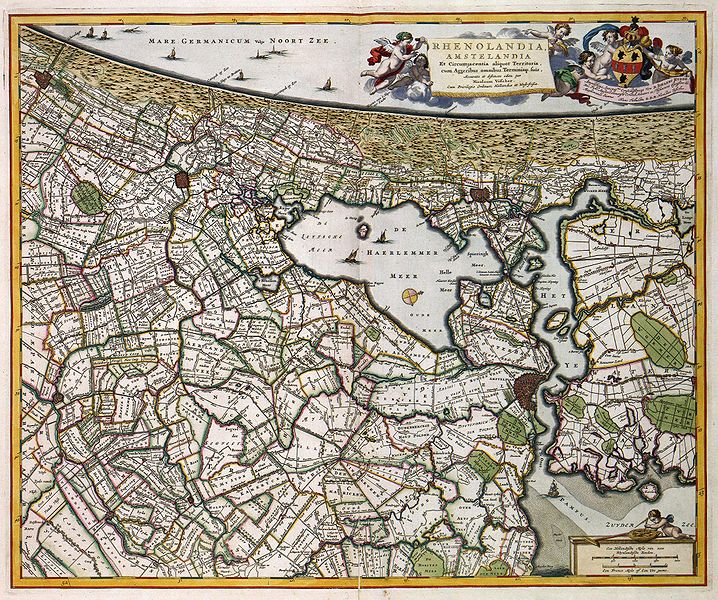
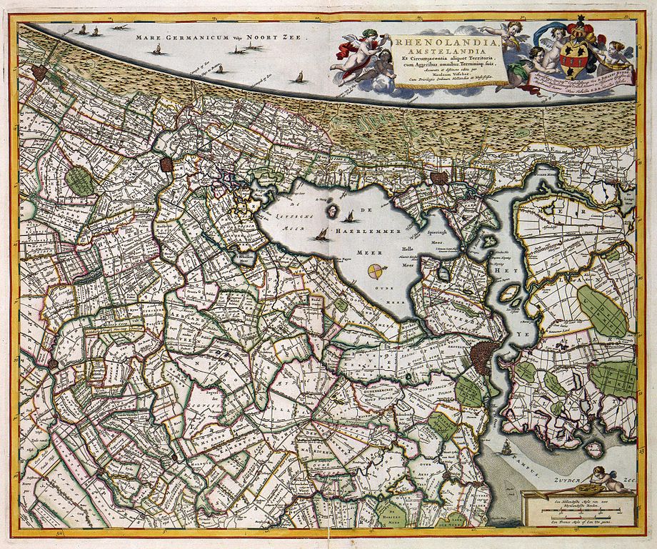
Map from 1681 showing the Haarlemmertrekvaart as connecting Haarlem to Amsterdam, and the Leidsevaart connecting Haarlem to Leiden. At Halfweg the two bodies of water "Haarlemmermeer" and "Het Ye" meet at Gemeenlandshuis Zwanenburg.
Summary[edit]
| Description | RHENOLANDIA, AMSTELANDIA Et Circumjacentia aliquot Territoria, cum Aggeribus omnibus Terminisq: suis, Accurate et distincte edita (historic map of Rijnland and Amstelland, Holland) |
| Date | |
| Source | www.geheugenvannederland.nl |
| Author | Nicolaas Visscher |
Licensing[edit]
|
This work is in the public domain in its country of origin and other countries and areas where the copyright term is the author's life plus 100 years or fewer. | |
| This file has been identified as being free of known restrictions under copyright law, including all related and neighboring rights. | |
File history
Click on a date/time to view the file as it appeared at that time.
| Date/Time | Thumbnail | Dimensions | User | Comment | |
|---|---|---|---|---|---|
| current | 16:13, 4 January 2008 | | 4,400 × 3,674 (4.54 MB) | P199 (talk | contribs) | == Summary == {{Information |Description=''RHENOLANDIA, AMSTELANDIA Et Circumjacentia aliquot Territoria, cum Aggeribus omnibus Terminisq: suis, Accurate et distincte edita'' (historic map of Rijnland and Amstelland, Holland) |Source=www.geheugenvannederl |
You cannot overwrite this file.
File usage on Commons
There are no pages that use this file.
File usage on other wikis
The following other wikis use this file:
- Usage on ca.wikipedia.org
- Usage on en.wikipedia.org
- Usage on es.wikipedia.org
- Usage on fr.wikipedia.org
- Usage on hu.wikipedia.org
- Usage on it.wikipedia.org
- Usage on nn.wikipedia.org
- Usage on no.wikipedia.org
- Usage on ro.wikipedia.org
- Usage on ru.wikipedia.org
- Usage on sl.wikipedia.org