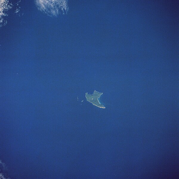
File:Raoul Island, New Zealand, looking southeast (STS008-36-1403).jpg

Tập tin gốc (4.096×4.096 điểm ảnh, kích thước tập tin: 14,62 MB, kiểu MIME: image/jpeg)
Chú thích
Chú thích
STS008-36-1403 Raoul Island, Kermadec Islands (New Zealand) September 1983 The most active volcanic island of all of the Kermadec Islands, Raoul can be seen in this south-looking view. Raoul, a stratovolcano, is located in the Pacific's volcanic "Ring of Fire" about halfway between the North Island of New Zealand and Tonga. Raoul sits atop the Indian/Australian Plate. The Pacific Plate to the island's east (left) is subducting beneath the Indian/Australian Plate forming the Tonga/Kermadec Trench. Raoul Volcano rises 8987 feet (2740 meters) above the ocean floor. The volcano rises to 1693 feet (516 meters) above sea level. The island is roughly triangular in shape with an area of 11 square miles (29 square km). Raoul has erupted 15 times in the historic past, the last in March 2006.
This image or video was catalogued by one of the centers of the United States National Aeronautics and Space Administration (NASA) under Photo ID: STS008-36-1403. This tag does not indicate the copyright status of the attached work. A normal copyright tag is still required. See Commons:Licensing. Other languages:
العربية ∙ беларуская (тарашкевіца) ∙ български ∙ català ∙ čeština ∙ dansk ∙ Deutsch ∙ English ∙ español ∙ فارسی ∙ français ∙ galego ∙ magyar ∙ հայերեն ∙ Bahasa Indonesia ∙ italiano ∙ 日本語 ∙ македонски ∙ മലയാളം ∙ Nederlands ∙ polski ∙ português ∙ русский ∙ sicilianu ∙ slovenščina ∙ Türkçe ∙ українська ∙ 简体中文 ∙ 繁體中文 ∙ +/− |
| Public domainPublic domainfalsefalse |
| This file is in the public domain in the United States because it was solely created by NASA. NASA copyright policy states that "NASA material is not protected by copyright unless noted". (See Template:PD-USGov, NASA copyright policy page or JPL Image Use Policy.) |  | |
 |
Warnings:
|
Lịch sử tập tin
Nhấn vào ngày/giờ để xem nội dung tập tin tại thời điểm đó.
| Ngày/Giờ | Hình xem trước | Kích cỡ | Thành viên | Miêu tả | |
|---|---|---|---|---|---|
| hiện tại | 15:40, ngày 27 tháng 1 năm 2007 |  | 4.096×4.096 (14,62 MB) | Delirium (thảo luận | đóng góp) | Much higher resolution version of the same image. |
| 06:09, ngày 12 tháng 1 năm 2005 |  | 640×640 (361 kB) | Evil Monkey (thảo luận | đóng góp) | The Auckland Islands as seen by the crew of STS-89. {{PD-USGov-NASA}} |
Bạn không được phép ghi đè tập tin này.
Trang sử dụng tập tin
Trang sau sử dụng tập tin này:
- File:STS008-36-1403.jpg (tập tin đổi hướng)
Sử dụng tập tin toàn cục
Những wiki sau đang sử dụng tập tin này:
- Trang sử dụng tại es.wikinews.org
- Trang sử dụng tại gl.wikipedia.org
- Trang sử dụng tại nl.wikipedia.org
Đặc tính hình
Tập tin này chứa thông tin bổ sung, có thể được thêm từ máy ảnh kỹ thuật số hoặc máy quét được sử dụng để tạo hoặc số hóa tệp.
Nếu tập tin đã được sửa đổi so với trạng thái ban đầu, một số chi tiết có thể không phản ánh đầy đủ tập tin đã sửa đổi.
| _error | 0 |
|---|