File:Russia edcp location map.svg

Original file (SVG file, nominally 1,181 × 637 pixels, file size: 2.59 MB)
Captions
Captions
Summary
| Description |
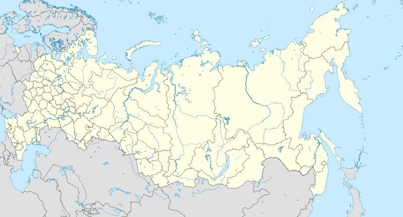
English: Location map of Russia.
EquiDistantConicProjection : Central parallel : * N: 54.0° N Central meridian : * E: 100.0° E Standard parallels: * 1: 49.0° N * 2: 59.0° N Made with Natural Earth. Free vector and raster map data @ naturalearthdata.com. Notice
Russia
other countries
disputed areas
international border
disputed border
Because the southern Kuril islands are claimed by Russia and Japan, they are shown as disputed. For more information about this see: en:Kuril Islands dispute. These islands are since 1945 under the jurisdiction of the Russian Federation. Русский: Схематическая карта России с границами субъектов федерации и водными ресурсами. Коническая равнопромежуточная проекция с центром по 54-й параллели северной широты и 100-му меридиану восточной долготы. На основе данных с сайта Natural Earth (www.naturalearthdata.com).
Особенности:
Условные обозначения:
Россия
другие страны
спорные территории
общепризнанные границы
спорные границы
|
| Date | |
| Source | Own work |
| Author | Uwe Dedering |
| Other versions |
|

Licensing
- You are free:
- to share – to copy, distribute and transmit the work
- to remix – to adapt the work
- Under the following conditions:
- attribution – You must give appropriate credit, provide a link to the license, and indicate if changes were made. You may do so in any reasonable manner, but not in any way that suggests the licensor endorses you or your use.
- share alike – If you remix, transform, or build upon the material, you must distribute your contributions under the same or compatible license as the original.
File history
Click on a date/time to view the file as it appeared at that time.
| Date/Time | Thumbnail | Dimensions | User | Comment | |
|---|---|---|---|---|---|
| current | 10:33, 27 January 2016 | | 1,181 × 637 (2.59 MB) | Denniss (talk | contribs) | Reverted to version as of 11:36, 11 July 2015 (UTC) |
| 09:19, 27 January 2016 |  | 1,201 × 637 (3.5 MB) | BasilLeaf (talk | contribs) | Crimea part of the Russia Federation according to the Russian Government. Wikipedia shall remain neutral in all affairs and locator maps of each individual country shall comply with that country's internal rules | |
| 11:36, 11 July 2015 |  | 1,181 × 637 (2.59 MB) | Denniss (talk | contribs) | Reverted to version as of 14:44, 17 August 2014 | |
| 07:24, 11 July 2015 |  | 1,201 × 637 (3.5 MB) | Doni Vëntersenz (talk | contribs) | Crimea is now a part of Russian Federation. | |
| 14:44, 17 August 2014 |  | 1,181 × 637 (2.59 MB) | Denniss (talk | contribs) | Reverted to version as of 20:53, 25 April 2014 - stop revert warring, it's clearly states this map is showing Kuril islands as disputed | |
| 14:01, 17 August 2014 |  | 1,181 × 637 (2.86 MB) | Nicolay Sidorov (talk | contribs) | Reverted to version as of 23:14, 6 July 2012 - спорный статус Курильских островов | |
| 20:53, 25 April 2014 |  | 1,181 × 637 (2.59 MB) | Denniss (talk | contribs) | Reverted to version as of 16:09, 11 April 2014 | |
| 19:38, 25 April 2014 |  | 1,201 × 637 (3.5 MB) | Логаритам (talk | contribs) | Reverted to version as of 15:44, 11 April 2014 and what? | |
| 16:09, 11 April 2014 |  | 1,181 × 637 (2.59 MB) | NordNordWest (talk | contribs) | Reverted to version as of 15:33, 11 April 2014; please don't destroy all templates which are using this map | |
| 15:44, 11 April 2014 |  | 1,201 × 637 (3.5 MB) | NoviSadGrad (talk | contribs) |
You cannot overwrite this file.
File usage on Commons
More than 100 pages use this file. The following list shows the first 100 pages that use this file only. A full list is available.
- File:Adygea in Russia.svg
- File:Altai Republic in Russia.svg
- File:Amur in Russia.svg
- File:Arkhangelsk in Russia.svg
- File:Arkhangelsk in Russia (+Nenets).svg
- File:Arkhangelsk in Russia (+Nenets hatched).svg
- File:Astrakhan in Russia.svg
- File:Bashkortostan in Russia.svg
- File:Belgorod in Russia.svg
- File:Bryansk in Russia.svg
- File:Buryat in Russia.svg
- File:Central in Russia.svg
- File:Chelyabinsk in Russia.svg
- File:Chukotka in Russia.svg
- File:Chuvash in Russia.svg
- File:Dagestan in Russia.svg
- File:Far Eastern in Russia.svg
- File:Ingushetia in Russia.svg
- File:Irkutsk in Russia.svg
- File:Ivanovo in Russia.svg
- File:Kabardino-Balkar in Russia.svg
- File:Kaliningrad in Russia.svg
- File:Kalmykia in Russia.svg
- File:Kaluga in Russia.svg
- File:Kamchatka in Russia.svg
- File:Karachay-Cherkess in Russia.svg
- File:Karelia in Russia.svg
- File:Kemerovo in Russia.svg
- File:Khabarovsk in Russia.svg
- File:Khakassia in Russia.svg
- File:Khanty-Mansi in Russia.svg
- File:Kirov in Russia.svg
- File:Komi in Russia.svg
- File:Kostroma in Russia.svg
- File:Krasnodar in Russia.svg
- File:Krasnoyarsk in Russia.svg
- File:Kurgan in Russia.svg
- File:Kursk in Russia.svg
- File:Leningrad in Russia.svg
- File:Lipetsk in Russia.svg
- File:Magadan in Russia.svg
- File:Map of Altai Krai in Russia.svg
- File:Map of Chechnya in Russia.svg
- File:Map of the Jewish Autonomous Oblast in Russia.svg
- File:Mari El in Russia.svg
- File:Mordovia in Russia.svg
- File:Moscow Oblast in Russia.svg
- File:Moscow in Russia.svg
- File:Moscow in Russia (special marker).svg
- File:Murmansk in Russia.svg
- File:Nenets in Russia.svg
- File:Nizhny Novgorod in Russia.svg
- File:North Caucasian in Russia.svg
- File:North Ossetia-Alania in Russia.svg
- File:Northwestern in Russia.svg
- File:Novgorod in Russia.svg
- File:Novosibirsk in Russia.svg
- File:Omsk in Russia.svg
- File:Orenburg in Russia.svg
- File:Oryol in Russia.svg
- File:Penza in Russia.svg
- File:Perm in Russia.svg
- File:Primorsky in Russia.svg
- File:Pskov in Russia.svg
- File:Rostov in Russia.svg
- File:Russia edcp location map 2.svg (file redirect)
- File:Russia edcp relief location map.jpg
- File:Ryazan in Russia.svg
- File:Saint Petersburg in Russia.svg
- File:Saint Petersburg in Russia (special marker).svg
- File:Sakha in Russia.svg
- File:Sakhalin in Russia (Japenese claims).svg
- File:Sakhalin in Russia (claimed).svg
- File:Sakhalin in Russia (hatched).svg
- File:Sakhalin in Russia (undisputed).svg
- File:Samara in Russia.svg
- File:Saratov in Russia.svg
- File:Siberian in Russia.svg
- File:Smolensk in Russia.svg
- File:Southern in Russia.svg
- File:Stavropol in Russia.svg
- File:Sverdlovsk in Russia.svg
- File:Tambov in Russia.svg
- File:Tatarstan in Russia.svg
- File:Tomsk in Russia.svg
- File:Tula in Russia.svg
- File:Tuva in Russia.svg
- File:Tver in Russia.svg
- File:Tyumen in Russia.svg
- File:Tyumen in Russia (+Khanty-Mansi +Yamalo-Nenets).svg
- File:Tyumen in Russia (+Khanty-Mansi +Yamalo-Nenets hatched).svg
- File:Udmurt in Russia.svg
- File:Ulyanovsk in Russia.svg
- File:Urals in Russia.svg
- File:Vladimir in Russia.svg
- File:Volga in Russia.svg
- File:Volgograd in Russia.svg
- File:Vologda in Russia.svg
- File:Voronezh in Russia.svg
- File:Yakutia notext.svg
.svg)
.svg)
.svg)
.svg)
.svg)
.svg)
.svg)
.svg)
.svg)
.svg)
View more links to this file.
File usage on other wikis
The following other wikis use this file:
- Usage on af.wikipedia.org
- Oimjakon
- Moskouse Kremlin
- Drie-eenheid-klooster van Sint Sergius
- Rooiplein
- Kolomenskoje
- Nowodewitsji-klooster
- Wit Monumente van Wladimir en Soezdal
- Ferapontof-klooster
- Vulkane van Kamtsjatka
- Kazanse Kremlin
- Goue Berge van Altai
- Solowjetski-klooster
- Sjabloon:Liggingkaart Rusland
- Tsjeko-meer
- Wladiwostok Internasionale Lughawe
- Bulgar
- Poetoranaplato
- Koerilemeer
- Usage on als.wikipedia.org
- Usage on ar.wikipedia.org
- Usage on ast.wikipedia.org
View more global usage of this file.