File:South-eastern Europe c. 1000.jpg

Tập tin gốc (1.100×858 điểm ảnh, kích thước tập tin: 221 kB, kiểu MIME: image/jpeg)
Chú thích
Chú thích
Miêu tả
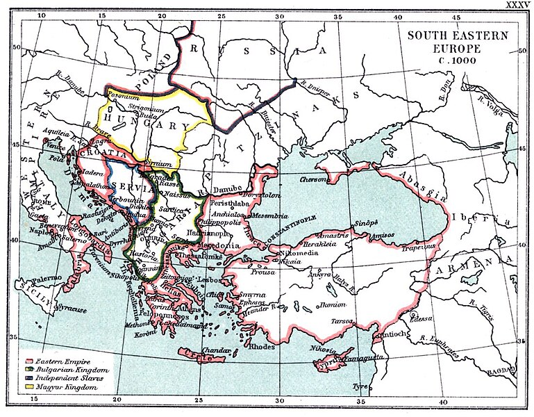
[sửa]| Miêu tả | XXXV SE Europe c. 1000 | ||||||||||||||||||||
| Nguồn gốc | The Atlas To Freeman's Historical Geography (third edition, 1903) | ||||||||||||||||||||
| Tác giả |
|
||||||||||||||||||||


Giấy phép
[sửa]
|
Tác phẩm này thuộc về phạm vi công cộng tại quốc gia gốc và các quốc gia và vùng lãnh thổ có thời hạn bản quyền là cuộc đời tác giả cộng thêm 70 trở xuống.
| |
| Tập tin này đã được đánh dấu là không bị hạn chế dưới luật bản quyền, kể cả tất cả những quyền liên quan và lần cận. | |
Lịch sử tập tin
Nhấn vào ngày/giờ để xem nội dung tập tin tại thời điểm đó.
| Ngày/Giờ | Hình xem trước | Kích cỡ | Thành viên | Miêu tả | |
|---|---|---|---|---|---|
| hiện tại | 19:36, ngày 25 tháng 11 năm 2022 | | 1.100×858 (221 kB) | Gyalu22 (thảo luận | đóng góp) | Reverted to version as of 13:05, 31 October 2007 (UTC) |
| 12:45, ngày 5 tháng 7 năm 2017 |  | 1.100×858 (599 kB) | MAXHO (thảo luận | đóng góp) | Cosmetic | |
| 13:05, ngày 31 tháng 10 năm 2007 |  | 1.100×858 (221 kB) | Alexandar.R.~commonswiki (thảo luận | đóng góp) | {{Information |Description=XXXV SE Europe c. 1000 |Source=The Atlas To Freeman's Historical Geography (third edition, 1903) |Date= |Author=J. B. Bury |Permission= |other_versions= }} |
Bạn không được phép ghi đè tập tin này.
Trang sử dụng tập tin
3 trang sau sử dụng tập tin này:
- Atlas of Croatia
- User:J budissin/Uploads/BiH/2017 July 1-10
- File:SeEuropeBury1903XXXV.jpg (tập tin đổi hướng)
Sử dụng tập tin toàn cục
Những wiki sau đang sử dụng tập tin này:
- Trang sử dụng tại bg.wikipedia.org
- Trang sử dụng tại de.wikipedia.org
- Trang sử dụng tại de.wikibooks.org
- Trang sử dụng tại el.wikipedia.org
- Trang sử dụng tại en.wikipedia.org
- Trang sử dụng tại es.wikipedia.org
- Trang sử dụng tại et.wikipedia.org
- Trang sử dụng tại fa.wikipedia.org
- Trang sử dụng tại fr.wikipedia.org
- Trang sử dụng tại hu.wikipedia.org
- Trang sử dụng tại hy.wikipedia.org
- Trang sử dụng tại id.wikipedia.org
- Trang sử dụng tại it.wikipedia.org
- Trang sử dụng tại ja.wikipedia.org
- Trang sử dụng tại ko.wikipedia.org
- Trang sử dụng tại mk.wikipedia.org
- Trang sử dụng tại nds.wikipedia.org
- Trang sử dụng tại ru.wikipedia.org
- Trang sử dụng tại sr.wikipedia.org
- Trang sử dụng tại tr.wikipedia.org
- Trang sử dụng tại vi.wikipedia.org
- Trang sử dụng tại zh.wikipedia.org
- Maps of the history of the medieval Balkans
- Old maps of the Byzantine Empire
- Maps of the history of Bulgaria in the Middle Ages
- Maps of the history of Romania in the Middle Ages
- Maps of the Kingdom of Croatia (medieval)
- Atlas To Freeman's Historical Geography
- Maps of the Byzantine empire in the 11th century
- Maps showing 1000