File:St. Lawrence Island location.png
Jump to navigation
Jump to search
No higher resolution available.
St._Lawrence_Island_location.png (738 × 501 pixels, file size: 50 KB, MIME type: image/png)
Captions
Captions
Add a one-line explanation of what this file represents
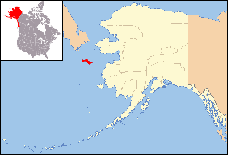
| Description | Use with En:Template:Location map USA Alaska, (N.B. Canada and Russia borders are approximate, from National Atlas). Location of St Lawrence Island. |
| Date | (UTC) |
| Source | |
| Author |
|
| This is a retouched picture, which means that it has been digitally altered from its original version. Modifications: location of St. Lawrence Island. The original can be viewed here: Alaska Locator Map with US.PNG:
|
I, the copyright holder of this work, hereby publish it under the following licenses:
This file is licensed under the Creative Commons Attribution-Share Alike 2.5 Generic license.
- You are free:
- to share – to copy, distribute and transmit the work
- to remix – to adapt the work
- Under the following conditions:
- attribution – You must give appropriate credit, provide a link to the license, and indicate if changes were made. You may do so in any reasonable manner, but not in any way that suggests the licensor endorses you or your use.
- share alike – If you remix, transform, or build upon the material, you must distribute your contributions under the same or compatible license as the original.

|
Permission is granted to copy, distribute and/or modify this document under the terms of the GNU Free Documentation License, Version 1.2 or any later version published by the Free Software Foundation; with no Invariant Sections, no Front-Cover Texts, and no Back-Cover Texts. A copy of the license is included in the section entitled GNU Free Documentation License. |
| This file is licensed under the Creative Commons Attribution-Share Alike 3.0 Unported license. | ||
| ||
| This licensing tag was added to this file as part of the GFDL licensing update. |
This image or file is a work of a United States Census Bureau employee, taken or made as part of that person's official duties. As a work of the U.S. federal government, the image is in the public domain.
|
 |
You may select the license of your choice.
Original upload log
[edit]
This image is a derivative work of the following images:
- Image:Alaska_Locator_Map_with_US.PNG licensed with Cc-by-sa-2.5, GFDL, PD-USGov-DOC-Census
- 2008-03-08T20:38:56Z Appraiser 738x501 (42754 Bytes) {{Information| |Description= Locator Map of Alaska, United States (N.B. Canada and Russia borders are approximate, from National Atlas) |Source= taken from US Census website |Source= taken from US Census website [http://fact
- 2008-03-03T02:12:59Z Appraiser 734x497 (45451 Bytes) {{Information| |Description= Locator Map of Alaska, United States (N.B. Canada and Russia borders are approximate, from National Atlas) |Source= taken from US Census website [http://factfinder.census.gov/] and modified by [[
Uploaded with derivativeFX
File history
Click on a date/time to view the file as it appeared at that time.
| Date/Time | Thumbnail | Dimensions | User | Comment | |
|---|---|---|---|---|---|
| current | 17:52, 26 October 2008 | | 738 × 501 (50 KB) | TCY (talk | contribs) | {{Information |Description=Use with En:Template:Location map USA Alaska, (N.B. Canada and Russia borders are approximate, from National Atlas). Location of St Lawrence Island. |Source=*Image:Alaska_Locator_Map_with_US.PNG |Date=2008-10-26 17:50 |
You cannot overwrite this file.
File usage on Commons
There are no pages that use this file.
File usage on other wikis
The following other wikis use this file:
- Usage on af.wikipedia.org
- Usage on cs.wikipedia.org
- Usage on el.wikipedia.org
- Usage on es.wikipedia.org
- Usage on fi.wikipedia.org
- Usage on gl.wikipedia.org
- Usage on hr.wikipedia.org
- Usage on lt.wikipedia.org
- Usage on pl.wikipedia.org
- Usage on tr.wikipedia.org