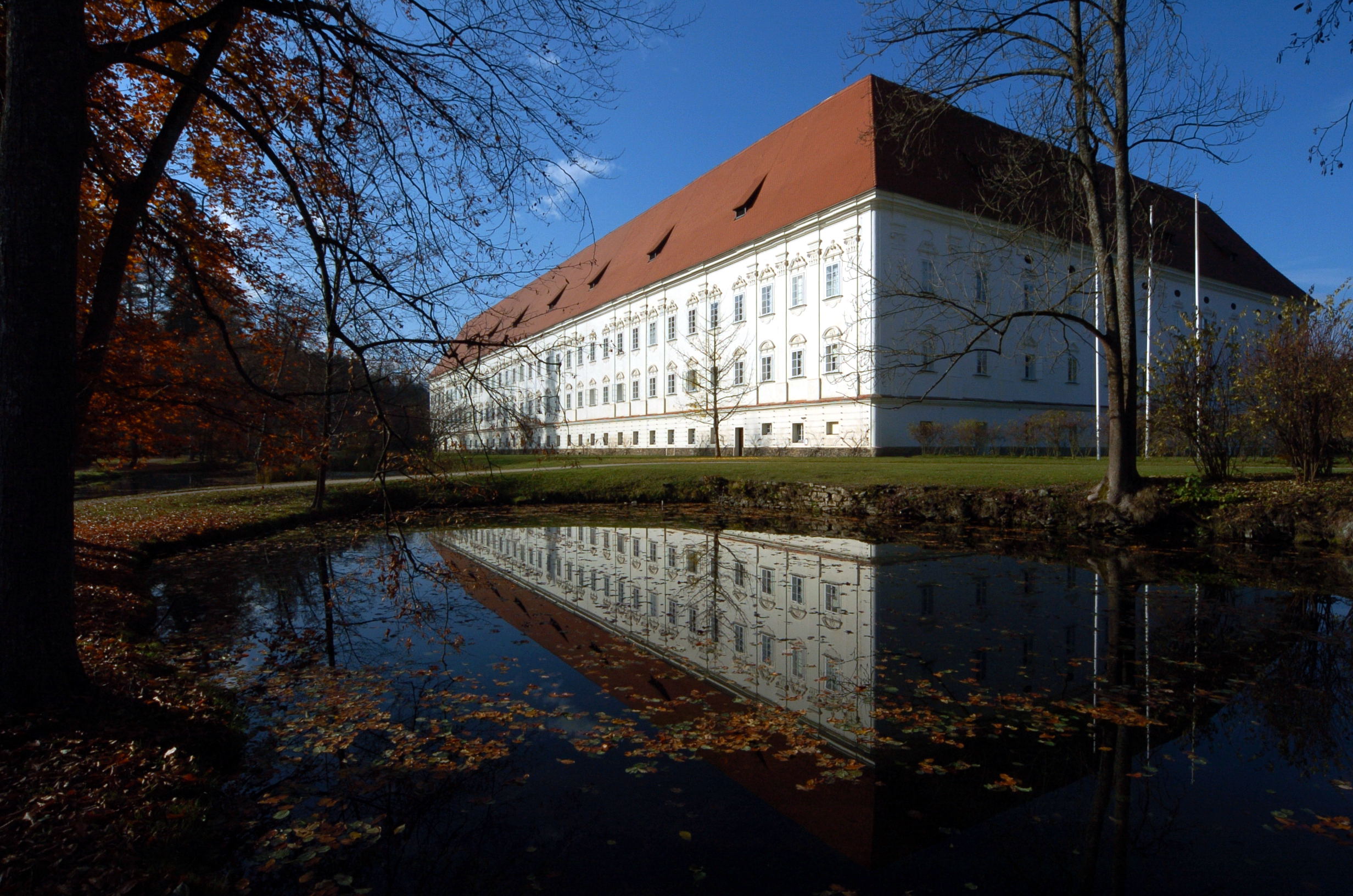
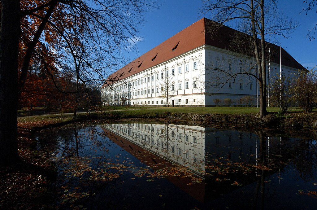
File:Stift Viktring 06112007 03.jpg
Original file (2,464 × 1,632 pixels, file size: 700 KB, MIME type: image/jpeg)
Captions
Captions
|
Summary[edit]
| Description |
English: Southeastern view at the cistercian monastery Viktring in Klagenfurt on the Lake Woerth, Carinthia, Austria
|
| Date | |
| Source | Own work |
| Author | Johann Jaritz |
| Permission (Reusing this file) |
GFDL/CC-by-sa |
| Other versions |
Deutsch: Von diesem Bild existieren die folgenden Bildbearbeitungen aus der Bilderwerkstatt:
English: Retouched versions of this picture from the german Graphic Lab:
|
|
Freedom of Panorama This picture of an otherwise copyrighted work may be distributed under the conditions of § 54 (1) Z. 5 of the Austrian copyright law which allows to reproduce, distribute, and publish architectural works of an actual building or other works of visual arts which were created to permanently remain at a public place. Note: Due to the principle of Lex loci protectionis, this applies only to reuse of this picture in Austria. Reuse in other countries is subject to local law. Further information can be found on Commons and in German Wikipedia.
|
| Camera location | | View this and other nearby images on: OpenStreetMap |
|---|
| Object location | | View this and other nearby images on: OpenStreetMap |
|---|
Licensing[edit]

|
Permission is granted to copy, distribute and/or modify this document under the terms of the GNU Free Documentation License, Version 1.2 or any later version published by the Free Software Foundation; with no Invariant Sections, no Front-Cover Texts, and no Back-Cover Texts. A copy of the license is included in the section entitled GNU Free Documentation License. |
- You are free:
- to share – to copy, distribute and transmit the work
- to remix – to adapt the work
- Under the following conditions:
- attribution – You must give appropriate credit, provide a link to the license, and indicate if changes were made. You may do so in any reasonable manner, but not in any way that suggests the licensor endorses you or your use.
- share alike – If you remix, transform, or build upon the material, you must distribute your contributions under the same or compatible license as the original.
File history
Click on a date/time to view the file as it appeared at that time.
| Date/Time | Thumbnail | Dimensions | User | Comment | |
|---|---|---|---|---|---|
| current | 14:56, 6 November 2007 | | 2,464 × 1,632 (700 KB) | Johann Jaritz (talk | contribs) | {{Information |Description=Monastery Viktring in the city of Klagenfurt, Carinthia, Austria |Source=own photograph |Date=November 6th, 2007 |Author=Johann Jaritz |Permission={{self2|GFDL|cc-by-sa-2.5,2.0,1.0}} |other_versions=Bild-G |
You cannot overwrite this file.
File usage on Commons
The following 6 pages use this file:
File usage on other wikis
The following other wikis use this file:
- Usage on de.wikipedia.org
- Usage on de.wiktionary.org
- Usage on en.wikipedia.org
- Usage on fr.wikipedia.org
- Usage on hr.wikipedia.org
- Usage on it.wikipedia.org
- Usage on lt.wikipedia.org
- Usage on nl.wikipedia.org
- Usage on sl.wikipedia.org
- Usage on zh.wikipedia.org