File:The A413 in Stoke Mandeville, going towards Wendover - geograph.org.uk - 269826.jpg
Jump to navigation
Jump to search
No higher resolution available.
The_A413_in_Stoke_Mandeville,_going_towards_Wendover_-_geograph.org.uk_-_269826.jpg (640 × 480 pixels, file size: 283 KB, MIME type: image/jpeg)
Captions
Captions
Add a one-line explanation of what this file represents
Summary[edit]
| Description |
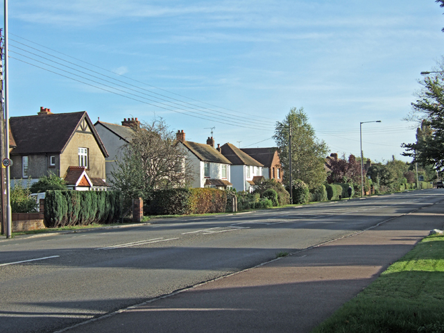
English: The A413 in Stoke Mandeville, going towards Wendover The pavement on the right is shared by cyclists & pedestrians. The houses on the left come just within the Weston Turville boundary. |
| Date | |
| Source | From geograph.org.uk |
| Author | sijon |
| Attribution (required by the license) | sijon / The A413 in Stoke Mandeville, going towards Wendover / |
| Object location | | View this and other nearby images on: OpenStreetMap |
|---|
_heading:157.00&language=en)
Licensing[edit]

|
This image was taken from the Geograph project collection. See this photograph's page on the Geograph website for the photographer's contact details. The copyright on this image is owned by sijon and is licensed for reuse under the Creative Commons Attribution-ShareAlike 2.0 license.
|
This file is licensed under the Creative Commons Attribution-Share Alike 2.0 Generic license.
Attribution: sijon
- You are free:
- to share – to copy, distribute and transmit the work
- to remix – to adapt the work
- Under the following conditions:
- attribution – You must give appropriate credit, provide a link to the license, and indicate if changes were made. You may do so in any reasonable manner, but not in any way that suggests the licensor endorses you or your use.
- share alike – If you remix, transform, or build upon the material, you must distribute your contributions under the same or compatible license as the original.
File history
Click on a date/time to view the file as it appeared at that time.
| Date/Time | Thumbnail | Dimensions | User | Comment | |
|---|---|---|---|---|---|
| current | 16:29, 12 December 2010 | | 640 × 480 (283 KB) | GeographBot (talk | contribs) | == {{int:filedesc}} == {{Information |description={{en|1=The A413 in Stoke Mandeville, going towards Wendover The pavement on the right is shared by cyclists & pedestrians. The houses on the left come just within the Weston Turville boundary.}} |date=200 |
You cannot overwrite this file.
File usage on Commons
The following page uses this file:
File usage on other wikis
The following other wikis use this file:
- Usage on af.wikipedia.org
- Usage on ar.wikipedia.org
- Usage on arz.wikipedia.org
- Usage on ceb.wikipedia.org
- Usage on cy.wikipedia.org
- Usage on en.wikipedia.org
- Usage on es.wikipedia.org
- Usage on fr.wikipedia.org
- Usage on it.wikipedia.org
- Usage on ja.wikipedia.org
- Usage on ko.wikipedia.org
- Usage on lld.wikipedia.org
- Usage on lt.wikipedia.org
- Usage on no.wikipedia.org
- Usage on ru.wikipedia.org
- Usage on sv.wikipedia.org
- Usage on uk.wikipedia.org
- Usage on www.wikidata.org
- Usage on zh-min-nan.wikipedia.org