File:Villers-le-Bouillet Liège Belgium Map.png
Jump to navigation
Jump to search
No higher resolution available.
Villers-le-Bouillet_Liège_Belgium_Map.png (290 × 220 pixels, file size: 7 KB, MIME type: image/png)
Captions
Captions
Add a one-line explanation of what this file represents

|
This locator map image could be re-created using vector graphics as an SVG file. This has several advantages; see Commons:Media for cleanup for more information. If an SVG form of this image is available, please upload it and afterwards replace this template with
{{vector version available|new image name}}.
It is recommended to name the SVG file “Villers-le-Bouillet Liège Belgium Map.svg”—then the template Vector version available (or Vva) does not need the new image name parameter. |
| Description |
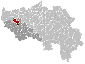
English: Map, municipality belgium Villers-le-Bouillet
Français : Carte indiquant la localisation de la commune de Villers-le-Bouillet dans la Province de Liège. |
| Source | Own work |
| Author | LennartBolks |
| Permission (Reusing this file) |
PD |
| This work has been released into the public domain by its author, LennartBolks. This applies worldwide. In some countries this may not be legally possible; if so: |
File history
Click on a date/time to view the file as it appeared at that time.
| Date/Time | Thumbnail | Dimensions | User | Comment | |
|---|---|---|---|---|---|
| current | 10:37, 5 March 2007 | | 290 × 220 (7 KB) | Siebrand (talk | contribs) | Updated map by Westermarck |
| 21:36, 4 April 2005 |  | 290 × 220 (5 KB) | Nicnac25~commonswiki (talk | contribs) | Map, municipality belgium Villers-le-Bouillet {{PD}} FR; Carte indiquant la localisation de la commune de Villers-le-Bouillet dans la Province de Liège. EN; Map from w:nl:Gebruiker:LennartBolks/kaartenhoekje in Public Domain by the Author choice. [ |
You cannot overwrite this file.
File usage on Commons
The following page uses this file: