Taguig
Jump to navigation
Jump to search
| Object location | | View all coordinates using: OpenStreetMap |
|---|
city of the Philippines in Metro Manila    Seal of the City of Taguig  | |||||
| Upload media | |||||
| Pronunciation audio | |||||
|---|---|---|---|---|---|
| Instance of |
| ||||
| Location |
| ||||
| Head of government |
| ||||
| Population |
| ||||
| Area |
| ||||
| Elevation above sea level |
| ||||
| Electorate |
| ||||
| official website | |||||
 | |||||
English: Taguig is a highly-urbanized city in the capital region of Metropolitan Manila in the Philippines.
Tagalog: Ang Lungsod ng Taguig ay mataas na urbanisadong lungsod sa punong rehiyon ng Kalakhang Maynila sa Pilipinas.
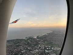
Skylines and general views
[edit]- Most of Taguig
-
 With Fort Bonifacio area, 2010
 -
 With Bicutan area; 2020


- Bonifacio Global City
-
 Panoramic view in 2012
 -
 View in 2012
 -
 View from BSA Twin Towers of Ortigas, 2015
 -
 Seen from the 10th floor of the BDO South Tower, Makati, 2018
 -
 View from FTI Tenement, 2018
 -
 View from One Ayala, Makati, 2023


_skyline_-_from_FTI_Tenement_(Taguig)(2018-04-02).jpg)

Landmarks
[edit]-
 Taguig City Hall
 -
 Archdiocesan Shrine of St. Anne or St. Anne Parish Church
 -
 Philippine Army headquarters
 -
 Arca South
 -
 FTI Tenement
 -
 Napindan Lighthouse (current)
 -
 Manila American Cemetery and Memorial


(2018-04-02).jpg)


Transportation
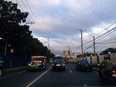
[edit]- Roads
-
 Laguna Lake Highway (C-6)
 -
 Lawton Avenue
 -
 Pasig–Pateros–Taguig–Alabang Road (M.L. Quezon Street)


_-_Lower_Bicutan_(with_Route_142_marker)_(Bicutan,Taguig)(2017-06-25).jpg)
- Railway stations (of Philippine National Railways)
-
 Nichols
 -
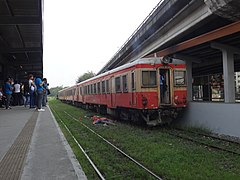 FTI
FTI

(2017-08-11)_(2).jpg)
Miscellaneous
[edit]-
 Food inside Market! Market!
