Category:Lotnisko Gliwice-Trynek
Jump to navigation
Jump to search
| Object location | | View all coordinates using: OpenStreetMap |
|---|
Recreational aerodrome in Poland  | |||||
| Upload media | |||||
| Instance of |
| ||||
|---|---|---|---|---|---|
| Location | Gliwice, Silesian Voivodeship, Poland | ||||
| Date of official opening |
| ||||
| Elevation above sea level |
| ||||
| ICAO airport code |
| ||||
 | |||||
Polski: Lotnisko Gliwice-Trynek (kod ICAO: EPGL) w obecnym miejscu zostało zbudowane na polach w kierunku Bojkowa w 1916 roku, na polecenie niemieckich władz wojskowych. Leżało na skrzyżowaniu tras:
- Londyn-Hamburg-Berlin-Wrocław-Gliwice-Lwów-Odessa-Tbilisi-Teheran
- Rzym-Genua-Triest-Wiedeń-Gliwice-Warszawa.
English: Gliwice airport (kod ICAO: EPGL) in its present location was built on the south side of the town Gliwice (near Bojkow) in 1916, at the request of the German military authorities. It is located at the crossroads:
It covers an area of about 117 hectares. In 1955, the Gliwice Aeroclub was created initially as a branch of the Silesia Aeroclub and since 1956 as an independent unit. Currently Gliwice Aeroclub owns Gliwice airport.
Subcategories
This category has the following 7 subcategories, out of 7 total.
Media in category "Lotnisko Gliwice-Trynek"
The following 8 files are in this category, out of 8 total.
-
 IS-C Żuraw, CSS-13, Gliwice.jpg 2,048 × 1,365; 976 KB
-
 PZL TS-11 Iskra 308 (1).jpg 2,048 × 1,377; 234 KB
-
 PZL TS-11 Iskra 308 (2).jpg 2,048 × 1,377; 308 KB
-
 PZL-101 Gawron SP-CGC.jpg 960 × 619; 93 KB
-
 PZL-104 Wilga 35 SP-EBL.jpg 960 × 659; 155 KB
-
 Samoloty PZL TS-8 Bies.jpg 962 × 494; 71 KB
-
 Zlín Z-326, Jan Strzałkowski, Gliwice.jpg 894 × 439; 27 KB
-
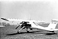
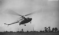 Śmigłowiec SM-1.JPG 1,158 × 693; 125 KB

.jpg)
.jpg)


