User talk:NordNordWest/Archive11
Wenn du da einen Löschantrag stellst wäre es mal schön gewesen wenn du die Dateieinbindungen fixt. Schönes Neues --2003:DE:711:18A9:58FB:49D:F04C:FB67 04:41, 1 January 2019 (UTC)
- war da eingebunden de:Bundesautobahn 553, jetzt ungesichteter Rotlink --2003:DE:711:18A9:58FB:49D:F04C:FB67 04:50, 1 January 2019 (UTC)
- Das ist aber nicht der Job des Löschantragstellers. Es könnte ja sein, dass der Antrag abgelehnt wird, dann wäre eine Abänderung nicht notwendig bzw. nicht rechtmäßig gewesen. NNW 11:01, 1 January 2019 (UTC)
- ich bin hier seit über 10 Jahren aktiv, ich weiß schon wie das geht und das die Weiterleitung gelöscht wird. Wenn ich mir mal deine uploads vom 23.12.18 von 18:25 bis 17:13 ansehe seh ich schon das du in genau diesen maps aktiv bist. Es ist nicht die erste Weiterleitung einer .svg auf eine .png die du hast löschen lassen. In der Folge hatte ich den Artikel gefixt, so wie jetzt auch. Damals war das der Artikel de:Bundesautobahn 565. Es kann wohl kaum dein Ziel sein das nach Löschung der Weiterleitung die Karte aus dem Artikel entfernt wird. --2003:DE:711:18A9:6913:1735:45AC:B16E 11:48, 1 January 2019 (UTC)
- die log zu deinem Löschantrag von damals log --2003:DE:711:18A9:6913:1735:45AC:B16E 11:56, 1 January 2019 (UTC)
- ich bin hier seit über 10 Jahren aktiv, ich weiß schon wie das geht und das die Weiterleitung gelöscht wird. Wenn ich mir mal deine uploads vom 23.12.18 von 18:25 bis 17:13 ansehe seh ich schon das du in genau diesen maps aktiv bist. Es ist nicht die erste Weiterleitung einer .svg auf eine .png die du hast löschen lassen. In der Folge hatte ich den Artikel gefixt, so wie jetzt auch. Damals war das der Artikel de:Bundesautobahn 565. Es kann wohl kaum dein Ziel sein das nach Löschung der Weiterleitung die Karte aus dem Artikel entfernt wird. --2003:DE:711:18A9:6913:1735:45AC:B16E 11:48, 1 January 2019 (UTC)
- Das ist aber nicht der Job des Löschantragstellers. Es könnte ja sein, dass der Antrag abgelehnt wird, dann wäre eine Abänderung nicht notwendig bzw. nicht rechtmäßig gewesen. NNW 11:01, 1 January 2019 (UTC)
- Du musst mir nicht sagen oder verlinken, was ich auf Commons mache, das weiß ich besser als du. Ein Benutzer hat unsinnige Weiterleitungen angelegt, und wenn ich auf sie stoße, dann stelle ich einen Löschantrag, c’est tout. Zum weiteren Ablauf habe ich dir oben schon was geschrieben, ich möchte mich nicht wiederholen. NNW 12:11, 1 January 2019 (UTC)
- die unsinnigen Weiterleitungen wurden wegen deiner Bearbeitung der Infobox angelegt [1], ansonsten wären da einige Artikel auf einmal ohne Karte gewesen. Eigentlich hätte ich auf etwas wie Entgegenkommen oder etwas ähnlichem gehofft. Das neue Jahr startet schlechter als sich das alte verabschiedet hat. --2003:DE:711:18A9:6913:1735:45AC:B16E 12:25, 1 January 2019 (UTC)
- Eigentlich wollte ich fragen, inwieweit ich dir entgegenkommen soll, aber dein letzter Satz bringt es gut auf den Punkt und ich will es gar nicht mehr wissen. NNW 12:44, 1 January 2019 (UTC)
- die unsinnigen Weiterleitungen wurden wegen deiner Bearbeitung der Infobox angelegt [1], ansonsten wären da einige Artikel auf einmal ohne Karte gewesen. Eigentlich hätte ich auf etwas wie Entgegenkommen oder etwas ähnlichem gehofft. Das neue Jahr startet schlechter als sich das alte verabschiedet hat. --2003:DE:711:18A9:6913:1735:45AC:B16E 12:25, 1 January 2019 (UTC)
- Du musst mir nicht sagen oder verlinken, was ich auf Commons mache, das weiß ich besser als du. Ein Benutzer hat unsinnige Weiterleitungen angelegt, und wenn ich auf sie stoße, dann stelle ich einen Löschantrag, c’est tout. Zum weiteren Ablauf habe ich dir oben schon was geschrieben, ich möchte mich nicht wiederholen. NNW 12:11, 1 January 2019 (UTC)
Hallo, mir ist aufgefallen, dass du bei File:Saalfeld-Saale in SLF.png die alte Version von Juli im Dezember nochmal mit der gleichen ersetzt hast, und somit (wahrscheinlich aus Versehen) immer noch der Stand von Juli aktuell ist. Bei der Datei File:Municipalities in SLF.png wird (dadurch?) auch noch der Stand von Juli angezeigt, obwohl dort die aktuelle Version hochgeladen ist. Ich wollte dich darauf hinweisen, damit du das verbessern kannst. MfG FrühlingsSonnenBad (talk) 23:11, 5 January 2019 (UTC)
- Hallo! Ich habe nochmal nachgeschaut, beide Dateien sind aktuell. Wenn du etwas anderes siehst, liegt das daran, dass die alte Version noch in deinem Browsercache ist. Den müsstest du einmal leeren, damit die Karten neu geladen werden. Viele Grüße, NNW 11:40, 6 January 2019 (UTC)
- Okay, das war mein Fehler. Mir ist aber noch aufgefallen, dass man auf den Karten von Saalfeld-Rudolstadt nicht auf Saalfeld/Saale klicken kann, also da ist trotzdem irgendwo noch ein Fehler drin. --FrühlingsSonnenBad (talk) 22:58, 16 January 2019 (UTC)
- Bei mir funktioniert es. NNW 07:45, 17 January 2019 (UTC)
- Komisch, bei mir funktioniert es auf keinem meiner Geräte, ich hab nochmal mehrere ausprobiert. --FrühlingsSonnenBad (talk) 14:40, 18 January 2019 (UTC)
- In de:Vorlage:Imagemap Landkreis Saalfeld-Rudolstadt ist Saalfeld enthalten. Ich kann da nicht helfen. NNW 15:51, 18 January 2019 (UTC)
- Komisch, bei mir funktioniert es auf keinem meiner Geräte, ich hab nochmal mehrere ausprobiert. --FrühlingsSonnenBad (talk) 14:40, 18 January 2019 (UTC)
- Bei mir funktioniert es. NNW 07:45, 17 January 2019 (UTC)
- Okay, das war mein Fehler. Mir ist aber noch aufgefallen, dass man auf den Karten von Saalfeld-Rudolstadt nicht auf Saalfeld/Saale klicken kann, also da ist trotzdem irgendwo noch ein Fehler drin. --FrühlingsSonnenBad (talk) 22:58, 16 January 2019 (UTC)
您好。很抱歉打扰阁下。我英语不好,请恕以我的母语汉语给您留言。旧县乡(w:Jiuxian Township,您可以在条目的信息框中找到他)已经在1996年1月23日由济南市平阴县划归至泰安市东平县,而在这个地图上,旧县乡仍然由济南市管辖。我这里有一份平阴县地图(File:Map_of_Pingyin_County.png)和东平县地图(File:东平县地图.png)以及一份旧县乡在东平县的位置图(File:Jiuxian_Township_in_Dongping_County.png)供阁下参考,如果您有空闲时间的话,您是否可以根据这些信息修改这个地图呢?我不会修改矢量图,如若阁下能够帮助修正此图,在下感激不尽。--Snghrax(UTC) 00:23, 10 January 2019 (UTC)
- Hello! Right now I am very busy but I will see what I can do as soon as possible. Best regards, NNW 12:53, 13 January 2019 (UTC)
Hallo,
könntest du die Karte der Markung von Pfullingen bei Gelegenheit berichtigen? Das kleine Gebiet östlich von Pfullingen zwischen Eningen und Lichtenstein gehört ebenfalls zu Pfullingen.
Besten Dank im voraus, freundliche Grüße, Martin Götz. — Preceding unsigned comment added by Mgoetzastro (talk • contribs) 22:04, 15 January 2019 (UTC)
- Danke für den Hinweis, werde ich mich am Wochenende drum kümmern. NNW 07:54, 16 January 2019 (UTC)
- Jetzt ist es doch schneller gegangen. NNW 20:54, 16 January 2019 (UTC)
- Besten Dank für die schnelle Korrektur. Viele Grüße, Martin Götz. — Preceding unsigned comment was added by 62.61.134.16 (talk) 13:08, 19 January 2019 (UTC)
Source of derivative work is not properly indicated: File:Group of Seven (G7) Countries.svg[edit]
| This file may be deleted. |
A file that you have uploaded to Wikimedia Commons, File:Group of Seven (G7) Countries.svg, is a derivative work, containing an "image within an image". Examples of such works would include a photograph of a sculpture, a scan of a magazine cover, or a map that has been altered from the original. In each of these cases, the rights of the creator of the original must be considered, as well as those of the creator of the derivative work.
While the description page states who made this derivative work, it currently doesn't specify who created the original work, so the overall copyright status is unclear. If you did not create the original work depicted in this image, you will need to specify the owner of the copyright. Please edit the file description and add the missing information, or the file may be deleted. If you created the original content yourself, enter this information as the source. If someone else created the content, the source should be the address to the web page where you found it, the name and ISBN of the book you scanned it from, or similar. You should also name the author, provide verifiable information to show that the content is in the public domain or has been published under a free license by its author, and add an appropriate template identifying the public domain or licensing status, if you have not already done so. Please add the required information for this and other files you have uploaded before adding more files. If you need assistance, please ask at the help desk. Thank you! |
Yann (talk) 09:06, 6 February 2019 (UTC)
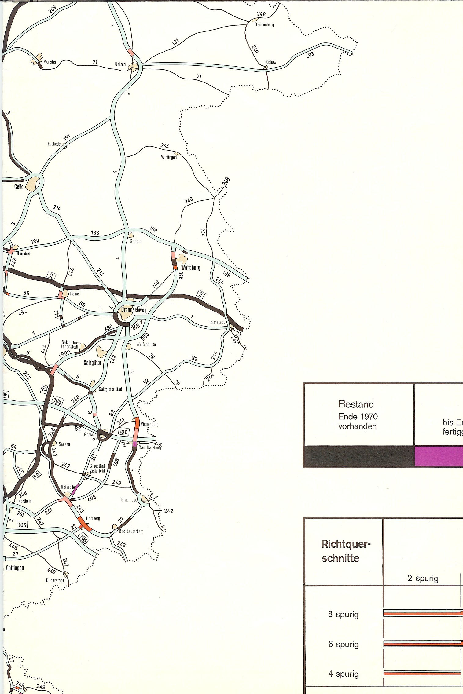
Karte der älteren Planung von BAB 369[edit]

- Hallo, ist es möglich, eine Karte der Planung von 1976 wie nach diesem Vorbild für die BAB 369 zu erstellen? Vielen Dank. Nin-TD (talk) 22:22, 24 February 2019 (UTC)
- Grundsätzlich ja, ich muss mir allerdings erstmal anschauen, wie die ursprüngliche A 369 laufen sollte. NNW 08:11, 25 February 2019 (UTC)
- Alles klar. Auf autobahnatlas-online.de findet sich weiteres Material dazu; die Plankarte aus 1972 (B4 von Braunschweig über Bad Harzburg nach Braunlage) als auch 1976 (hier eindeutig als A 369) zeigen einen sehr ähnlichen Verlauf. Einzig in Braunlage besteht eine nennenswerte Abweichung: In der 1972er-Version ist eine westliche Ortsumgehung eingetragen, die später um 1995 auch dreispurig realisiert wurde, während die "eigentliche" Karte von 1976 die Autobahn direkt in Braunlage münden lässt. Da in Bad Harzburg in der 76er-Version ein scharfer Knick nach Osten enthalten ist, der keinesfalls als Autobahnstrecke funktionieren kann, muss man davon ausgehen, dass diese Karte sich viel stärker auf den gegebenen Verlauf der Bundesstraßen als Vorlage stützt und darum weniger Aussagekraft als die 72er-Version besitzt, man hier also auch die OU Braunlage miteinbeziehen sollte. Nin-TD (talk) 02:53, 26 February 2019 (UTC)
- Das ist alles so klein in diesem Maßstab, das macht keinen Unterschied. NNW 18:59, 27 February 2019 (UTC)
- Alles klar. Auf autobahnatlas-online.de findet sich weiteres Material dazu; die Plankarte aus 1972 (B4 von Braunschweig über Bad Harzburg nach Braunlage) als auch 1976 (hier eindeutig als A 369) zeigen einen sehr ähnlichen Verlauf. Einzig in Braunlage besteht eine nennenswerte Abweichung: In der 1972er-Version ist eine westliche Ortsumgehung eingetragen, die später um 1995 auch dreispurig realisiert wurde, während die "eigentliche" Karte von 1976 die Autobahn direkt in Braunlage münden lässt. Da in Bad Harzburg in der 76er-Version ein scharfer Knick nach Osten enthalten ist, der keinesfalls als Autobahnstrecke funktionieren kann, muss man davon ausgehen, dass diese Karte sich viel stärker auf den gegebenen Verlauf der Bundesstraßen als Vorlage stützt und darum weniger Aussagekraft als die 72er-Version besitzt, man hier also auch die OU Braunlage miteinbeziehen sollte. Nin-TD (talk) 02:53, 26 February 2019 (UTC)
Iberische Halbinsel[edit]
Hallo! Welche Karte ist die Basis hierfür. Ich würde mich auf einen Hinweis freuen. Gruß bilgikurdu 14:11, 6 March 2019 (UTC) — Preceding unsigned comment added by Saitcank (talk • contribs) 14:11, 6 March 2019 (UTC)
- Moin! Das steht in der Dateibeschreibung, also Daten der United States National Imagery and Mapping Agency (NIMA). NNW 14:18, 6 March 2019 (UTC)
Danke für die schnelle Antwort. Das habe ich gelesen. Mir war jedoch nicht klar, wie ich die Ursprungsdatei finden kann. Kann man diese Karte noch online finden? Eine weitere Frage haette ich noch. Ich bin ein Laie was Karten angeht. Bedeutet N/S stretching 130 %, dass die Karte vertikal etwa 30 Prozent vergrößert wurde? Kann man dies rückgaengig machen? Saitcank
- Das sind VMAP 0-Daten, die sind frei verfügbar. Da die Projektion eine Plattkarte ist und die nicht gut aussieht, habe ich die Karte in der Tat um 130 % gestreckt. Du kannst natürlich die Datei herunterladen und vertikal auf 76,923 % bringen, um sie wieder in die eigentliche Plattkarten-Darstellung zu bringen (aber bitte nicht über diese Datei als neue Version hochladen). NNW 14:50, 6 March 2019 (UTC)
- Herzlichen Dank für die Antwort. In welchem Programm haben Sie diese Veraenderungen durchgeführt und in welchem Programm kann man die Karte wieder verkleinern? Ich würde mich auf ein paar nützliche Links freuen. Saitcank
- Das geht mit jedem Vektorgrafikprogramm: Adobe Illustrator, Corel Draw, Inkscape ... NNW 15:04, 6 March 2019 (UTC)
Herzlichen Dank für ihre Hilfe. Wo kann man die kostenlosen VMAP 0-Daten herunterladen? Kann man danach diese Daten auch ganz einfach in einem Vektorgrafikprogramm öffnen? Saitcank
- Im englischen Wikipedia-Artikel gibt es einige Links, die weiterhelfen sollten. Die Daten bekommt man als Shapefile, die muss man erst konvertieren. NNW 16:12, 6 March 2019 (UTC)
- Kann man die Shapefile Dateien problemlos in .svg dateien konvertieren? Wenn ja, wie geht das? Sie sehen, dass ich wenig Ahnung zu dem Thema habe, aber ihre Antworten helfen sehr. Saitcank
- Ich nutze da spezielle kartografische Programme, die ich aber natürlich nicht weiterempfehlen kann, wenn man auf dem Gebiet eigentlich nicht unterwegs ist, denn dafür sind sie zu teuer. Da müssten Sie sich was eigenes suchen. NNW 18:00, 6 March 2019 (UTC)
File:Deutschland_Landschaften.png[edit]
Hallo! Das ist eine wirklich exzellente Karte. Dazu aber eine Bemerkung. Der Fluss Saalach scheint da über die Chiemgauer Alpen zu gehen und weiter sich in den Fluss Traun zu verwandeln. Ist das ein beabsichtigter oder ein echter Fehler? Übrigens. Ich habe die Karte als Grundlage genommen und um einige Sachen erweitert. Habe z.B. viele Städte eingebracht und die Karte anklickbar gemacht. Auch eine Suchfunktion ist dabei. Kann ich das so lassen oder brauche ich irgendwelche Lizenz? Meine Karte ist unter http://wido.vpndns.org/Deutschland.html zu sehen (wenn mein Rechner gerade läuft). — Preceding unsigned comment added by Wikibenutzer96 (talk • contribs) 17:19, 10 March 2019 (UTC)
- Hallo! Das ist dann ein Fehler der Grunddaten. Bei denen konnte ich unmöglich alle Verläufe kontrollieren. Zur Kartennutzung: Die Lizenz verlangt Nennung des Autors der Grundkarte und der Lizenz, sonst ist es eine Urheberrechtsverletzung. Das könntest du ja irgendwo in eine Ecke schreiben. NNW 18:33, 10 March 2019 (UTC)
- Siehe hier: http://www.alternatehistory.com/forum/attachments/napger_1879-png.356371 — Preceding unsigned comment added by Wikibenutzer69 (talk • contribs)
- Was soll ich mir da ansehen? NNW 12:44, 9 October 2019 (UTC)
- Sie haben unser Land gestohlen!
A barnstar for you![edit]

|
The Original Barnstar |
| Wirklich exzellente Karten! Wikibenutzer96 (talk) 17:24, 10 March 2019 (UTC) |
Vielen Dank! NNW 18:33, 10 March 2019 (UTC)
Hallo! Man sollte eventuell noch in Karte einbauen, das Albanien den Warschauer Pakt im Jahr 1968 verließ.
Was denkst du darüber? Gruß, Koreanovsky (talk) 14:29, 16 March 2019 (UTC)
- Hallo! Das fehlt in der Tat. NNW 16:09, 16 March 2019 (UTC)
Hallo NordNordWest,
der Naturpark Dümmer wurde am 19. Oktober 2011 erheblich erweitert und reicht heute im Norden bis an den Naturpark Wildeshauser Geest heran, siehe z. B. beim Verband Deutscher Naturparke. Du hast die Karte schon mehrfach aktualisiert und bist darin erfahren. Magst Du diese Aktualisierung ebenfalls einpflegen?
Die dementsprechende Aktualisierung von File:Karte Naturpark Dümmer.png wäre natürlich grandios.
Grüße --Sonojak (talk) 09:26, 19 March 2019 (UTC)
- Moin! Ich kümmere mich darum. Danke für den Hinweis! NNW 09:46, 19 March 2019 (UTC)
- Vielen Dank, das ist klasse. Im Übrigen habe ich mir die Karte noch einmal ein bisschen genauer angesehen und musste feststellen, dass der Naturpark Hümmling (seit 2015) fehlt. Zudem wurde der Naturpark Meißner-Kaufunger Wald 2017 auch deutlich vergrößert und heißt jetzt Geo-Naturpark Frau-Holle-Land.
- Beste Grüße --Sonojak (talk) 11:08, 19 March 2019 (UTC)
- Herzlichen Dank für Deine überaus schnelle Korrektur. Nun hat mich der Ehrgeiz gepackt und ich habe die Karte systematisch auf Gebietsabweichungen hin untersucht. Folgende fehlende Naturpark-Erweiterungen konnte ich dabei ermitteln:
- Münden (2003)
- Bergisches Land (2006)
- Siebengebirge (2007)
- TERRA.vita (2012)
- Schwäbisch-Fränkischer Wald (2014)
- Soonwald-Nahe (2014)
- Lahn-Dill-Bergland (2017)
- Außerdem existiert der Naturpark Mecklenburgisches Elbetal seit 2015 nicht mehr.
- Das müsste es bis dato gewesen sein.
- Grüße --Sonojak (talk) 09:00, 20 March 2019 (UTC)
- Herzlichen Dank für Deine überaus schnelle Korrektur. Nun hat mich der Ehrgeiz gepackt und ich habe die Karte systematisch auf Gebietsabweichungen hin untersucht. Folgende fehlende Naturpark-Erweiterungen konnte ich dabei ermitteln:
Thailand location map[edit]
Hi. I am Garam. I created new thailand election map using your original map, and I think, now it look like simple. So, I wish to change copylight license of "this map" to Public Domain or Attribution such as my all works, if you let me. How do you think about? Thanks. --Garam talk 15:00, 26 March 2019 (UTC)
- Hello! {{Attribution}} is okay for me as long as you link my answer that this is an exception in this case. NNW 15:38, 26 March 2019 (UTC)
- Thanks! I changed its license. special:diff/344075825. --Garam talk 10:13, 27 March 2019 (UTC)
Hi NordNordWest!
Wollte fragen was mit der Zentralafrikanischen Republik in dieser Karte passiert ist? :)
Gru', Koreanovsky (talk) 17:42, 7 April 2019 (UTC)
- Sehr gute Frage. Ich hasse die Probleme von SVG mit Schraffuren. Jetzt ist es wieder behoben. Viele Grüße, NNW 17:53, 7 April 2019 (UTC)
Change image border[edit]
Hello. Can you upload the same .svg file but the border of the image to be exactly where the areas borders are? I mean, the top of the page will be the Northerner point of the district. I have the coordinates to use them for a location map. Xaris333 (talk) 01:01, 27 April 2019 (UTC)
- Hello! Everything is possible. Do you have some special file in mind? In most cases it is better to have some area surrounding the district that you want to show and it's easy to find out which coordinates those maps have. NNW 13:05, 27 April 2019 (UTC)
Hello,
I wonder if you still have the blank map of this map. If yes and if you have the time, could you translate it into Kurdish with these information:
- Östliches Osmanisches Reich um 1880 = Împeratoriya osmanî ya rojhilatê
- ungefährer Einflussbereich von Scheich Ubeydullah um 1880 = Desthilata Şêx Ubeydelayê Nehrî di 1880î de
- Russisches Reich = Împaratoriya rûsî
- Osmanisches Reich = Împeratoriya osmanî
- Persien = Îran
- Schwarzes Meer = Deryaya Reş // Kaspisches Meer = Deryaya Qezwînê // Vansee = Gola Wanê // Urmiasee= Gola Ûrmiyeyê // Tigris = Dîcle
- Van = Wan // Gever = Gever // Nehri = Nehrî // Amediye = Amêdî // Mahabad = Mehabad // Urmia = Ûrmiye
- Mosul = Mûsil // Beyazid = Bazîd // Elâzığ = Xarpêt // Erzurum = Erzîrom // Trabzon = Trabzon // Eriwan = Êrîvan // Baku =Bakû
Otherwise, I will do it myself. Thank you in advance.--Ghybu (talk) 18:31, 21 May 2019 (UTC)
- That's not a problem, I can do it. Do you have a file name for it? NNW 18:37, 21 May 2019 (UTC)
- Thanks! You can name it File:Karte Scheich Ubeydallah ku.png--Ghybu (talk) 19:31, 21 May 2019 (UTC)
- It’s uploaded now. NNW 20:00, 21 May 2019 (UTC)
- It was very fast... Thanks again!--Ghybu (talk) 21:01, 21 May 2019 (UTC)
- It’s uploaded now. NNW 20:00, 21 May 2019 (UTC)
- Thanks! You can name it File:Karte Scheich Ubeydallah ku.png--Ghybu (talk) 19:31, 21 May 2019 (UTC)
Could you please make these corrections:
- Împaratoriya rûsî → Împeratoriya Rûsî
- Împeratoriya osmanî ya rojhilatê → Împeratoriya osmanî ya rojhilatê li derûdora 1880
- Desthilata Şêx Ubeydelayê Nehrî di 1880î de → Desthilata Şêx Ubeydelayê Nehrî li derûdora 1880
- Täbris = Tewrêz // Miandoab = Miyanduaw
Thanks.--Ghybu (talk) 23:08, 26 May 2019 (UTC)
- It's corrected now. NNW 08:23, 27 May 2019 (UTC)
Karte Pokalsieger[edit]
Durch die Aktualisierung sind bei Kaiserslautern die Jahreszahlen weggefallen. Das lässt sic/ doch bestimmt korrigieren. Danke und Grüße —Vertigo Man-iac (talk) 14:18, 26 May 2019 (UTC)
- Danke fürs Aufpassen! Ist jetzt korrigiert. NNW 14:59, 26 May 2019 (UTC)
Tour de France – Pyrenäenanstiege[edit]
Bitte die Karte [TdF Pyrenäen] aktualisieren, letzter Stand ist 2012. Es kam weiterer Anstieg hinzu. Vielen Dank. --Superbia23 (talk) 17:44, 15 June 2019 (UTC)
- Und sagst du mir auch gleich seinen Namen oder muss ich den erst recherchieren? NNW 17:48, 15 June 2019 (UTC)
- Dass es der Col de Portet ist, weiß ich mittlerweile, aber was für eine Kategorie hat er? NNW 07:00, 16 June 2019 (UTC)
- Tschuldige. Col de Portet hat die Kategorie HC. --Superbia23 (talk) 10:52, 16 June 2019 (UTC)
- Die Karte ist jetzt aktualisiert. NNW 20:56, 17 June 2019 (UTC)
- Tschuldige. Col de Portet hat die Kategorie HC. --Superbia23 (talk) 10:52, 16 June 2019 (UTC)
Asking for a favour[edit]
In File:Bhutan_(+claims),_administrative_divisions_-_de_-_monochrome.svg, can change you INDIEN to INDIA and upload it again with similar name? It's one of the thousands of maps with TUBS's name on it, created 5-6 years ago. In one of the categories on your user page. Most of the maps there are in German. English version for this would be nice, since there's a FLC going on for a page that uses this map. I would have done it myself if I had a computer, it seems to be very easy but since I only have my phone, I can't do it. I would be very thankful to you. Regards, TryKid (talk) 20:33, 19 June 2019 (UTC)
- Voilà: Bhutan (+claims), administrative divisions - en - monochrome.svg. NNW 08:39, 20 June 2019 (UTC)
Thank you so much!!!!!!!!! I'm very grateful for this NNW. I hope you keep helping others like this and be happy. Regards, TryKid (talk) 10:40, 20 June 2019 (UTC).
A request[edit]
Is it possible to create File:Israel North relief location map 2.png but for all of Israel, without rivers and borders? I know there is already a map but in the resolution of the one for Israel's north only. Please ping me if you respond--Bolter21 (talk) 15:05, 24 June 2019 (UTC)
- @Bolter21: It is possible, of course, but I use different colours now and didn't save the old colour template so it will look different, lighter, more transparent. No ocean/Dead Sea, either? NNW 13:10, 18 September 2019 (UTC)
- As long as the colors look good it's ok. With the Dead Sea and Ocean. I just want to reserve the option to add rivers to myself. You can make two version, one without rivers and borders, and one with, if it is not a burden.--Bolter21 (talk) 16:13, 26 September 2019 (UTC)
- @Bolter21: Israel relief map.png is available now. NNW 09:38, 1 October 2019 (UTC)
- Great!! Is it possible to make the resolution of this map even higher?--Bolter21 (talk) 09:42, 1 October 2019 (UTC)
File:Karte Naturpark Sauerland-Rothaargebirge Vorläufer.png[edit]
Hallo NordNordWest, Du hast eine interssante und infomative Karte erstellt. Leider ist Grenze von Naturpark Sauerland-Rothaargebirge nicht klar ersichtlich. Kannst Du die Grenze vom NordNordWest in rot oder anderer Farbe klar sichtbar machen. Dann füge ich sie in Artikel.--Falkmart (talk) 09:42, 14 July 2019 (UTC)
- Moin! „Grenze vom NordNordWest“? Ich verstehe nicht. NNW 09:56, 14 July 2019 (UTC)
A barnstar for you![edit]
|
|
The Original Barnstar |
| HI NordNordWest, The maps you create on wiki commons are great. Can you tell me how you make them or if there are any tutorials on how to make them? Jknightsmith (talk) 01:06, 26 July 2019 (UTC) |
Thank you very much. I use vector graphics editors like Adobe Illustrator or Inkscape, sometimes Photoshop and some special cartographic programs for the GIS data like ArcMap or QGIS (and even more special programs for the shadings). The best information about map-making in WP can be found at fr:Catégorie:Didacticiel cartographique. The French WP made the most efforts on tutorials, the other projects usually thought that this is too special for someone who wants to start to create maps. NNW 13:24, 29 July 2019 (UTC)
S-tog Kopenhagen.svg[edit]
Hei, du hast das Diagramm gemacht. Kannst du es bitte um den neuen Bahnhof in Køge Nord erweitern? Danke und Gruß --Mef.ellingen (talk) 23:11, 29 July 2019 (UTC)
- Køge Nord ist jetzt drin. Viele Grüße, NNW 08:33, 30 July 2019 (UTC)
Problems with File:Taiwan relief location map.jpg[edit]
Hey- today I noticed some severe problems with File:Taiwan relief location map.jpg. I made some sloppy changes, but that map is too important for me to allow myself to use Microsoft Paint to fix it and then just let it go. It needs the touch of someone who makes maps. I have made temporary quick changes based on my assessment of the situation, but I would appreciate it if you would review what I wrote on the talk page of File:Taiwan relief location map.jpg and change that map to something more like the map you made (File:Taiwan location map.svg). The issue I am having surrounds the question of where to draw the dotted line in the waters to the west of Kinmen County, Taiwan/ROC. In File:Taiwan relief location map.jpg, the dotted line originally put Dadan Island, Erdan Island and Binlang Islet outside of Kinmen County (as far as I could tell). If you can't do this work or don't have the time/resources, let me know and I will try to find someone else. Thanks for your help and any recommendations you may have. --Geographyinitiative (talk) 08:16, 3 August 2019 (UTC)
- Hello! It's corrected now. NNW 17:10, 3 August 2019 (UTC)
- I think that the corrections you made were of extremely high quality. It's a little incredible to me that this situation had been left as it was for eight years. Thanks for responding so quickly. --Geographyinitiative (talk) 02:35, 4 August 2019 (UTC)
Map Information[edit]
Hi! I need a scaled map of Queensland for my maths assignment and the one you've created is the only one I can find that works with what I need it to do. Unfortunately there isn't a scale provided on the image. Would you be able to let me know what the scale of the map of Queensland you made is? I would be greatly appreciative. Thank you! Love, Marshmallow (talk) 04:19, 15 August 2019 (UTC)
- Hello! Are we talking about Australia Queensland location map.svg? NNW 07:45, 15 August 2019 (UTC)
Straßenkarte Namibia[edit]
Hi NNW!
Siehst du eine Chance, Karte für den Verlauf der Autobahn und Nationalstraßen in Namibia zu erstellen? Die vorhandenen Karten sind sehr improvisiert erstellt worden.--Lidhe (talk) 19:58, 20 August 2019 (UTC)
- Ohne mich jetzt in die Thematik eingelesen zu haben, ahne ich mal, dass das Straßennetz eher übersichtlich ist und daher kein Riesenaufwand droht, wenn man sowas vektoriell herstellt. Von daher: machbar. NNW 06:52, 21 August 2019 (UTC)
- Es gibt insgesamt 15 Nationalstraße (B1-B15) und ein kurzes Stück Autobahn (A1). Die anderen Straßen sind für die Betrachtung für das Straßennetz hier bei Wiki nicht weiter von belang. Hilft es die, wenn du Karten hast? Es gibt hier online ein paar gute Quellen. Oder kann du das z.B. aus OpenStreet erzeugen? --Lidhe (talk) 13:55, 21 August 2019 (UTC)
- OSM ist eine gute Grundlage, aber ich übernehme die Daten nicht direkt, da dadurch die Datenmenge unnötig groß werden würde. NNW 08:50, 22 August 2019 (UTC)
@Lidhe: Ist das so für dich in Ordnung? Dann mache ich die anderen auch so. NNW 10:26, 22 August 2019 (UTC)
@NordNordWest: Das hast du ja extrem schnell umgesetzt, das sieht ja richtig klasse aus!!!
Was zusätzlich gut mit drauf könnte sind die Regionalgrenzen (so ähnlich wie bei uns die Bundesländer). Eine Beispielkarte mit den Grenzen habe ich mit eingefügt. Zur Orientierung finde ich das bei großen Ländern recht gut, wenn die Regionen mit eingezeichnet sind. Wäre das noch möglich? --Lidhe (talk) 11:49, 22 August 2019 (UTC)
- Kein Problem, ist jetzt drin. NNW 12:34, 22 August 2019 (UTC)
- @NordNordWest: Perfekt, kann so bleiben. --Lidhe (talk) 12:51, 22 August 2019 (UTC)
- Es ist jetzt alles unter Category:Road maps of Namibia zu finden. NNW 14:15, 22 August 2019 (UTC)
- Super, vielen Dank. Binde ich gleich in die Seiten ein. --Lidhe (talk) 16:53, 22 August 2019 (UTC)
Map adjustment[edit]
Hey- thanks again for correcting the Taiwan relief location map.jpg back in August. I have been doing editing on Quemoy and Matsu since that time and am more deeply familiar with the lay of the land in the area. I have come to the conclusion that adding one more change to the map would make the map slightly more informative to the readers of Wikipedia. If you look at the map as it stands, there are four independent dotted lines in the waters around Quemoy and Matsu. They all give a clear idea of which islands are and aren't part of the present-day ROC except in the case of the Dongyin islands in the far north. Except for Dongyin, all of the islands of Quemoy and Matsu are within a hair's distance of one of those four dotted lines. Dongyin is about a fingernail's width away from the closest dotted line. The Matsu Islands' dotted line ends right above Liang Island, which makes it seem to my eye like Liang Island is the last one in the group. If I was coming to Taiwan relief location map.jpg as an uninformed person, I would not get a clear impression that Dongyin was part of Lienchiang County, ROC- I might conclude it was a nearby PRC territory. I would like to request that you help me learn how to edit the map to extend that dotted line, help me find someone who can make this edit or (if you have the time) extend the dotted line out to Dongyin. Additionally, in the southern, western and eastern cardinal directions, the nearest territory under actual ROC administration is about half a fingernail's width away from the edge of the map, but in the case of the northern edge, the map is right on top of Dongyin. I would suggest pushing the northern edge of the map upward a little bit. Let me know what you think. Thanks for your previous help and thanks for your time. --Geographyinitiative (talk) 08:23, 17 September 2019 (UTC) (modified)
- It's too late to change the extent of the map. It is used in dozens of templates and is the base map of even more maps. It's not ideal for Dongyin but at least it's completely shown. NNW 15:13, 17 September 2019 (UTC)

- Thank you for acknowledging that it is not ideal for Dongyin. I had the same realization a while back. And once you have realized that it's not ideal, then you will eventually realize that it has to be changed. The map I am adding here shows a line which is more complete. In the light of this more correct map, I would like to again ask for your help to make the arduous changes necessary that will bring this right. Is Wikipedia less good than a 1990's map? No, Wikipedia should be way better than anything produced in the 20th century. As it stands, we are not. Geographyinitiative (talk) 02:07, 18 September 2019 (UTC)

_Countries.svg)
.svg)
_Countries.svg)
_Countries.svg&action=edit)
.svg)
.svg)
,_administrative_divisions_-_de_-_monochrome.svg)
,_administrative_divisions_-_en_-_monochrome.svg)
- Dongyin is near the edge of the map, it's not missing. So this map isn't incorrect, it's just not ideal for Dongyin. Thats's all. NNW 08:07, 18 September 2019 (UTC)
Karte aller SADC-Routen[edit]
Hi NNW!
Ich habe mal wieder ein ganz großes Anlagen, bei dem du mir vielleicht weiter helfen könntest. In der nächsten Zeit möchte ich einen Artikel über die nordafrikanischen SADC-Routen schreiben. In den Artikel würde ich gerne eine Straßenkarte mit einhängen. Von der Idee her kann man sich die SADC-Routen so vorstellen wie die europäischen E-Straßen (Europastraßen). Die ca. 40 Routen laufen durch insgesamt zehn Länder. Würdest du so etwas machen können? --Lidhe (talk) 08:37, 10 October 2019 (UTC)
- Das ist hauptsächlich eine Frage, ob es vernünftige Vorlagen gibt oder nicht. NNW 08:42, 10 October 2019 (UTC)
- Hier ein Link zu Manuals, Articles & Information. Dort einmal das + bei SIGNS MANUAL VOLUME 1 anklicken. Dann das Dokument Road Traffic Signs Manual Vol 1 Chapter 8 & 9 öffnen. Dort findet Du auf Seite 4 die Abbildung 8.1, eine Karte aller SADC-Routen. Ich weiß nur nicht, ob das so ausreichend ist. --Lidhe (talk) 08:58, 10 October 2019 (UTC)
- Mitunter sind die Zahlen nicht zu lesen, Hauptproblem scheint mir aber die fehlende Aktualität zu sein, weil der Kongo fehlt (s. z. B. https://www.openstreetmap.org/relation/2211108#map=6/-2.416/31.707). NNW 09:03, 10 October 2019 (UTC)
- Das von OpenStreetMap kenne ich, da gibt es die Seite SADC_Regional_Trunk_Road_Network. Leider kann ich das nicht nachvollziehen, wo diese Informationen herkommen. Mein Link ist ein SADC-Dokument aus dem Jahr 2012. Dort sind Routen drauf, die es in OSM nicht gibt. Da es aber ein offizielles Dokument der vergangenen Revision aus 2012 ist, würde ich sagen, dass es den aktuellen Stand wieder spiegelt. --Lidhe (talk) 09:14, 10 October 2019 (UTC)
- Siehst Du denn eine Chance, aus dem was da ist etwas zu machen oder ist das so aussichtslos? --Lidhe (talk) 18:08, 10 October 2019 (UTC)
- Das kann man schon machen, wird aber dauern, da ich im Moment andere Projekte am Laufen habe. NNW 18:13, 10 October 2019 (UTC)
- Das ist kein Problem. Ich muss den Artikel auch erst einmal schreiben. Bin ja ganz ehrlich, ich habe keinen blassen Schimmer wie aufwendig das ist. Schätze mal, dass es vermutlich mehrere Monate sind, oder? --Lidhe (talk) 18:27, 10 October 2019 (UTC)
- Das nicht, aber mal eben geht das auch nicht. NNW 19:37, 10 October 2019 (UTC)
- Das ist doch super. Dann passt das ja perfekt. --Lidhe (talk) 14:07, 11 October 2019 (UTC)
Hi NNW! Siehst du bei dir schon ein Zeitfenster um die Karte zu erstellen? --Lidhe (talk) 08:24, 23 January 2020 (UTC)
mecklenburger bucht[edit]
hallo. Du hast 2015 mal eine karte erstellt von der mecklenburger bucht. Aktuell ist die geändert worden.![]() . Kannst du da mal drüber schauen, ob das so i.O. ist? Ich finde nur ungenaue aussagen über die begrenzenden landmassen, die als referenz dienen könnten.2003:E9:DF1B:7A00:6589:F3AE:A106:489F 06:47, 19 October 2019 (UTC)
. Kannst du da mal drüber schauen, ob das so i.O. ist? Ich finde nur ungenaue aussagen über die begrenzenden landmassen, die als referenz dienen könnten.2003:E9:DF1B:7A00:6589:F3AE:A106:489F 06:47, 19 October 2019 (UTC)
- hab nun was gefunden: https://www.schleswig-holstein.de/DE/UXO/Berichte/PDF/Karten/karte_Z.pdf?__blob=publicationFile&v=2. Eine amtliche karte mit benennung/abgrenzung der seegebiete. Dort ist auch die MB verzeichnet, aber sind a) die "balken" die grenzen der bucht ? b) wie sollte man die örtlichkeit benennen und c) würde ich eine schummierung (wie auf deiner karte) für besser ansehen.
(siehe auch die disk zum wikipedia artikel)--2003:E9:DF1B:7A00:6589:F3AE:A106:489F 06:53, 19 October 2019 (UTC)
- Prerow und Zingst liegen an der Mecklenburger Bucht? Soso. Wenn das die Diskussion ist, klinke ich mich gerne aus. NNW 08:40, 19 October 2019 (UTC)
- Der autor der neue karte schrieb in der disk zum artikel nun, er wolle die "grenzen" wieder seiner karte entnehmen. Wahrscheinlich traut er der referenzkarte nicht ganz. Vielleicht liest man die aber auch falsch. Die scheinbar begrenzenden balken begrenzen ein SEEGEBIET das mitunter ja über die bucht hinaus gehen kann.--2003:E9:DF1B:7A00:B5D8:9620:A78B:DB 14:47, 19 October 2019 (UTC)
- aus der disk zum artikel ist zu entnehmen, das man die karte an die kartenwerkstatt zurück gegeben hat. Bin gespannt.....--2003:E9:DF1B:7A00:B5D8:9620:A78B:DB 15:39, 19 October 2019 (UTC)
- [[2]] link zur kartenwerkstatt --2003:E9:DF1B:7A00:B5D8:9620:A78B:DB 15:43, 19 October 2019 (UTC)
- aus der disk zum artikel ist zu entnehmen, das man die karte an die kartenwerkstatt zurück gegeben hat. Bin gespannt.....--2003:E9:DF1B:7A00:B5D8:9620:A78B:DB 15:39, 19 October 2019 (UTC)
- Der autor der neue karte schrieb in der disk zum artikel nun, er wolle die "grenzen" wieder seiner karte entnehmen. Wahrscheinlich traut er der referenzkarte nicht ganz. Vielleicht liest man die aber auch falsch. Die scheinbar begrenzenden balken begrenzen ein SEEGEBIET das mitunter ja über die bucht hinaus gehen kann.--2003:E9:DF1B:7A00:B5D8:9620:A78B:DB 14:47, 19 October 2019 (UTC)
Brocken[edit]
Moin. Gut, dass Du das gesehen und den "Wurmberg" umbenannt hast. [3] Der Fotograf hatte seinen Irrtum bemerkt, mir aber nicht Bescheid gegeben.--Mehlauge (talk) 15:26, 20 October 2019 (UTC)
![[3]](https://commons.wikimedia.org/wiki/File:Brocken_HZ_EO5P2992-2.jpg)
- Moin! Da musst du dich bei Isjc99 bedanken, ich habe nur ausgeführt. Viele Grüße, NNW 15:51, 20 October 2019 (UTC)
Kartenüberlagerung[edit]
Moin, Du hattest netterweise die Karte von Fliegerhorst Lipperbruch (Bauplan/Stadtplan) bearbeitet/überlagert. Könntest Du evtl. ein weiteres Mal helfen? Von einer mittlerweile stilggelegten Bahnstrecke zwischen Lippstadt und Rheda ging von den 1930er Jahren bis Mitte der 1950er ein Abzweig zum Fliegerhorst. Leider ist in den Bahnarchiven dazu nichts zu finden (s. memo bei den Einzelnachweisen im Artikel), ich konnte bei Landkarten.org ein Messtischblatt von 1956 finden, in dem die Strecke noch eingezeichnet ist. Im Katasterplan ist der Verlauf im Bereich von Lipperbruch noch nachvollziehbar, im Bereich Bad Waldliesborn jedoch durch Überbauung nicht mehr. Siehst du eine Möglichkeit, den Streckenverlauf in eine OSM-Karte einzutragen, damit das in den Artikel eingepflegt werden kann? Näheres per Mail? LG Filiusque (talk) 10:57, 27 October 2019 (UTC)
- Moin! In File:Plan Fliegerhorst Lipperbruch.png oder als zweite Karte? NNW 11:03, 27 October 2019 (UTC)
Kleine Kategorienkorrektur gewünscht[edit]
Ich habe gerade bemerkt, dass die Kategorie Köhlbrandtreppe eine Unterkategorie von Große Elbstraße ist. Die Köhlbrandtreppe steht selber im Straßenverzeichnis und berührt die Große Elbstraße nicht einmal. Könntest du sie in die Kategorie Streets in Hamburg-Altona-Altstadt verschieben?--Hinnerk11 (talk) 23:04, 4 November 2019 (UTC)
- Hab zufällig mitgelesen. Da muss man nix verschieben. Da reicht es, die Kategorien zu ändern. ;-) Problematisch wird es auf Commons nur, wenn man mal Categories umbenennen oder gar löschen will. Das ist dann ein ganz schöner Verwaltungsaufwand. Gruß --Dirtsc (talk) 08:24, 5 November 2019 (UTC)
- Schön, wenn sich Dinge regeln, ohne dass ich tätig werden muss. :o) NNW 08:50, 5 November 2019 (UTC)
Important message for file movers[edit]

A community discussion has been closed where the consensus was to grant all file movers the suppressredirect user right. This will allow file movers to not leave behind a redirect when moving files and instead automatically have the original file name deleted. Policy never requires you to suppress the redirect, suppression of redirects is entirely optional.
Possible acceptable uses of this ability:
- To move recently uploaded files with an obvious error in the file name where that error would not be a reasonable redirect. For example: moving "Sheep in a tree.jpg" to "Squirrel in a tree.jpg" when the image does in fact depict a squirrel.
- To perform file name swaps.
- When the original file name contains vandalism. (File renaming criterion #5)
Please note, this ability should be used only in certain circumstances and only if you are absolutely sure that it is not going to break the display of the file on any project. Redirects should never be suppressed if the file is in use on any project. When in doubt, leave a redirect. If you forget to suppress the redirect in case of file name vandalism or you are not fully certain if the original file name is actually vandalism, leave a redirect and tag the redirect for speedy deletion per G2.
The malicious or reckless breaking of file links via the suppressredirect user right is considered an abuse of the file mover right and is grounds for immediate revocation of that right. This message serves as both a notice that you have this right and as an official warning. Questions regarding this right should be directed to administrators. --Majora (talk) 21:36, 7 November 2019 (UTC)
Grafikwunsch[edit]
Lieber NNW,
kannst Du mir von dieser Grafik eine aktuelle Version, also nach der Landtagswahl 2018 und mit zusätzlich dargestellter AfD (Wert von 2013 war 4,0 %, müsste auch aus den Sonstigen herausgenommen werden), erstellen? Vielen Dank im Voraus! --Mogelzahn (talk) 17:04, 2 December 2019 (UTC)
- Ziemlicher Pestkram, sowas passabel reinzuretuschieren, aber es ist jetzt aktualisiert. Viele Grüße, NNW 18:53, 2 December 2019 (UTC)
- Vielen Dank, aber ich sehe zwar Deine neue Version, aber da keine Änderung zum Vorzustand ... --Mogelzahn (talk) 18:59, 2 December 2019 (UTC)
- Du musst einmal deinen Browser-Cache leeren. NNW 19:00, 2 December 2019 (UTC)
- Hast recht, danke! --Mogelzahn (talk) 19:19, 2 December 2019 (UTC)
- Und da ich hier ebenfalls nicht auf des Cacheleeren geachtet habe, habe ich überflüssigerweise dies hier angelegt. Magst Du das für mich tonnen, ist schlicht überflüssig? --Mogelzahn (talk) 19:24, 2 December 2019 (UTC)
- Ich bin seit zwei Jahren kein Commons-Admin mehr. NNW 19:31, 2 December 2019 (UTC)
- Oh, das wusste ich nicht, schade. Wen spreche ich denn da sinnvollerweise an? Dafür braucht man ja eher keine LD. --Mogelzahn (talk) 22:31, 2 December 2019 (UTC)
- Ich würde für sowas Reinhard anfragen. NNW 13:50, 3 December 2019 (UTC)
- Oh, das wusste ich nicht, schade. Wen spreche ich denn da sinnvollerweise an? Dafür braucht man ja eher keine LD. --Mogelzahn (talk) 22:31, 2 December 2019 (UTC)
- Ich bin seit zwei Jahren kein Commons-Admin mehr. NNW 19:31, 2 December 2019 (UTC)
File:Karte Schmöckwitz-Grünauer Uferbahn.png[edit]
Hallo NNW, Hab Dir eine Info zum Verlauf der Schmöckwitz-Grünauer Uferbahn bis ca. 1925 hinterlassen. File:Karte Schmöckwitz-Grünauer Uferbahn.png
Frohe Weihnachtsgrüße --91.11.88.251 12:12, 25 December 2019 (UTC)
Montenegro municipalities map (Tuzi, etc)[edit]
Hi NordNordWest,
Recently you created the Tuzi municipality map [4]. However, the boundaries shown are from the old urban sub-unit of Tuzi which was an autonomous part of Podgorica municipality. The new municipal unit contains all Albanian villages in the area (except Fundina). Though Tuzi municipality has not listed it settlements on its website, Podgorica municipality has listed all the settlements that have remained within it [5]. So your map will need to be readjusted. To get an idea of Tuzi's contours, here are a few maps that could assist you: [6], [7], [8]. Here is a recent map showing ethnic group demographics from the 2011 census. The map also shows the lines of the cadastral boundaries of the villages [9]. Ping me if you have any queries or need to discuss something further. Best.Resnjari (talk) 19:44, 25 December 2019 (UTC)
![[4]](https://en.wikipedia.org/wiki/File:Tuzi_in_Montenegro_(2018).svg)
![[6]](https://www.dan.co.me/gfx_bb/pod103022016.jpg)
![[7]](https://www.dan.co.me/gfx_bb/Aart_51846_Tuzi_mapa.jpg)
![[8]](https://www.google.com.au/imgres?imgurl=https%3A%2F%2Fwww.dan.co.me%2Fgfx_bb%2Fpod913102015.jpg&imgrefurl=https%3A%2F%2Fwww.dan.co.me%2F%3Fnivo%3D3%26datum%3D2015-10-30%26rubrika%3DPodgoricom%26najdatum%3D2015-10-13%26clanak%3D514155%26naslov%3DDPS%2520%25E6uti%2520o%2520novoj%2520op%25B9tini&tbnid=0SM0-RnSsPdN_M&vet=12ahUKEwjQv6_pv9HmAhWD5HMBHemPDcsQMygIegUIARDcAQ..i&docid=smi-lSqskZ62zM&w=407&h=302&q=Op%C5%A1tina%20Tuzi%20&hl=en-GB&ved=2ahUKEwjQv6_pv9HmAhWD5HMBHemPDcsQMygIegUIARDcAQ)
![[9]](https://upload.wikimedia.org/wikipedia/commons/0/07/MontenegroEthnic2011.PNG)
- Thanks for the links, the maps are corrected now. NNW 18:54, 27 December 2019 (UTC)
- The corrections are much appreciated. I had a look at other Montenegrin maps for municipalities. They either have not been updated and Tuzi is missing or they have been updated and Tuzi is shown with its now redundant boundaries of the old urban sub-unit (some maps are found here: [10]). Here is a quick way of also seeing what is needed for an update [11] and [12]. When you have time could you update those with the correct municipal border. Best.Resnjari (talk) 04:44, 28 December 2019 (UTC)
- It is okay to have maps in Category:SVG locator maps of municipalities of Montenegro (location map scheme) that show the municipalities of Montenegro before Tuzi, they do not have to be updated but can be used if you need a map that shows the municipalities in 2016. It is better to change the maps in the articles. NNW 10:41, 28 December 2019 (UTC)
- Yeah, ok sounds good. Thank you for your work. There is one more map. Its this one [13] which is used for this article [14]. Tuzi is not shown and needs an update. Best.Resnjari (talk) 00:51, 31 December 2019 (UTC)
- It is okay to have maps in Category:SVG locator maps of municipalities of Montenegro (location map scheme) that show the municipalities of Montenegro before Tuzi, they do not have to be updated but can be used if you need a map that shows the municipalities in 2016. It is better to change the maps in the articles. NNW 10:41, 28 December 2019 (UTC)
![[13]](https://en.wikipedia.org/wiki/File:Municipalities_of_Montenegro.svg)