Category:1830s maps of Michigan
Jump to navigation
Jump to search
States of the United States: Alabama · Alaska · Arizona · Arkansas · California · Connecticut · Delaware · Florida · Georgia · Hawaii · Illinois · Indiana · Iowa · Kansas · Kentucky · Louisiana · Maine · Maryland · Massachusetts · Michigan · Mississippi · Missouri · Nebraska · Nevada · New Hampshire · New Jersey · New York · Ohio · Oklahoma · Pennsylvania · Rhode Island · South Carolina · Tennessee · Texas · Utah · Vermont · Virginia
Puerto Rico
Puerto Rico
Subcategories
This category has the following 2 subcategories, out of 2 total.
- 1830 maps of Michigan (2 F)
- 1834 maps of Michigan (1 F)
Media in category "1830s maps of Michigan"
The following 4 files are in this category, out of 4 total.
-
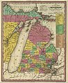 1836 Michigan.jpg 1,760 × 2,158; 3.48 MB
-
 Map of Michigan and Part of Wisconsin Territory WDL9603.png 1,376 × 1,024; 2.23 MB
-
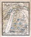 Map of Michigan (1831) DH Burr.jpg 3,511 × 4,158; 4.8 MB
-


_DH_Burr.jpg)
