Category:1840s maps of Berlin
Jump to navigation
Jump to search
|
Federal states of Germany: |
Subcategories
This category has the following 2 subcategories, out of 2 total.
- 1842 maps of Berlin (3 F)
- 1846 maps of Berlin (3 F)
Media in category "1840s maps of Berlin"
The following 22 files are in this category, out of 22 total.
-
 Herzberg Grundriss von Berlin 1840.jpg 7,045 × 5,530; 13.61 MB
-
 Urmesstischblatt 3446 (Berlin Nord) um 1840 (Panke Luisenbrunnen).jpg 1,348 × 1,337; 991 KB
-
 Urmesstischblatt 3446 (Berlin Nord) um 1840 (Panke).jpg 2,167 × 1,571; 1.79 MB
-
 Urmesstischblatt 3446 (Berlin Nord) um 1840.jpg 4,429 × 4,399; 6.79 MB
-
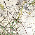
 Urmesstischblatt 3446 (Berlin Nord) um 1840; Berlin-Reinickendorf (cropped).jpg 1,269 × 1,117; 739 KB
-
 Morin Plan von Berlin 1841.jpg 3,896 × 3,024; 4.29 MB
-
 Plan von Berlin - no-nb krt 00773.jpg 9,400 × 7,784; 28.17 MB
-
 Selter Grundriss von Berlin 1841.jpg 2,048 × 1,536; 2.98 MB
-
 Morin Plan von Berlin 1843.jpg 4,328 × 2,952; 4.32 MB
-
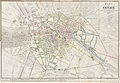
 BECHSTEIN(1843) p016 Plan der Königlichen Residenz-Stadt Berlin.jpg 4,566 × 2,982; 6.93 MB
-
 Morin Plan von Berlin 1844.jpg 2,274 × 1,613; 875 KB
-
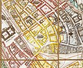 Selter Grundriss von Berlin 1846 (Nikolaiviertel).jpg 2,054 × 1,676; 1.77 MB
-
 Selter Grundriss von Berlin 1846.jpg 11,465 × 8,387; 20.58 MB
-
 Schroeder Plan von Berlin 1847.jpg 9,128 × 6,312; 13.65 MB
-
 Berlin 1847 Detail.jpg 1,545 × 1,466; 1.14 MB
-
 Morin Plan von Berlin 1847.jpg 7,200 × 4,288; 14.35 MB
-
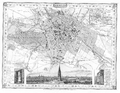 Berlin und Umgegend Karte Hildburghausen 1848.png 4,190 × 3,242; 13.38 MB
-
 Jättnig Plan von Berlin 1848.jpg 10,517 × 8,191; 21.48 MB
-
 1849 Berlin public libraries map HouseOfCommonsSelectCommittee.jpg 2,100 × 1,296; 584 KB
-
 Boehm Grundriss von Berlin mit nächster Umgebung 1849 (Panke u Neue Panke).jpg 2,416 × 2,522; 2.5 MB
-
 Boehm Grundriss von Berlin mit nächster Umgebung 1849.jpg 10,639 × 9,628; 25.65 MB
-
 Plan von Berlin - no-nb krt 00777.jpg 6,320 × 4,592; 12.07 MB

_um_1840_(Panke_Luisenbrunnen).jpg)
_um_1840_(Panke).jpg)
_um_1840.jpg)
_um_1840;_Berlin-Reinickendorf_(cropped).jpg)


_p016_Plan_der_K%C3%B6niglichen_Residenz-Stadt_Berlin.jpg)

.jpg)


.jpg)

