Category:1890 maps of Texas
Jump to navigation
Jump to search
States of the United States: California · Connecticut · Florida · Georgia · Hawaii · Idaho · Illinois · Indiana · Iowa · Kansas · Kentucky · Louisiana · Maine · Maryland · Massachusetts · Michigan · Minnesota · Mississippi · Missouri · Montana · Nevada · New Hampshire · New Jersey · New Mexico · New York · North Carolina · North Dakota · Ohio · Oklahoma · Oregon · Pennsylvania · Rhode Island · South Carolina · South Dakota · Texas · Utah · Vermont · Virginia · Washington · West Virginia · Wisconsin · Wyoming – Washington, D.C.
| ← 1890 1891 1892 1893 1894 1895 1896 1897 1898 1899 → |
Subcategories
This category has the following 6 subcategories, out of 6 total.
S
Media in category "1890 maps of Texas"
The following 35 files are in this category, out of 35 total.
-
 Abraham Lincoln; a history (1890) (14760352404).jpg 1,426 × 1,546; 585 KB
-
 Alvord, Texas. LOC 76696209.jpg 6,576 × 4,152; 5.54 MB
-
 Alvord, Texas. LOC 76696209.tif 6,576 × 4,152; 78.12 MB
-
 Sanborn Fire Insurance Map from Athens, Henderson County, Texas. LOC sanborn08413 002.jpg 6,586 × 7,778; 4.24 MB
-
 Sanborn Fire Insurance Map from Athens, Henderson County, Texas. LOC sanborn08413 002.tif 6,586 × 7,778; 146.56 MB
-
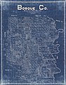 Bosque County LOC 2012592009.jpg 11,504 × 14,630; 27.39 MB
-
 Childress, Texas 1890 LOC gm70000620.jpg 5,888 × 4,160; 4.46 MB
-
 Childress, Texas 1890 LOC gm70000620.tif 5,888 × 4,160; 70.08 MB
-
 Clarendon, Texas, Donley Co. 1890 LOC gm71005383.jpg 8,248 × 5,024; 5.77 MB
-
 Cram Dallas, Texas 1890 UTA.jpg 3,201 × 4,176; 4.85 MB
-
 Hardin County, Texas LOC 2013592008.jpg 6,995 × 6,253; 5.71 MB
-
 Hardin County, Texas LOC 2013592008.tif 6,995 × 6,253; 125.14 MB
-
 Sanborn Fire Insurance Map from La Grange, Fayette County, Texas. LOC sanborn08607 002-1.jpg 6,450 × 7,650; 3.29 MB
-
 Sanborn Fire Insurance Map from La Grange, Fayette County, Texas. LOC sanborn08607 002-1.tif 6,450 × 7,650; 141.17 MB
-
 Sanborn Fire Insurance Map from La Grange, Fayette County, Texas. LOC sanborn08607 002-2.jpg 6,450 × 7,650; 3.66 MB
-
 Sanborn Fire Insurance Map from La Grange, Fayette County, Texas. LOC sanborn08607 002-2.tif 6,450 × 7,650; 141.17 MB
-

-
 Sanborn Fire Insurance Map from La Grange, Fayette County, Texas. LOC sanborn08607 002-3.tif 6,450 × 7,650; 141.17 MB
-
 Sanborn Fire Insurance Map from La Grange, Fayette County, Texas. LOC sanborn08607 002-4.jpg 6,450 × 7,650; 3.22 MB
-
 Sanborn Fire Insurance Map from La Grange, Fayette County, Texas. LOC sanborn08607 002-4.tif 6,450 × 7,650; 141.17 MB
-
 Llano County, state of Texas. LOC 2005625343.jpg 12,761 × 9,453; 15.71 MB
-
 Llano County, Texas LOC 2012590034.jpg 12,319 × 12,575; 29.77 MB
-
 Map of Glasscock County, Texas LOC 2009583509.jpg 7,138 × 8,925; 7.44 MB
-
 Map of Glasscock County, Texas LOC 2009583509.tif 7,138 × 8,925; 182.27 MB
-
 Map of Houston Heights.jpg 748 × 997; 279 KB
-
 Map of the city of Galveston Texas LOC 2015586097.jpg 8,226 × 6,230; 7.2 MB
-
 Map of the city of Galveston Texas LOC 2015586097.tif 8,226 × 6,230; 146.62 MB
-
 Old map-Wichita Falls-1890.jpg 9,259 × 6,309; 11.93 MB
-

-

-

-
 Rullman's map of the city of San Antonio LOC 2009583814.jpg 12,818 × 14,324; 22.93 MB
-
 Rullman's map of the city of San Antonio LOC 2009583814.tif 12,818 × 14,324; 525.3 MB
-
 Sunset, Montague Co., Texas, 1890. LOC 78693267.jpg 6,272 × 3,896; 3.56 MB
-
 Sunset, Montague Co., Texas, 1890. LOC 78693267.tif 6,272 × 3,896; 69.91 MB
_(14760352404).jpg)


.jpg)


