Category:1890 maps of New Jersey
Jump to navigation
Jump to search
States of the United States: California · Connecticut · Florida · Georgia · Idaho · Illinois · Kansas · Kentucky · Louisiana · Maryland · Massachusetts · Michigan · Minnesota · Mississippi · Missouri · Montana · Nevada · New Jersey · New Mexico · New York · North Carolina · Ohio · Oklahoma · Oregon · Pennsylvania · South Carolina · South Dakota · Texas · Utah · Virginia · Washington · West Virginia · Wisconsin · Wyoming – Washington, D.C.
| ← 1890 1891 1892 1895 1896 1897 1898 1899 → |
Subcategories
This category has the following 7 subcategories, out of 7 total.
S
Media in category "1890 maps of New Jersey"
The following 3 files are in this category, out of 3 total.
-
 Colton's road map of Union and Essex counties, New Jersey LOC 2019585057.jpg 6,008 × 6,999; 7.25 MB
-

-
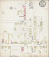 Sanborn Fire Insurance Map from Pennington, Mercer County, New Jersey. LOC sanborn05595 001.tif 6,450 × 7,650; 141.17 MB

