Category:1890 maps of Wisconsin
Jump to navigation
Jump to search
States of the United States: California · Connecticut · Florida · Georgia · Idaho · Illinois · Kansas · Kentucky · Louisiana · Maryland · Michigan · Minnesota · Mississippi · Missouri · Montana · Nevada · New Jersey · New Mexico · New York · North Carolina · Ohio · Oklahoma · Oregon · Pennsylvania · South Carolina · South Dakota · Texas · Utah · Virginia · Washington · West Virginia · Wisconsin · Wyoming – Washington, D.C.
| ← 1890 1891 1892 1893 1894 1895 1896 1897 1898 1899 → |
Subcategories
This category has the following 3 subcategories, out of 3 total.
Media in category "1890 maps of Wisconsin"
The following 9 files are in this category, out of 9 total.
-
 Ashland, Lake Superior, Wis. 1890. LOC 75696702.jpg 12,497 × 7,492; 20.39 MB
-
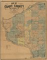 Map of Grant County, Wisconsin LOC 2012593196.jpg 8,078 × 10,444; 10.34 MB
-
 Map of the county of La Crosse, Wisconsin LOC 2012593191.jpg 16,402 × 16,786; 39.68 MB
-

-

-
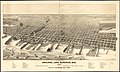
 Perspective map of Beloit, Wis. 1890. LOC 75696704.jpg 9,152 × 6,768; 14.49 MB
-
 Perspective map of Beloit, Wis. 1890. LOC 75696704.tif 9,152 × 6,768; 177.21 MB
-

-


