Category:1920s maps of Sudan
Jump to navigation
Jump to search
Countries of Africa: Algeria · Angola · Democratic Republic of the Congo · Djibouti · Egypt‡ · Ethiopia · Madagascar · Mauritania · Morocco · Nigeria · South Africa · Sudan · Tunisia
‡: partly located in Africa
‡: partly located in Africa
Subcategories
This category has the following 2 subcategories, out of 2 total.
- 1921 maps of Sudan (1 F)
- 1928 maps of Sudan (3 F)
Media in category "1920s maps of Sudan"
The following 4 files are in this category, out of 4 total.
-
 1925 - Africa Orientale - Carta dimostrativa fisico-politica.jpg 15,331 × 16,739; 39.43 MB
-
 Admiralty Chart No 3492 Port Sudan, Published 1929, New Edition 1952.jpg 16,428 × 11,281; 37.19 MB
-
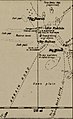 Bir Natrun 1925 Anglo-Egyptian Sudan.jpg 701 × 1,144; 202 KB
-
 Chad-Sudan border 1924.jpg 3,247 × 2,679; 1.51 MB


