Category:1960s maps of Sudan
Jump to navigation
Jump to search
Countries of Africa: Algeria · Angola · Botswana · Chad · Democratic Republic of the Congo · Egypt‡ · Eritrea · Ethiopia · Ghana · Kenya · Liberia · Libya · Madagascar · Malawi · Mali · Mauritania · Morocco · Mozambique · Namibia · Niger · Nigeria · Senegal · Sierra Leone · South Africa · Sudan · Tanzania · Tunisia · Uganda · Zambia · Zimbabwe
‡: partly located in Africa
‡: partly located in Africa
Countries of the Arab world: Algeria · Chad · Egypt · Eritrea · Iraq · Libya · Mauritania · Morocco · State of Palestine · Saudi Arabia · Sudan · Syria · Tunisia
Media in category "1960s maps of Sudan"
The following 14 files are in this category, out of 14 total.
-
 Sudan. LOC 2013588063.jpg 2,338 × 3,001; 874 KB
-
 Sudan. LOC 2013588063.tif 2,338 × 3,001; 20.07 MB
-
 Sudan - local government LOC 2019589289.jpg 6,150 × 8,622; 4.84 MB
-
 Sudan - local government LOC 2019589289.tif 6,150 × 8,622; 151.71 MB
-
 Sudan - administrative and railroads. LOC 2013590437.jpg 4,771 × 5,834; 2.17 MB
-
 Sudan - administrative and railroads. LOC 2013590437.tif 4,771 × 5,834; 79.63 MB
-
 Sudan - terrain and regions. LOC 2013588022.jpg 4,835 × 5,650; 3.22 MB
-
 Sudan - terrain and regions. LOC 2013588022.tif 4,835 × 5,650; 78.16 MB
-
 Sudan. LOC 2001628370.jpg 6,755 × 7,905; 6.73 MB
-
 Sudan. LOC 2001628370.tif 6,755 × 7,905; 152.77 MB
-
 1967 data of Northern African countries.jpg 3,912 × 2,896; 1.49 MB
-
 Deim Zubeir Sheet NB-35-B 1968.jpg 1,507 × 1,179; 249 KB
-
 Central African Republic-Sudan Boundary.jpg 400 × 481; 40 KB
-
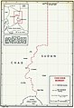 Chad-Sudan boundary map.jpg 665 × 968; 110 KB


