Category:1980s maps of Sudan
Jump to navigation
Jump to search
Countries of Africa: Democratic Republic of the Congo · Egypt‡ · Equatorial Guinea · Eritrea · Ethiopia · Kenya · Malawi · Mauritania · Namibia · Senegal · Sierra Leone · Sudan · Tanzania · Zambia
‡: partly located in Africa
‡: partly located in Africa
Countries of the Arab world: Egypt · Eritrea · Lebanon · Mauritania · State of Palestine · Saudi Arabia · Sudan
Subcategories
This category has the following 3 subcategories, out of 3 total.
- 1983 maps of Sudan (2 F)
- 1986 maps of Sudan (2 F)
- 1989 maps of Sudan (1 F)
Media in category "1980s maps of Sudan"
The following 2 files are in this category, out of 2 total.
-
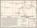 Egypt-Sudan border map.jpg 941 × 718; 207 KB
-
 Sudan - DPLA - 38f4fb8310ad79aa384daced48bd1f2d.jpg 2,552 × 3,276; 6.77 MB

