Category:2020s maps of Massachusetts
Jump to navigation
Jump to search
States of the United States: Alabama · Alaska · Arizona · California · Colorado · Delaware · Florida · Georgia · Hawaii · Idaho · Indiana · Iowa · Kentucky · Louisiana · Maine · Maryland · Massachusetts · Michigan · Nebraska · Nevada · New Jersey · New York · North Carolina · Ohio · Pennsylvania · South Carolina · Tennessee · Texas · Utah · Vermont · Wisconsin · Wyoming – Washington, D.C.
Subcategories
This category has the following 4 subcategories, out of 4 total.
- 2020 maps of Massachusetts (8 F)
- 2022 maps of Massachusetts (empty)
- 2024 maps of Massachusetts (2 F)
B
- 2020s maps of Boston (12 F)
Media in category "2020s maps of Massachusetts"
The following 8 files are in this category, out of 8 total.
-
 Boston Greater Massachusetts US vector Map 24x36 inch svg free.svg 1,728 × 2,592; 32.87 MB
-
 Fitchburg Cutoff modern status map.svg 1,850 × 1,150; 39 KB
-
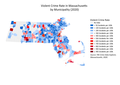 Mass. Municipal Crime Rates.png 3,507 × 2,480; 658 KB
-
 Massachusetts Governor's Council Districts 2021.png 821 × 557; 126 KB
-
 MBTA Commuter Rail Diagram.svg 512 × 568; 1.12 MB
-
 MBTA Silver Line Geographic Map (2022).svg 949 × 900; 618 KB
-
 MBTA Subway Geographic Map (2022).svg 1,600 × 1,069; 953 KB
-
 MW Service Region.png 788 × 466; 60 KB


.svg)
.svg)
