Category:2020s maps of Tennessee
Jump to navigation
Jump to search
States of the United States: Alabama · Alaska · Arizona · California · Colorado · Delaware · Florida · Georgia · Hawaii · Idaho · Indiana · Iowa · Kentucky · Louisiana · Maine · Maryland · Massachusetts · Michigan · Nebraska · Nevada · New Jersey · New York · North Carolina · Ohio · Pennsylvania · Tennessee · Texas · Utah · Vermont · Wyoming – Washington, D.C.
Media in category "2020s maps of Tennessee"
The following 5 files are in this category, out of 5 total.
-
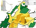
 2021 Chattanooga mayoral election first round.jpg 1,080 × 847; 243 KB
-
 2021 Chattanooga mayoral election runoff.jpg 500 × 388; 238 KB
-
 Alcohol Laws of Tennessee Counties 2022.png 1,986 × 486; 183 KB
-
 Population density of Tennessee counties (2020).png 5,839 × 2,128; 1.39 MB
-
 Tennessee Senate District 2 (2023-).svg 1,480 × 356; 432 KB


.png)
.svg)