Category:2020s maps of New York (state)
Jump to navigation
Jump to search
States of the United States: Alabama · Alaska · Arizona · California · Colorado · Connecticut · Delaware · Florida · Georgia · Hawaii · Idaho · Indiana · Iowa · Kentucky · Louisiana · Maine · Maryland · Massachusetts · Michigan · Nebraska · Nevada · New Jersey · New York · North Carolina · Ohio · Oregon · Pennsylvania · Rhode Island · South Carolina · Tennessee · Texas · Utah · Vermont · Virginia · Washington · Wisconsin · Wyoming – Washington, D.C.
Subcategories
This category has the following 6 subcategories, out of 6 total.
N
Media in category "2020s maps of New York (state)"
The following 2 files are in this category, out of 2 total.
-
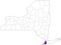 Monkeypox in New York so far.png 633 × 476; 57 KB
-
 Rensselaer, New York Territory Map.svg 744 × 1,052; 439 KB

