Category:Bedford County, Pennsylvania
Saltar para a navegação
Saltar para a pesquisa
Counties of Pennsylvania : Adams · Allegheny · Armstrong · Beaver · Bedford · Berks · Blair · Bradford · Bucks · Butler · Cambria · Cameron · Carbon · Centre · Chester · Clarion · Clearfield · Clinton · Columbia · Crawford · Cumberland · Dauphin · Delaware · Elk · Erie · Fayette · Forest · Franklin · Fulton · Greene · Huntingdon · Indiana · Jefferson · Juniata · Lackawanna · Lancaster · Lawrence · Lebanon · Lehigh · Luzerne · Lycoming · McKean · Mercer · Mifflin · Monroe · Montgomery · Montour · Northampton · Northumberland · Perry · Philadelphia · Pike · Potter · Schuylkill · Snyder · Somerset · Sullivan · Susquehanna · Tioga · Union · Venango · Warren · Washington · Wayne · Westmoreland · Wyoming · York
county in Pennsylvania, United States   | |||||
| Carregar ficheiro | |||||
| Instância de | |||||
|---|---|---|---|---|---|
| Nomeado em referência a | |||||
| Localização | Pensilvânia, EUA | ||||
| Capital | |||||
| Data de criação ou fundação |
| ||||
| População |
| ||||
| Área |
| ||||
| Diferente de | |||||
| sítio web oficial | |||||
 | |||||
Subcategorias
Esta categoria contém as seguintes 13 subcategorias (de um total de 13).
*
G
H
P
S
Multimédia na categoria "Bedford County, Pennsylvania"
Esta categoria contém os seguintes 192 ficheiros (de um total de 192).
-
 2Martinhill.jpg 319 × 213; 43 kB
-
 2WillsMtn. edited.jpg 639 × 327; 274 kB
-
 Beaverdale Region - panoramio (1).jpg 5 184 × 3 456; 8,24 MB
-
 Beaverdale Region - panoramio (10).jpg 5 184 × 3 456; 8,47 MB
-
 Beaverdale Region - panoramio (11).jpg 5 184 × 3 456; 7,69 MB
-
 Beaverdale Region - panoramio (12).jpg 5 184 × 3 456; 7,22 MB
-
 Beaverdale Region - panoramio (13).jpg 5 184 × 3 456; 6,94 MB
-
 Beaverdale Region - panoramio (14).jpg 5 184 × 3 456; 8,01 MB
-
 Beaverdale Region - panoramio (15).jpg 5 184 × 3 456; 7,73 MB
-
 Beaverdale Region - panoramio (16).jpg 5 184 × 3 456; 5,46 MB
-
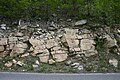
 Bedford County PA Shale.jpg 2 048 × 2 089; 2,3 MB
-
 Bedford Route 30 - panoramio (1).jpg 5 184 × 3 456; 4,12 MB
-
 Bedford Route 30 - panoramio (2).jpg 5 184 × 3 456; 4,1 MB
-
 Bedford Route 30 - panoramio (3).jpg 5 184 × 3 456; 3,95 MB
-
 Bedford Route 56 - panoramio.jpg 5 184 × 3 456; 4,11 MB
-
 Bedford-co-air.jpg 1 024 × 593; 265 kB
-
 Bedford-co-rt30-warrior.jpg 2 046 × 726; 280 kB
-
 Bedford-gaps.jpg 663 × 321; 226 kB
-
 Bedford-thrustfault.jpg 1 231 × 236; 131 kB
-
 Black Valley Branch and Route 326.jpg 6 016 × 4 000; 6,41 MB
-
 Blue Knob Clouds.jpg 2 016 × 1 495; 1,21 MB
-
 Blue Knob Ski Resort - panoramio (113).jpg 5 184 × 3 456; 6,91 MB
-
 Blue Knob Ski Resort - panoramio (114).jpg 5 184 × 3 456; 6,05 MB
-
 Blue Knob Ski Resort - panoramio (115).jpg 5 184 × 3 456; 6,13 MB
-
 Blue Knob Ski Resort - panoramio (116).jpg 5 184 × 3 456; 6,51 MB
-
 Blue Knob Ski Resort - panoramio (118).jpg 5 184 × 3 456; 5,8 MB
-
 Blue Knob Ski Resort - panoramio (119).jpg 5 184 × 3 456; 6,24 MB
-
 Blue Knob Ski Resort Panorama - panoramio (1).jpg 10 241 × 3 142; 15,77 MB
-
 Blue Knob Ski Resort Panorama - panoramio.jpg 9 341 × 3 175; 13,55 MB
-
 Blue Knob Sking - panoramio (1).jpg 1 000 × 1 774; 1,38 MB
-
 Blue Knob Sking - panoramio (2).jpg 1 380 × 2 448; 986 kB
-
 Broad Top Landsat 1.jpg 201 × 311; 71 kB
-
 CCC Camp and Camp Cathedral - panoramio (1).jpg 5 184 × 3 456; 3,89 MB
-
 CCC Camp and Camp Cathedral - panoramio.jpg 5 184 × 3 456; 3,01 MB
-
 Chestnut Ridge Bedford Co aerial.jpg 683 × 519; 203 kB
-
 Chestnut Ridge LC08 L1TP 016032 20161114 20170219 01 T1.jpg 560 × 700; 109 kB
-
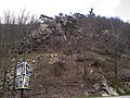
 Chimney rocks.jpg 834 × 717; 157 kB
-
 Cows - panoramio (14).jpg 2 305 × 1 426; 874 kB
-
 Dogwoods, redbuds, … and cows (8748343629).jpg 3 298 × 5 339; 7,67 MB
-
 Dunning Mountain LC08 L1TP 016032 20161114 20170219 01 T1.jpg 600 × 960; 157 kB
-
 Farm - panoramio (32).jpg 5 184 × 3 456; 4,61 MB
-
 Flag of Bedford County, Pennsylvania.gif 360 × 216; 16 kB
-
 Gapsville Pennsylvania.JPG 2 048 × 1 000; 423 kB
-

-
 Ghost mountain.jpg 1 419 × 871; 111 kB
-
 Harrell Shale outcrop Bedford County PA 2006.jpg 3 072 × 2 048; 5,21 MB
-
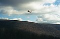 Heli BK.jpg 640 × 420; 134 kB
-
 Herman Point.jpg 2 272 × 1 704; 1,03 MB
-
 Juniata River meander.jpg 870 × 862; 189 kB
-
 Kinton Ice.jpg 1 888 × 1 180; 536 kB
-
 Kinton Knob.jpg 2 272 × 1 704; 870 kB
-
 Kinton.jpg 2 272 × 1 704; 843 kB
-
 Massifcloseup.jpg 2 083 × 678; 130 kB
-
 Miller rd - panoramio.jpg 5 184 × 3 456; 2,63 MB
-
 Morrison Cove from Brumbaugh Road.jpg 6 016 × 4 000; 6,78 MB
-
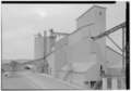
 New Enterprise REMC offices.jpg 6 016 × 4 000; 5,71 MB
-
 New Enterprise school, built 1928.jpg 6 016 × 4 000; 5,71 MB
-
 New Life (9371632057).jpg 5 616 × 3 744; 6,13 MB
-
 Newpariscoral.jpg 493 × 331; 69 kB
-
 North slope.jpg 1 727 × 1 133; 984 kB
-
 Out to Pasture - panoramio.jpg 2 048 × 1 366; 1 006 kB
-

-

-
 Panorama Weather Shot - panoramio (68).jpg 10 896 × 3 153; 20,53 MB
-
 Panorama Weather Shot - panoramio (72).jpg 6 763 × 1 038; 917 kB
-
 Panorama Weather Shot - panoramio (81).jpg 11 656 × 2 133; 3,21 MB
-
 Pavia - panoramio (10).jpg 5 184 × 3 456; 3,14 MB
-
 Pavia vista.jpg 2 272 × 1 704; 871 kB
-
 Pitt Street in Schellsburg.jpg 6 016 × 3 760; 5,39 MB
-
 Pleasantville Sunrise - panoramio (1).jpg 5 184 × 3 456; 6,7 MB
-
 Pleasantville Sunrise - panoramio (2).jpg 5 184 × 3 456; 4,8 MB
-
 Pleasantville Sunrise - panoramio (3).jpg 5 184 × 3 456; 5,78 MB
-
 Pleasantville Sunrise - panoramio.jpg 5 184 × 3 456; 7,53 MB
-
 Raystown Branch of Juniata River in Bedford County 1905.jpg 2 250 × 1 500; 1,33 MB
-
 Retired Army (11784370833).jpg 5 616 × 3 744; 7,53 MB
-
 Riddlesburg town.jpg 2 048 × 1 536; 452 kB
-
 Ritchey Knob.jpg 954 × 714; 210 kB
-
 Road along Raystown Branch Juniata River 1905.png 2 260 × 1 610; 6,9 MB
-
 Route 56 Pleasantville Mountain - panoramio (1).jpg 5 184 × 3 456; 4,18 MB
-
 Route 56 Pleasantville Mountain - panoramio (2).jpg 5 184 × 3 456; 3,99 MB
-
 Route 56 Pleasantville Mountain - panoramio (3).jpg 5 184 × 3 456; 3,19 MB
-
 Route 56 Pleasantville Mountain - panoramio (5).jpg 5 184 × 3 456; 4,05 MB
-
 S.S. Grand View Point Service Station (NBY 1768).jpg 3 296 × 2 076; 787 kB
-
 Seal of Bedford County Pennsylvania.svg 144 × 144; 191 kB
-
 Senic Route late December - panoramio (10).jpg 3 936 × 5 248; 5,43 MB
-
 Senic Route late December - panoramio (100).jpg 3 936 × 5 248; 4,65 MB
-
 Senic Route late December - panoramio (102).jpg 3 936 × 5 248; 3,97 MB
-
 Senic Route late December - panoramio (104).jpg 3 936 × 5 248; 5,03 MB
-
 Senic Route late December - panoramio (109).jpg 3 936 × 5 248; 3,93 MB
-
 Senic Route late December - panoramio (11).jpg 3 936 × 5 248; 5,48 MB
-
 Senic Route late December - panoramio (12).jpg 3 936 × 5 248; 4,61 MB
-
 Senic Route late December - panoramio (13).jpg 3 936 × 5 248; 5,39 MB
-
 Senic Route late December - panoramio (14).jpg 3 936 × 5 248; 4,92 MB
-
 Senic Route late December - panoramio (15).jpg 3 936 × 5 248; 4,4 MB
-
 Senic Route late December - panoramio (16).jpg 3 936 × 5 248; 5,03 MB
-
 Senic Route late December - panoramio (17).jpg 3 936 × 5 248; 5,02 MB
-
 Senic Route late December - panoramio (18).jpg 3 936 × 5 248; 4,85 MB
-
 Senic Route late December - panoramio (19).jpg 3 936 × 5 248; 4,57 MB
-
 Senic Route late December - panoramio (20).jpg 3 936 × 5 248; 6,15 MB
-
 Senic Route late December - panoramio (21).jpg 3 936 × 5 248; 5,11 MB
-
 Senic Route late December - panoramio (22).jpg 3 936 × 5 248; 5,06 MB
-
 Senic Route late December - panoramio (23).jpg 3 936 × 5 248; 5,53 MB
-
 Senic Route late December - panoramio (24).jpg 3 936 × 5 248; 5,22 MB
-
 Senic Route late December - panoramio (25).jpg 3 936 × 5 248; 4,28 MB
-
 Senic Route late December - panoramio (26).jpg 3 936 × 5 248; 3,39 MB
-
 Senic Route late December - panoramio (27).jpg 3 936 × 5 248; 4,3 MB
-
 Senic Route late December - panoramio (28).jpg 3 936 × 5 248; 5,08 MB
-
 Senic Route late December - panoramio (29).jpg 3 936 × 5 248; 4,3 MB
-
 Senic Route late December - panoramio (30).jpg 3 936 × 5 248; 5,44 MB
-
 Senic Route late December - panoramio (31).jpg 3 936 × 5 248; 4,08 MB
-
 Senic Route late December - panoramio (32).jpg 3 936 × 5 248; 5,25 MB
-
 Senic Route late December - panoramio (33).jpg 3 936 × 5 248; 5,48 MB
-
 Senic Route late December - panoramio (34).jpg 3 936 × 5 248; 4,08 MB
-
 Senic Route late December - panoramio (35).jpg 3 936 × 5 248; 4,31 MB
-
 Senic Route late December - panoramio (36).jpg 3 936 × 5 248; 4,2 MB
-
 Senic Route late December - panoramio (37).jpg 3 936 × 5 248; 4,48 MB
-
 Senic Route late December - panoramio (38).jpg 3 936 × 5 248; 4,46 MB
-
 Senic Route late December - panoramio (39).jpg 3 936 × 5 248; 4,37 MB
-
 Senic Route late December - panoramio (40).jpg 3 936 × 5 248; 4,31 MB
-
 Senic Route late December - panoramio (41).jpg 3 936 × 5 248; 4,27 MB
-
 Senic Route late December - panoramio (42).jpg 3 936 × 5 248; 4,11 MB
-
 Senic Route late December - panoramio (43).jpg 3 936 × 5 248; 4,16 MB
-
 Senic Route late December - panoramio (44).jpg 3 936 × 5 248; 4,18 MB
-
 Senic Route late December - panoramio (45).jpg 3 936 × 5 248; 4,37 MB
-
 Senic Route late December - panoramio (46).jpg 3 936 × 5 248; 4,95 MB
-
 Senic Route late December - panoramio (47).jpg 3 936 × 5 248; 4,31 MB
-
 Senic Route late December - panoramio (48).jpg 3 936 × 5 248; 4,16 MB
-
 Senic Route late December - panoramio (49).jpg 3 936 × 5 248; 4,67 MB
-
 Senic Route late December - panoramio (5).jpg 3 936 × 5 248; 5,37 MB
-
 Senic Route late December - panoramio (50).jpg 3 936 × 5 248; 4,28 MB
-
 Senic Route late December - panoramio (52).jpg 3 936 × 5 248; 4,29 MB
-
 Senic Route late December - panoramio (53).jpg 3 936 × 5 248; 4,47 MB
-
 Senic Route late December - panoramio (56).jpg 3 936 × 5 248; 4,66 MB
-
 Senic Route late December - panoramio (57).jpg 3 936 × 5 248; 5,18 MB
-
 Senic Route late December - panoramio (58).jpg 3 936 × 5 248; 4,73 MB
-
 Senic Route late December - panoramio (6).jpg 3 936 × 5 248; 5,67 MB
-
 Senic Route late December - panoramio (60).jpg 3 936 × 5 248; 5,01 MB
-
 Senic Route late December - panoramio (61).jpg 3 936 × 5 248; 4,45 MB
-
 Senic Route late December - panoramio (62).jpg 3 936 × 5 248; 4,4 MB
-
 Senic Route late December - panoramio (63).jpg 3 936 × 5 248; 5,26 MB
-
 Senic Route late December - panoramio (64).jpg 3 936 × 5 248; 5,27 MB
-
 Senic Route late December - panoramio (65).jpg 3 936 × 5 248; 4,07 MB
-
 Senic Route late December - panoramio (66).jpg 3 936 × 5 248; 4,21 MB
-
 Senic Route late December - panoramio (67).jpg 3 936 × 5 248; 4,57 MB
-
 Senic Route late December - panoramio (68).jpg 3 936 × 5 248; 4,88 MB
-
 Senic Route late December - panoramio (69).jpg 3 936 × 5 248; 4,19 MB
-
 Senic Route late December - panoramio (70).jpg 3 936 × 5 248; 4,46 MB
-
 Senic Route late December - panoramio (71).jpg 3 936 × 5 248; 4,79 MB
-
 Senic Route late December - panoramio (72).jpg 3 936 × 5 248; 4,46 MB
-
 Senic Route late December - panoramio (73).jpg 3 936 × 5 248; 4,63 MB
-
 Senic Route late December - panoramio (74).jpg 3 936 × 5 248; 4,65 MB
-
 Senic Route late December - panoramio (75).jpg 3 936 × 5 248; 4,69 MB
-
 Senic Route late December - panoramio (76).jpg 3 936 × 5 248; 4,37 MB
-
 Senic Route late December - panoramio (77).jpg 3 936 × 5 248; 4,55 MB
-
 Senic Route late December - panoramio (78).jpg 3 936 × 5 248; 4,44 MB
-
 Senic Route late December - panoramio (79).jpg 3 936 × 5 248; 4,4 MB
-
 Senic Route late December - panoramio (80).jpg 3 936 × 5 248; 5,09 MB
-
 Senic Route late December - panoramio (82).jpg 3 936 × 5 248; 4,04 MB
-
 Senic Route late December - panoramio (83).jpg 3 936 × 5 248; 4,47 MB
-
 Senic Route late December - panoramio (84).jpg 3 936 × 5 248; 4,67 MB
-
 Senic Route late December - panoramio (85).jpg 3 936 × 5 248; 5,18 MB
-
 Senic Route late December - panoramio (88).jpg 3 936 × 5 248; 4,43 MB
-
 Senic Route late December - panoramio (9).jpg 3 936 × 5 248; 5,1 MB
-
 Senic Route late December - panoramio (92).jpg 3 936 × 5 248; 5,3 MB
-
 Senic Route late December - panoramio (95).jpg 3 936 × 5 248; 5,05 MB
-
 Shawnee Lake 1VBKT00010038.jpg 2 220 × 2 140; 1,56 MB
-
 Shawnee State Park Pennsylvania Paddling.jpg 650 × 487; 69 kB
-
 Sinking Valley LC08 L1TP 016032 20161114 20170219 01 T1.jpg 740 × 800; 156 kB
-
 Snake Spring valley LC08 L1TP 016032 20161114 20170219 01 T1.jpg 440 × 560; 67 kB
-
 The View - panoramio (6).jpg 5 184 × 3 456; 2,98 MB
-

-
 Treelined - panoramio.jpg 5 184 × 3 456; 6,26 MB
-
 Tuscarora Formation outcrop Bedford County PA 2006.jpg 3 072 × 2 048; 4,64 MB
-
 Tuscarora Tussey Everett.jpg 2 048 × 1 536; 911 kB
-
 Tussey.jpg 2 272 × 1 704; 844 kB
-
 USA Bedford County, Pennsylvania age pyramid.svg 520 × 600; 7 kB
-

-

-
-

-

-

-
 Village - panoramio (19).jpg 3 456 × 2 304; 4,54 MB
-
 Vintage Route 30 Heading East sept 2016 - panoramio - Ron Shawley (193).jpg 3 936 × 5 248; 6,23 MB
-
 Westface.jpg 1 409 × 989; 614 kB
-
 Wild Dogwood (11724810364).jpg 5 616 × 3 744; 5,86 MB
-
 Wild Dogwood (11724840924).jpg 5 616 × 3 744; 6,52 MB
-
 Wild Dogwoods (9379547341).jpg 4 792 × 2 960; 4,18 MB
-
 Wills Mountain LC08 L1TP 016032 20161114 20170219 01 T1.jpg 900 × 1 480; 347 kB
-
 Wills Mtn night.jpg 869 × 575; 99 kB
-
 Windswept days of September at Jean Bonnet Tavern.jpg 4 928 × 3 264; 4,02 MB
-
 Wooded stretch through Bedford County on the Pennsylvania Turnpike (85099).jpg 3 265 × 2 100; 2,9 MB


.jpg)
.jpg)
.jpg)
.jpg)
.jpg)
.jpg)
.jpg)
.jpg)

.jpg)
.jpg)
.jpg)


.jpg)
.jpg)
.jpg)
.jpg)
.jpg)
.jpg)
.jpg)
.jpg)

.jpg)


.jpg)
.jpg)

.jpg)


.jpg)


.jpg)
.jpg)
.jpg)


.jpg)
.jpg)
.jpg)


.jpg)


.jpg)
.jpg)
.jpg)
.jpg)
.jpg)

.jpg)
.jpg)
.jpg)
.jpg)
.jpg)
.jpg)
.jpg)
.jpg)
.jpg)
.jpg)
.jpg)
.jpg)
.jpg)
.jpg)
.jpg)
.jpg)
.jpg)
.jpg)
.jpg)
.jpg)
.jpg)
.jpg)
.jpg)
.jpg)
.jpg)
.jpg)
.jpg)
.jpg)
.jpg)
.jpg)
.jpg)
.jpg)
.jpg)
.jpg)
.jpg)
.jpg)
.jpg)
.jpg)
.jpg)
.jpg)
.jpg)
.jpg)
.jpg)
.jpg)
.jpg)
.jpg)
.jpg)
.jpg)
.jpg)
.jpg)
.jpg)
.jpg)
.jpg)
.jpg)
.jpg)
.jpg)
.jpg)
.jpg)
.jpg)
.jpg)
.jpg)
.jpg)
.jpg)
.jpg)
.jpg)
.jpg)
.jpg)
.jpg)
.jpg)
.jpg)
.jpg)
.jpg)
.jpg)
.jpg)
.jpg)
.jpg)
.jpg)
.jpg)
.jpg)
.jpg)
.jpg)


.jpg)


.jpg)
.jpg)

.jpg)
.jpg)
.jpg)


.jpg)
.jpg)
.jpg)
.jpg)
.jpg)