Category:Montour County, Pennsylvania
Jump to navigation
Jump to search
Counties of Pennsylvania : Adams · Allegheny · Armstrong · Beaver · Bedford · Berks · Blair · Bradford · Bucks · Butler · Cambria · Cameron · Carbon · Centre · Chester · Clarion · Clearfield · Clinton · Columbia · Crawford · Cumberland · Dauphin · Delaware · Elk · Erie · Fayette · Forest · Franklin · Fulton · Greene · Huntingdon · Indiana · Jefferson · Juniata · Lackawanna · Lancaster · Lawrence · Lebanon · Lehigh · Luzerne · Lycoming · McKean · Mercer · Mifflin · Monroe · Montgomery · Montour · Northampton · Northumberland · Perry · Philadelphia · Pike · Potter · Schuylkill · Snyder · Somerset · Sullivan · Susquehanna · Tioga · Union · Venango · Warren · Washington · Wayne · Westmoreland · Wyoming · York
county in Pennsylvania, United States   | |||||
| Upload media | |||||
| Instance of | |||||
|---|---|---|---|---|---|
| Named after |
| ||||
| Location | Pennsylvania | ||||
| Capital | |||||
| Inception |
| ||||
| Population |
| ||||
| Area |
| ||||
| official website | |||||
 | |||||
Subcategories
This category has the following 14 subcategories, out of 14 total.
E
H
N
P
T
Media in category "Montour County, Pennsylvania"
The following 49 files are in this category, out of 49 total.
-
 Bald Top.JPG 2,256 × 1,504; 1.93 MB
-
 Beaver Run looking downstream in Liberty Township.JPG 2,056 × 3,088; 1.92 MB
-
 Chillisquaque Creek looking downstream at the Gottlieb Brown Covered Bridge.JPG 3,088 × 2,056; 1.98 MB
-
 Chillisquaque Creek looking downstream north of Washingtonville.JPG 3,088 × 2,056; 2.22 MB
-
 Chillisquaque Creek near Washingtonville 1.JPG 2,256 × 1,504; 2.39 MB
-
 Chillisquaque Creek near Washingtonville 2.JPG 2,256 × 1,504; 2.45 MB
-
 Chillisquaque Creek.JPG 2,048 × 1,536; 1.33 MB
-
 Cliff on Roaring Creek.JPG 2,256 × 1,504; 3 MB
-
 Danville and Mahoning Township, Montour County, Pennsylvania.JPG 3,264 × 2,448; 2.26 MB
-
 East Branch Chillisquaque Creek in the summer 1.JPG 2,256 × 1,504; 2.58 MB
-
 East Branch Chillisquaque Creek in the summer 2.JPG 2,256 × 1,504; 2.38 MB
-
 Field in Anthony Township, Montour County, Pennsylvania 2.JPG 2,256 × 1,504; 2.09 MB
-
 Irrigation ditch in Montour County, Pennsylvania.JPG 2,056 × 3,088; 2.01 MB
-
 J. Manley Robbins Trail.JPG 2,256 × 1,504; 2.66 MB
-
 Kase Run looking downstream.JPG 2,256 × 1,504; 2.89 MB
-
 Kase Run looking upstream.JPG 2,256 × 1,504; 2.93 MB
-
 Limestone Run looking downstream.JPG 2,056 × 3,088; 2.05 MB
-
 Little Roaring Creek.JPG 2,256 × 1,504; 3.57 MB
-
 Map of Pennsylvania highlighting Montour County.svg 4,950 × 2,846; 106 KB
-
 Mauses Creek looking downstream.JPG 2,256 × 1,504; 3.21 MB
-
 Mauses Creek looking upstream.JPG 2,256 × 1,504; 2.83 MB
-
 McKee Run (cropped).JPG 1,733 × 1,328; 1.35 MB
-
 McKee Run.JPG 2,256 × 1,504; 2.01 MB
-
 Middle Branch Chillisquaque Creek in July 2015.jpg 3,088 × 2,056; 2.22 MB
-
 Middle Branch Chillisquaque Creek.JPG 2,256 × 1,504; 2.83 MB
-
 Montour Ridge from Clinic Road.JPG 2,256 × 1,504; 2.07 MB
-
 Montour Ridge.JPG 3,088 × 2,056; 1.5 MB
-
 PA-44 map.svg 1,475 × 860; 910 KB
-
 Pennsylvania Route 54 north of Danville.JPG 2,256 × 1,504; 2.4 MB
-
 Pennsylvania Route 642 looking north.JPG 1,504 × 2,256; 1.86 MB
-
 Pennsylvania Route 642 looking south.JPG 1,504 × 2,256; 1.87 MB
-
 Roaring Creek looking downstream near its mouth.JPG 2,256 × 1,504; 2.57 MB
-
 Roaring Creek looking upstream near its mouth.JPG 1,504 × 2,256; 2.8 MB
-
 Sechler Run looking downstream in Mechanicsville.JPG 2,256 × 1,504; 2.91 MB
-
 Sechler Run looking upstream in Mechanicsville.JPG 2,256 × 1,504; 2.71 MB
-
 Sechler Run.JPG 2,442 × 3,122; 2.96 MB
-
 Side of the Chillisquaque Dam.JPG 2,256 × 1,504; 2.31 MB
-
 Soybean field in Anthony Township, Montour County, Pennsylvania.JPG 2,256 × 1,504; 1.87 MB
-
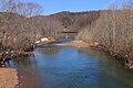
 Susquehanna River in Danville.JPG 2,199 × 1,504; 1.43 MB
-
 Susquehanna River in late March.JPG 2,256 × 1,504; 2.6 MB
-
 Toby Run looking upstream in March (2).JPG 1,504 × 2,256; 3.1 MB
-
 USA Montour County, Pennsylvania age pyramid.svg 520 × 600; 7 KB
-
 View of northern Montour County, Pennsylvania.JPG 3,088 × 2,056; 1.63 MB
-
 West Branch Chillisquaque Creek in the summer.JPG 2,256 × 1,504; 2.37 MB
-
 West Branch Chillisquaque Creek.JPG 2,448 × 3,264; 2.88 MB
-
 West Branch Chillisquauqe Creek satellite map.PNG 252 × 386; 238 KB
-
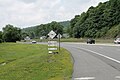
 Westbound (4) (15578006345).jpg 3,971 × 1,977; 5.28 MB
-
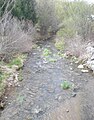
 White Hall Creek looking downstream.JPG 2,056 × 3,088; 2.56 MB
-
 White Hall Creek looking upstream.JPG 2,056 × 3,088; 3.45 MB


.JPG)


.JPG)


_(15578006345).jpg)

