Category:Westmoreland County, Pennsylvania
Jump to navigation
Jump to search
Counties of Pennsylvania : Adams · Allegheny · Armstrong · Beaver · Bedford · Berks · Blair · Bradford · Bucks · Butler · Cambria · Cameron · Carbon · Centre · Chester · Clarion · Clearfield · Clinton · Columbia · Crawford · Cumberland · Dauphin · Delaware · Elk · Erie · Fayette · Forest · Franklin · Fulton · Greene · Huntingdon · Indiana · Jefferson · Juniata · Lackawanna · Lancaster · Lawrence · Lebanon · Lehigh · Luzerne · Lycoming · McKean · Mercer · Mifflin · Monroe · Montgomery · Montour · Northampton · Northumberland · Perry · Philadelphia · Pike · Potter · Schuylkill · Snyder · Somerset · Sullivan · Susquehanna · Tioga · Union · Venango · Warren · Washington · Wayne · Westmoreland · Wyoming · York
county in Pennsylvania, United States   | |||||
| Upload media | |||||
| Instance of | |||||
|---|---|---|---|---|---|
| Named after | |||||
| Location | Pennsylvania | ||||
| Capital | |||||
| Inception |
| ||||
| Population |
| ||||
| Area |
| ||||
| Different from | |||||
| official website | |||||
 | |||||
Subcategories
This category has the following 21 subcategories, out of 21 total.
*
A
- Antiochian Village (12 F)
E
F
- Five Star Trail (16 F)
G
H
I
- Idlewild and Soak Zone (7 F)
N
P
R
S
T
W
Media in category "Westmoreland County, Pennsylvania"
The following 200 files are in this category, out of 317 total.
(previous page) (next page)-

-

-
 A. & H.S. Overholt Company Distillery, Frick Avenue, West Overton, Westmoreland County, PA 7.tif 5,000 × 3,979; 18.98 MB
-

-

-

-

-

-

-

-
-

-

-

-

-
 Arctic Cat HDX 700 XT EPS.jpg 3,264 × 2,448; 4.51 MB
-
 Barbra Paul In Scottdale, Pennsylvania (7408259830).jpg 600 × 397; 143 KB
-
 BigMacMuseum.jpg 1,133 × 789; 357 KB
-
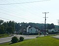
 Blue Spruce mall Murrysville from US 22 jeh.jpg 4,604 × 2,589; 1.8 MB
-
 Borough of Export Flood Protection Project April 2016.jpg 3,264 × 1,836; 2.68 MB
-
 Chestnut Ridge (28775317652).jpg 3,286 × 2,432; 2.85 MB
-
 Conemaugh Gap Early Fall 2016 - panoramio - Ron Shawley (1).jpg 3,936 × 5,248; 5.44 MB
-
 Conemaugh Gap Early Fall 2016 - panoramio - Ron Shawley (10).jpg 3,936 × 5,248; 6.25 MB
-
 Conemaugh Gap Early Fall 2016 - panoramio - Ron Shawley (11).jpg 3,936 × 5,248; 6.55 MB
-
 Conemaugh Gap Early Fall 2016 - panoramio - Ron Shawley (12).jpg 3,936 × 5,248; 6.79 MB
-
 Conemaugh Gap Early Fall 2016 - panoramio - Ron Shawley (13).jpg 3,936 × 5,248; 10.6 MB
-
 Conemaugh Gap Early Fall 2016 - panoramio - Ron Shawley (14).jpg 3,936 × 5,248; 9.91 MB
-
 Conemaugh Gap Early Fall 2016 - panoramio - Ron Shawley (15).jpg 3,936 × 5,248; 10.9 MB
-
 Conemaugh Gap Early Fall 2016 - panoramio - Ron Shawley (16).jpg 3,936 × 5,248; 10.56 MB
-
 Conemaugh Gap Early Fall 2016 - panoramio - Ron Shawley (17).jpg 3,936 × 5,248; 11.01 MB
-
 Conemaugh Gap Early Fall 2016 - panoramio - Ron Shawley (18).jpg 3,936 × 5,248; 11.66 MB
-
 Conemaugh Gap Early Fall 2016 - panoramio - Ron Shawley (19).jpg 3,936 × 5,248; 12.09 MB
-
 Conemaugh Gap Early Fall 2016 - panoramio - Ron Shawley (2).jpg 3,936 × 5,248; 6.56 MB
-
 Conemaugh Gap Early Fall 2016 - panoramio - Ron Shawley (20).jpg 3,936 × 5,248; 10.32 MB
-
 Conemaugh Gap Early Fall 2016 - panoramio - Ron Shawley (21).jpg 3,936 × 5,248; 10.68 MB
-
 Conemaugh Gap Early Fall 2016 - panoramio - Ron Shawley (22).jpg 3,936 × 5,248; 9.64 MB
-
 Conemaugh Gap Early Fall 2016 - panoramio - Ron Shawley (23).jpg 3,936 × 5,248; 9.72 MB
-
 Conemaugh Gap Early Fall 2016 - panoramio - Ron Shawley (24).jpg 3,936 × 5,248; 6.19 MB
-
 Conemaugh Gap Early Fall 2016 - panoramio - Ron Shawley (26).jpg 3,936 × 5,248; 7.31 MB
-
 Conemaugh Gap Early Fall 2016 - panoramio - Ron Shawley (27).jpg 3,936 × 5,248; 9.37 MB
-
 Conemaugh Gap Early Fall 2016 - panoramio - Ron Shawley (28).jpg 3,936 × 5,248; 9.7 MB
-
 Conemaugh Gap Early Fall 2016 - panoramio - Ron Shawley (29).jpg 3,936 × 5,248; 10.22 MB
-
 Conemaugh River viaduct near New Florence.jpg 6,016 × 4,000; 6.37 MB
-
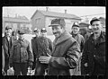
 Construction worker on the Westmoreland subsistence homestead project, 8c52044u.tif 4,871 × 6,046; 28.09 MB
-
 Construction worker on the Westmoreland subsistence homestead project.jpg 4,408 × 5,176; 8.86 MB
-
 Country market - panoramio.jpg 5,184 × 3,456; 2.5 MB
-
 Crabtree Pennsylvania USA Route 119.jpg 602 × 392; 116 KB
-
 Deep Woods - panoramio (1).jpg 3,936 × 5,248; 2.66 MB
-
 Deep Woods - panoramio (10).jpg 3,936 × 5,248; 8.88 MB
-
 Deep Woods - panoramio (11).jpg 3,936 × 5,248; 10.14 MB
-
 Deep Woods - panoramio (12).jpg 3,936 × 5,248; 9.83 MB
-
 Deep Woods - panoramio (13).jpg 3,936 × 5,248; 8.1 MB
-
 Deep Woods - panoramio (14).jpg 3,936 × 5,248; 8.64 MB
-
 Deep Woods - panoramio (15).jpg 3,936 × 5,248; 8.73 MB
-
 Deep Woods - panoramio (16).jpg 3,936 × 5,248; 9.12 MB
-
 Deep Woods - panoramio (17).jpg 3,936 × 5,248; 8.69 MB
-
 Deep Woods - panoramio (18).jpg 3,936 × 5,248; 9.39 MB
-
 Deep Woods - panoramio (19).jpg 3,936 × 5,248; 8.91 MB
-
 Deep Woods - panoramio (2).jpg 3,936 × 5,248; 9.51 MB
-
 Deep Woods - panoramio (20).jpg 3,936 × 5,248; 9.74 MB
-
 Deep Woods - panoramio (21).jpg 3,936 × 5,248; 10.6 MB
-
 Deep Woods - panoramio (22).jpg 3,936 × 5,248; 9.14 MB
-
 Deep Woods - panoramio (23).jpg 3,936 × 5,248; 7.79 MB
-
 Deep Woods - panoramio (24).jpg 3,936 × 5,248; 8.41 MB
-
 Deep Woods - panoramio (3).jpg 3,936 × 5,248; 7.48 MB
-
 Deep Woods - panoramio (4).jpg 3,936 × 5,248; 10.7 MB
-
 Deep Woods - panoramio (5).jpg 3,936 × 5,248; 10.67 MB
-
 Deep Woods - panoramio (6).jpg 3,936 × 5,248; 10.73 MB
-
 Deep Woods - panoramio (7).jpg 3,936 × 5,248; 8.11 MB
-
 Deep Woods - panoramio (8).jpg 3,936 × 5,248; 10.35 MB
-
 Deep Woods - panoramio (9).jpg 3,936 × 5,248; 9.49 MB
-
 Deep Woods - panoramio.jpg 3,936 × 5,248; 3.06 MB
-
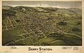 Derry Station PA 1900 BEye View.jpg 7,104 × 4,480; 8.01 MB
-
 Detail of remains of coal mine fan house.jpg 4,320 × 3,240; 6.05 MB
-
 Donegal Turnpike Interchange.jpg 960 × 630; 133 KB
-
 Early Fall 2016 - panoramio - Ron Shawley (33).jpg 3,936 × 5,248; 7.66 MB
-
 Early Fall 2016 - panoramio - Ron Shawley (34).jpg 3,936 × 5,248; 5.23 MB
-
 Early Fall 2016 - panoramio - Ron Shawley (35).jpg 3,936 × 5,248; 5.54 MB
-
 Early Fall 2016 - panoramio - Ron Shawley (36).jpg 3,936 × 5,248; 5.35 MB
-
 Early Fall 2016 - panoramio - Ron Shawley (37).jpg 3,936 × 5,248; 5.09 MB
-
 Early Fall 2016 - panoramio - Ron Shawley (38).jpg 3,936 × 5,248; 6.52 MB
-
 Early Fall 2016 - panoramio - Ron Shawley (39).jpg 3,936 × 5,248; 7.35 MB
-
 Early Fall 2016 - panoramio - Ron Shawley (40).jpg 3,936 × 5,248; 5.46 MB
-
 Early Fall 2016 - panoramio - Ron Shawley (41).jpg 3,936 × 5,248; 6.25 MB
-
 Early Fall 2016 - panoramio - Ron Shawley (42).jpg 3,936 × 5,248; 5.57 MB
-
 Early Fall 2016 - panoramio - Ron Shawley (43).jpg 3,936 × 5,248; 6.66 MB
-
 Early Fall 2016 - panoramio - Ron Shawley (44).jpg 3,936 × 5,248; 7.86 MB
-
 Early Fall 2016 - panoramio - Ron Shawley (45).jpg 3,936 × 5,248; 6.41 MB
-
 Early Fall 2016 - panoramio - Ron Shawley (46).jpg 3,936 × 5,248; 7.93 MB
-
 Early Fall 2016 - panoramio - Ron Shawley (47).jpg 3,936 × 5,248; 8.5 MB
-
 Early Fall 2016 - panoramio - Ron Shawley (48).jpg 3,936 × 5,248; 7.84 MB
-
 Early Fall 2016 - panoramio - Ron Shawley (49).jpg 3,936 × 5,248; 7.18 MB
-
 Early Fall 2016 - panoramio - Ron Shawley (50).jpg 3,936 × 5,248; 7.27 MB
-
 East Huntingdon fields from Hodge Road.jpg 6,016 × 4,000; 7.26 MB
-
 Exits Zero A-B (31157983976).jpg 2,400 × 1,600; 1.39 MB
-
 Export caboose Jan 2016.jpg 3,264 × 1,836; 3.02 MB
-
 Faith Lutheran Ch New Florence, PA jeh.jpg 2,321 × 1,306; 344 KB
-
 Fall - panoramio - Ron Shawley (1).jpg 1,920 × 1,080; 1.71 MB
-
 Fall season - panoramio.jpg 1,920 × 1,080; 1.65 MB
-
 First Home of Collinsburg Band.jpg 3,654 × 1,971; 2.23 MB
-
 Forbes rd houses.png 1,489 × 827; 1.56 MB
-
 Forbes rd hugus st.jpg 2,048 × 1,536; 797 KB
-

-

-
-

-
-

-

-
 Greensburg Junction (P.9058.46).png 5,547 × 3,355; 34.69 MB
-

-

-

-

-

-

-
-

-

-

-

-
-

-

-

-

-

-
-

-

-

-

-

-

-

-

-

-

-
-

-
-

-
-

-

-

-

-

-

-

-
-
-

-

-

-
-

-
 Horse Farm.jpg 640 × 254; 76 KB
-
 Hunker Pennsylvania 2010.jpg 2,834 × 1,948; 2.27 MB
-

-
 It's a thing of beauty - panoramio.jpg 1,920 × 1,080; 1.9 MB
-
 Laurel Highlands - Linn Run Road.jpg 810 × 1,024; 355 KB
-
 Laurel Mountain on fire tower looking west - panoramio.jpg 1,007 × 663; 284 KB
-
 Laurelhighlandsbanner.jpg 4,288 × 613; 609 KB
-
 Ligonier Valley Library.jpg 4,032 × 3,024; 3.21 MB
-
 Lloydsville Pa 2011.jpg 1,763 × 1,371; 741 KB
-

-

-
 Madison Pennsylvania Main Street 2010.jpg 3,264 × 2,448; 3.76 MB
-
 Main Street Donegal Pennsylvania.jpg 3,264 × 2,448; 3.69 MB
-
 Main Street in West Leechburg.jpg 6,016 × 4,000; 7.07 MB
-
 McKinley from Chambers in East Vandergrift.jpg 6,016 × 4,000; 6.36 MB
-
 Miller's Hill School Mural.jpg 460 × 250; 47 KB
-

-
-

-
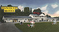 Montique's Motel in Donegal, 1954.jpg 700 × 382; 100 KB
-
 MudBoggingSeptember2007(cropped).jpg 1,993 × 947; 1.75 MB
-
 Murrysville Station c1900.png 2,071 × 1,453; 1.62 MB
-
 Murtha Casey.jpg 400 × 325; 60 KB
-
 New Alexandria from US 22 jeh.jpg 3,988 × 2,243; 1.33 MB
-
 New Florence - panoramio (10).jpg 3,000 × 2,000; 8.14 MB
-
 New Florence - panoramio (2).jpg 5,184 × 3,456; 6.1 MB
-
 New Florence - panoramio (3).jpg 5,184 × 3,456; 5.26 MB
-
 New Florence - panoramio (4).jpg 5,184 × 3,456; 4.87 MB
-
 New Florence - panoramio (5).jpg 5,184 × 3,456; 4.6 MB
-
 New Florence - panoramio (7).jpg 3,000 × 2,000; 8.54 MB
-
 New Florence - panoramio (8).jpg 5,184 × 3,456; 6.93 MB
-
 New Florence - panoramio (9).jpg 5,184 × 3,456; 6.61 MB
-
 New Florence - panoramio.jpg 5,184 × 3,456; 5.92 MB
-
 New Florence PA Presby PHS408.jpg 2,784 × 4,424; 18.98 MB
-
 North Irwin Pennsylvania 2012.jpg 2,534 × 1,699; 1.39 MB
-

-

-
 Original Rolling Rock Bottle.jpg 530 × 1,114; 175 KB
-

-
 P010-DavidAlter.jpg 195 × 259; 16 KB
-

-

-


,_Laughlintown,_Westmoreland_County,_PA_HABS_PA,65-LAULT.V,1-_(sheet_1_of_12).png)
,_Laughlintown,_Westmoreland_County,_PA_HABS_PA,65-LAULT.V,1-_(sheet_10_of_12).png)
,_Laughlintown,_Westmoreland_County,_PA_HABS_PA,65-LAULT.V,1-_(sheet_11_of_12).png)
,_Laughlintown,_Westmoreland_County,_PA_HABS_PA,65-LAULT.V,1-_(sheet_12_of_12).png)
,_Laughlintown,_Westmoreland_County,_PA_HABS_PA,65-LAULT.V,1-_(sheet_2_of_12).png)
,_Laughlintown,_Westmoreland_County,_PA_HABS_PA,65-LAULT.V,1-_(sheet_3_of_12).png)
,_Laughlintown,_Westmoreland_County,_PA_HABS_PA,65-LAULT.V,1-_(sheet_4_of_12).png)
,_Laughlintown,_Westmoreland_County,_PA_HABS_PA,65-LAULT.V,1-_(sheet_5_of_12).png)
,_Laughlintown,_Westmoreland_County,_PA_HABS_PA,65-LAULT.V,1-_(sheet_6_of_12).png)
,_Laughlintown,_Westmoreland_County,_PA_HABS_PA,65-LAULT.V,1-_(sheet_7_of_12).png)
,_Laughlintown,_Westmoreland_County,_PA_HABS_PA,65-LAULT.V,1-_(sheet_8_of_12).png)
,_Laughlintown,_Westmoreland_County,_PA_HABS_PA,65-LAULT.V,1-_(sheet_9_of_12).png)

.jpg)


.jpg)
.jpg)
.jpg)
.jpg)
.jpg)
.jpg)
.jpg)
.jpg)
.jpg)
.jpg)
.jpg)
.jpg)
.jpg)
.jpg)
.jpg)
.jpg)
.jpg)
.jpg)
.jpg)
.jpg)
.jpg)
.jpg)


.jpg)
.jpg)
.jpg)
.jpg)
.jpg)
.jpg)
.jpg)
.jpg)
.jpg)
.jpg)
.jpg)
.jpg)
.jpg)
.jpg)
.jpg)
.jpg)
.jpg)
.jpg)
.jpg)
.jpg)
.jpg)
.jpg)
.jpg)
.jpg)


.jpg)
.jpg)
.jpg)
.jpg)
.jpg)
.jpg)
.jpg)
.jpg)
.jpg)
.jpg)
.jpg)
.jpg)
.jpg)
.jpg)
.jpg)
.jpg)
.jpg)
.jpg)

.jpg)


.jpg)


.png)
.png)


_fsa_8a00946_http-_hdl.loc.gov_loc.pnp_fsa.8a00946.jpg)
_fsa_8a00958_http-_hdl.loc.gov_loc.pnp_fsa.8a00958.jpg)

.jpg)


.jpg)
.jpg)
.jpg)
.jpg)
.jpg)
.jpg)
.jpg)
.jpg)


