Category:Somerset County, Pennsylvania
Jump to navigation
Jump to search
Counties of Pennsylvania : Adams · Allegheny · Armstrong · Beaver · Bedford · Berks · Blair · Bradford · Bucks · Butler · Cambria · Cameron · Carbon · Centre · Chester · Clarion · Clearfield · Clinton · Columbia · Crawford · Cumberland · Dauphin · Delaware · Elk · Erie · Fayette · Forest · Franklin · Fulton · Greene · Huntingdon · Indiana · Jefferson · Juniata · Lackawanna · Lancaster · Lawrence · Lebanon · Lehigh · Luzerne · Lycoming · McKean · Mercer · Mifflin · Monroe · Montgomery · Montour · Northampton · Northumberland · Perry · Philadelphia · Pike · Potter · Schuylkill · Snyder · Somerset · Sullivan · Susquehanna · Tioga · Union · Venango · Warren · Washington · Wayne · Westmoreland · Wyoming · York

county in Pennsylvania, United States   | |||||
| Upload media | |||||
| Instance of | |||||
|---|---|---|---|---|---|
| Named after | |||||
| Location | Pennsylvania | ||||
| Capital | |||||
| Inception |
| ||||
| Highest point | |||||
| Population |
| ||||
| Area |
| ||||
| Different from | |||||
| official website | |||||
 | |||||
Subcategories
This category has the following 19 subcategories, out of 19 total.
Media in category "Somerset County, Pennsylvania"
The following 151 files are in this category, out of 151 total.
-
 7 Springs Mountain resort - panoramio (16).jpg 5,184 × 3,456; 2.62 MB
-
 7 Springs Mountain resort - panoramio (20).jpg 5,184 × 3,456; 3.31 MB
-
 7 Springs Mountain resort - panoramio (23).jpg 5,184 × 3,456; 4.16 MB
-
 7 Springs Mountain resort - panoramio (29).jpg 5,184 × 3,456; 3.84 MB
-
 A Solitary Leaf Endured the Winter (47291820022).jpg 2,048 × 1,366; 2.14 MB
-
 Baltimore and Ohio employees magazine (1912) (14758612301).jpg 4,160 × 2,842; 3.3 MB
-
 Bauchman Rocks - panoramio (2).jpg 5,184 × 3,456; 6.03 MB
-
 Bauchman Rocks - panoramio (5).jpg 5,184 × 3,456; 4.4 MB
-
 Bauchman Rocks - panoramio (7).jpg 5,184 × 3,456; 7.19 MB
-
 Callimont Gameland Road.jpg 6,016 × 4,000; 6.18 MB
-

-

-
-

-
 Casselman Road farm fields.jpg 6,016 × 4,000; 7.17 MB
-
 ColdWet&AlivePutIn.jpg 4,120 × 2,720; 5.47 MB
-
 David Eash In Holsopple, Pennsylvania (6966809508).jpg 400 × 533; 150 KB
-
 Edith Eash And Son In Hollsopple, Pennsylvania (6836058214).jpg 458 × 313; 26 KB
-
 Flag of Somerset County, Pennsylvania.gif 400 × 240; 29 KB
-
 Flight 93 impact site - panoramio.jpg 640 × 480; 48 KB
-
 Flight 93 memorial - panoramio.jpg 640 × 480; 47 KB
-
 Garett Short cut - panoramio (1).jpg 5,184 × 3,456; 6.59 MB
-
 Garett Short cut - panoramio (10).jpg 5,184 × 3,456; 5.72 MB
-
 Garett Short cut - panoramio (11).jpg 5,184 × 3,456; 4.77 MB
-
 Garett Short cut - panoramio (12).jpg 5,184 × 3,456; 4.72 MB
-
 Garett Short cut - panoramio (13).jpg 5,184 × 3,456; 5.18 MB
-
 Garett Short cut - panoramio (14).jpg 5,184 × 3,456; 5.27 MB
-
 Garett Short cut - panoramio (15).jpg 5,184 × 3,456; 5.67 MB
-
 Garett Short cut - panoramio (16).jpg 5,184 × 3,456; 4.66 MB
-
 Garett Short cut - panoramio (17).jpg 5,184 × 3,456; 5.54 MB
-
 Garett Short cut - panoramio (18).jpg 5,184 × 3,456; 5.7 MB
-
 Garett Short cut - panoramio (19).jpg 5,184 × 3,456; 4.98 MB
-
 Garett Short cut - panoramio (2).jpg 5,184 × 3,456; 5.49 MB
-
 Garett Short cut - panoramio (20).jpg 5,184 × 3,456; 5.56 MB
-
 Garett Short cut - panoramio (21).jpg 5,184 × 3,456; 5 MB
-
 Garett Short cut - panoramio (22).jpg 5,184 × 3,456; 6.52 MB
-
 Garett Short cut - panoramio (23).jpg 5,184 × 3,456; 5.75 MB
-
 Garett Short cut - panoramio (24).jpg 5,184 × 3,456; 4.26 MB
-
 Garett Short cut - panoramio (3).jpg 5,184 × 3,456; 5.42 MB
-
 Garett Short cut - panoramio (4).jpg 5,184 × 3,456; 4.39 MB
-
 Garett Short cut - panoramio (5).jpg 5,184 × 3,456; 4.94 MB
-
 Garett Short cut - panoramio (6).jpg 5,184 × 3,456; 5.79 MB
-
 Garett Short cut - panoramio (7).jpg 5,184 × 3,456; 6.02 MB
-
 Garett Short cut - panoramio (8).jpg 5,184 × 3,456; 5.57 MB
-
 Garett Short cut - panoramio (9).jpg 5,184 × 3,456; 4.66 MB
-
 Garett Short cut - panoramio.jpg 5,184 × 3,456; 6.78 MB
-

-

-

-
-
-

-

-

-

-

-

-

-
-

-

-
 Humenik 000066 154529 494120 4578 (35529342473).jpg 1,440 × 1,920; 1.12 MB
-
 Humenik 000067 154530 494116 4578 (36293679756).jpg 1,811 × 1,919; 1.38 MB
-
 Humenik 000068 154531 494112 4578 (36293679506).jpg 1,920 × 1,440; 1.15 MB
-
 Humenik 000069 154532 494111 4578 (36293679106).jpg 1,920 × 1,439; 1.24 MB
-
 Humenik 000070 154533 494100 4578 (36337902625).jpg 1,440 × 1,920; 1.15 MB
-
 Humenik 000071 154534 494098 4578 (36337902235).jpg 1,920 × 780; 691 KB
-
 Humenik 000115 154526 494143 4578 (36337901985).jpg 1,920 × 582; 510 KB
-
 Humenik 000116 154527 494137 4578 (36293678046).jpg 1,920 × 1,440; 999 KB
-
 Humenik 000117 154528 494129 4578 (36293677446).jpg 1,920 × 1,440; 588 KB
-
 Jerome and vicinity 09-12-67.jpg 7,390 × 7,395; 4.24 MB
-
 LHSP CCC Cabin.jpg 3,456 × 2,592; 2.38 MB
-
 LSSP Above the Beam Rocks Overlook.jpg 2,112 × 2,816; 3.55 MB
-
 LSSP Green trials.jpg 2,816 × 2,112; 4.64 MB
-
 Map of the Pittsburgh, Westmoreland and Somerset Railroadd 1913.jpg 3,943 × 4,770; 9.58 MB
-
 Meadow Mountain from Brothersvalley Township.jpg 6,016 × 4,000; 6.98 MB
-
 Meyersdale - panoramio (1).jpg 5,184 × 3,456; 3.98 MB
-
 Meyesdale - panoramio.jpg 5,184 × 3,456; 3.82 MB
-
 Mount Ararat Panorama (46621144274).jpg 8,455 × 2,048; 13.67 MB
-
 Mt Davis Region - panoramio (5).jpg 5,184 × 3,456; 3.99 MB
-
 Near Bakersville PA - panoramio.jpg 5,184 × 3,456; 2.8 MB
-

-
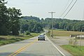
 Old Deal Road near Flaugherty Creek.jpg 6,016 × 4,000; 6.19 MB
-
 Old School House - panoramio (5).jpg 5,184 × 3,456; 4.28 MB
-
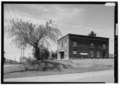
 Old Somerset Count, Pennsylvania, Courthouse.jpg 895 × 771; 217 KB
-

-
 PA Pennwood Farms2 - Flickr - USDAgov.jpg 3,264 × 1,840; 267 KB
-
 Panorama Weather Shot - panoramio (101).jpg 6,886 × 3,277; 2.69 MB
-
 Panorama Weather Shot - panoramio (102).jpg 6,541 × 3,204; 2.55 MB
-
 Panorama Weather Shot - panoramio (103).jpg 6,818 × 3,306; 2.81 MB
-
 Panorama Weather Shot - panoramio (104).jpg 6,597 × 3,235; 2.61 MB
-
 Panorama Weather Shot - panoramio (105).jpg 6,568 × 3,268; 4.14 MB
-
 Panorama Weather Shot - panoramio (106).jpg 6,968 × 3,337; 2.63 MB
-
 Panorama Weather Shot - panoramio (107).jpg 6,568 × 3,268; 2.41 MB
-
 Panorama Weather Shot - panoramio (108).jpg 6,886 × 3,277; 4.46 MB
-
 Panorama Weather Shot - panoramio (109).jpg 6,519 × 3,458; 3.17 MB
-
 Panorama Weather Shot - panoramio (110).jpg 9,817 × 2,065; 2.45 MB
-
 Panorama Weather Shot - panoramio (111).jpg 7,942 × 2,965; 3.81 MB
-
 Panorama Weather Shot - panoramio (112).jpg 6,519 × 3,458; 5.5 MB
-
 Panorama Weather Shot - panoramio (117).jpg 4,589 × 1,150; 706 KB
-
 Panorama Weather Shot - panoramio (119).jpg 5,399 × 1,042; 935 KB
-
 Panorama Weather Shot - panoramio (120).jpg 3,825 × 1,100; 736 KB
-
 Panorama Weather Shot - panoramio (123).jpg 4,511 × 1,065; 717 KB
-
 Panorama Weather Shot - panoramio (125).jpg 4,511 × 1,065; 717 KB
-
 Panorama Weather Shot - panoramio (126).jpg 3,750 × 1,110; 570 KB
-
 Panorama Weather Shot - panoramio (5).jpg 12,681 × 1,842; 3.49 MB
-
 PATurnpikechurchsteps.jpg 541 × 960; 85 KB
-
-
-
 Place to reflect 2.JPG 4,000 × 3,000; 5.37 MB
-
 Ponfeigh Farm barn and silo.jpg 6,016 × 4,000; 6.44 MB
-
 Quecreek Mine rescue airlock.jpg 3,264 × 2,448; 3.62 MB
-
 Quecreek Mine Rescue shaft.jpg 3,264 × 2,448; 3.86 MB
-
 Quecreek Mine Rescue Site.jpg 2,448 × 2,464; 4.34 MB
-
 Rockwood, Pennsylvania Somerset County.jpg 4,896 × 3,264; 7.59 MB
-
 Savage Mountain wind farm.jpg 6,016 × 4,000; 6.13 MB
-
 Senic Route - panoramio (10).jpg 3,936 × 5,248; 4.31 MB
-
 Senic Route - panoramio (4).jpg 3,936 × 5,248; 4.63 MB
-
 Senic Route late December - panoramio (1).jpg 3,936 × 5,248; 4.5 MB
-
 Senic Route late December - panoramio (2).jpg 3,936 × 5,248; 5.55 MB
-
 Senic Route late December - panoramio (3).jpg 3,936 × 5,248; 5.09 MB
-
 Senic Route late December - panoramio (4).jpg 3,936 × 5,248; 4.31 MB
-
 Senic Route late December - panoramio (7).jpg 3,936 × 5,248; 5.12 MB
-
 Senic Route late December - panoramio (8).jpg 3,936 × 5,248; 4.56 MB
-
 Senic Route late December - panoramio.jpg 3,936 × 5,248; 4.38 MB
-
-

-
-
 Snow - panoramio (54).jpg 5,184 × 3,456; 3.83 MB
-
 Snow Covered Cobra - panoramio.jpg 600 × 450; 53 KB
-
 Snow on forest road - panoramio.jpg 5,184 × 3,456; 2.92 MB
-
 Snow on power lines - panoramio.jpg 5,184 × 3,456; 2.32 MB
-
 Snow reaches forest - panoramio.jpg 5,184 × 3,456; 4.63 MB
-
 Snowy road - panoramio.jpg 5,184 × 3,456; 2.84 MB
-
 Somerset Toll Booth PA Turnpike.jpg 1,024 × 768; 163 KB
-

-
-
 State forest road - panoramio.jpg 5,184 × 3,456; 3.55 MB
-
 Sun thru snow - panoramio.jpg 5,184 × 3,456; 2.58 MB
-
 Swiss Mountain Condo Living Room, Seven Springs PA.jpg 890 × 667; 314 KB
-
 The Great Laurel Ridge.jpg 1,024 × 768; 377 KB
-
 USA Somerset County, Pennsylvania age pyramid.svg 520 × 600; 7 KB
-

-

-
 Water station - panoramio.jpg 5,184 × 3,456; 3.23 MB
-
 West portal sand patch.jpg 1,078 × 984; 891 KB
-

-

-
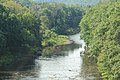
 Wills Creek at Philson.jpg 6,016 × 4,000; 6.39 MB
-
 YMCA Camp - panoramio (1).jpg 5,184 × 3,456; 4.75 MB
-
 YMCA Camp - panoramio.jpg 5,184 × 3,456; 4.43 MB
.jpg)
.jpg)
.jpg)
.jpg)
.jpg)
_(14758612301).jpg)
.jpg)
.jpg)
.jpg)

.jpg)
.jpg)
.jpg)
.jpg)


.jpg)
.jpg)


.jpg)
.jpg)
.jpg)
.jpg)
.jpg)
.jpg)
.jpg)
.jpg)
.jpg)
.jpg)
.jpg)
.jpg)
.jpg)
.jpg)
.jpg)
.jpg)
.jpg)
.jpg)
.jpg)
.jpg)
.jpg)
.jpg)
.jpg)
.jpg)

.jpg)
.jpg)
.jpg)
.jpg)
.jpg)
.jpg)
.jpg)


.jpg)

.jpg)


.jpg)


.jpg)
.jpg)
.jpg)
.jpg)
.jpg)
.jpg)
.jpg)
.jpg)
.jpg)
.jpg)


.jpg)
.jpg)
.jpg)
.jpg)
.jpg)
.jpg)
.jpg)
.jpg)

.jpg)


.jpg)

.jpg)
.jpg)
.jpg)
.jpg)
.jpg)
.jpg)
.jpg)
.jpg)
.jpg)
.jpg)
.jpg)
.jpg)