Category:Wyoming County, Pennsylvania
Jump to navigation
Jump to search
Counties of Pennsylvania : Adams · Allegheny · Armstrong · Beaver · Bedford · Berks · Blair · Bradford · Bucks · Butler · Cambria · Cameron · Carbon · Centre · Chester · Clarion · Clearfield · Clinton · Columbia · Crawford · Cumberland · Dauphin · Delaware · Elk · Erie · Fayette · Forest · Franklin · Fulton · Greene · Huntingdon · Indiana · Jefferson · Juniata · Lackawanna · Lancaster · Lawrence · Lebanon · Lehigh · Luzerne · Lycoming · McKean · Mercer · Mifflin · Monroe · Montgomery · Montour · Northampton · Northumberland · Perry · Philadelphia · Pike · Potter · Schuylkill · Snyder · Somerset · Sullivan · Susquehanna · Tioga · Union · Venango · Warren · Washington · Wayne · Westmoreland · Wyoming · York
English: Wyoming County is a county located in the U.S. state of Pennsylvania. It was created in 1842 from part of Luzerne County. Its county seat is Tunkhannock.
county in Pennsylvania, United States   | |||||
| Upload media | |||||
| Instance of | |||||
|---|---|---|---|---|---|
| Named after | |||||
| Location | Pennsylvania | ||||
| Capital | |||||
| Inception |
| ||||
| Population |
| ||||
| Area |
| ||||
| Different from | |||||
| official website | |||||
 | |||||
Subcategories
This category has the following 14 subcategories, out of 14 total.
*
E
G
H
N
P
S
T
Media in category "Wyoming County, Pennsylvania"
The following 39 files are in this category, out of 39 total.
-
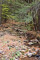
 Baker Run.JPG 2,056 × 3,088; 3.23 MB
-
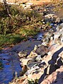
 Beth Run.JPG 3,088 × 2,056; 2.53 MB
-
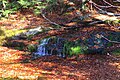
 Cedar Ledge.JPG 3,088 × 2,056; 1.68 MB
-
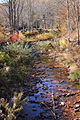
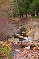
 Cider Run looking upstream.JPG 2,056 × 3,088; 3.5 MB
-
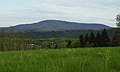
 Endless Mountains Landscape (1).jpg 4,608 × 3,149; 12.04 MB
-
 Field in Northmoreland Township, Wyoming County, Pennsylvania.jpg 3,088 × 2,056; 2.31 MB
-
 Flickr - Nicholas T - Endless Mountains Landscape (2).jpg 4,608 × 2,391; 6.9 MB
-
 Flickr - Nicholas T - Windy Valley (2).jpg 4,608 × 2,785; 11.26 MB
-
 Kayaker on Lake Winola.jpg 960 × 640; 70 KB
-
 Lake Winola in March.jpg 960 × 640; 105 KB
-
 Leonard Creek looking downstream.JPG 2,056 × 3,088; 2.75 MB
-
 Leonard Creek looking upstream.JPG 2,056 × 3,088; 3.21 MB
-
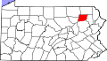 Map of Pennsylvania highlighting Wyoming County.svg 4,950 × 2,846; 106 KB
-
 Marsh Creek looking downstream from Jenks Road.JPG 2,056 × 3,088; 3.11 MB
-
 Marsh Creek looking upstream from Jenks Road.JPG 2,056 × 3,088; 3.03 MB
-
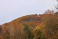
 Miller Mountain.JPG 3,088 × 2,056; 1.52 MB
-
 Miller.jpg 1,713 × 1,024; 290 KB
-
 Newton Run looking downstream.JPG 2,056 × 3,088; 2.85 MB
-
 Newton Run looking upstream.JPG 2,056 × 3,088; 2.79 MB
-
 Old Sorber Mountain Road.JPG 3,088 × 2,056; 2.82 MB
-
 PA Wyoming county Meshoppen city Procter&Gamble Susquehanna river IMG 1888.JPG 5,030 × 2,617; 7.45 MB
-
 PA Wyoming county Meshoppen city Procter&Gamble Susquehanna river IMG 1889.JPG 5,184 × 2,455; 7.2 MB
-
 PA Wyoming county Meshoppen Procter&Gamble Susquehanna river IMG 1890.JPG 3,456 × 5,184; 9.98 MB
-
 PA Wyoming county Meshoppen Procter&Gamble Susquehanna river IMG 1892.JPG 5,184 × 3,456; 10.92 MB
-
 PA Wyoming county Meshoppen Procter&Gamble Susquehanna river Lake Carey IMG 1891.JPG 5,184 × 3,456; 10.69 MB
-
 PA Wyoming county Meshoppen Procter&Gamble Susquehanna river Lake Carey IMG 1893.JPG 4,668 × 2,519; 6.64 MB
-
 PA Wyoming county Susquehanna river Bowman creek Tunkhannock city IMG 1896.JPG 4,744 × 2,854; 7.18 MB
-
 PA Wyoming county Susquehanna river Bowman creek Tunkhannock city IMG 1897.JPG 4,806 × 2,941; 7.77 MB
-
 PA Wyoming county Susquehanna river Lake Carey Tunkhannock city IMG 1895.JPG 5,184 × 3,456; 10.15 MB
-
 PA Wyoming county Susquehanna river Tunkhannock city Skyhaven airport IMG 1898.JPG 5,184 × 3,246; 10.76 MB
-
 Roaring Run looking downstream.JPG 2,056 × 3,088; 2.73 MB
-
 Roaring Run looking upstream.JPG 3,088 × 2,056; 2.73 MB
-
 Sorber Run looking downstream at its mouth.JPG 2,056 × 2,760; 2.25 MB
-
 Sorber Run looking upstream near its mouth.JPG 2,056 × 1,826; 2.08 MB
-
 South Run looking downstream.JPG 2,056 × 3,088; 3.07 MB
-
 South Run looking upstream.JPG 1,923 × 3,088; 3.17 MB
-
 USA Wyoming County, Pennsylvania age pyramid.svg 520 × 600; 7 KB
-
 York Run looking downstream.JPG 2,056 × 3,088; 2.94 MB
-
 York Run looking upstream.JPG 2,056 × 3,088; 2.69 MB


.jpg)

.jpg)
.jpg)


