Category:Bunessan
Jump to navigation
Jump to search
village in Argyll and Bute, Scotland, UK  | |||||
| Upload media | |||||
| Instance of | |||||
|---|---|---|---|---|---|
| Location |
| ||||
| Inception |
| ||||
 | |||||
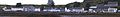
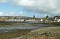
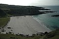
English: Bunessan (Scottish Gaelic: Bun Easain) is a small village on the Ross of Mull in the south of the island of Mull, on the west coast of Scotland. Originally a small community of farmers in the Scottish farming tradition called crofting, the village had a mill, weavers and a small fishing fleet until the 1900s. For Bunessan hymn tune see Category:Morning Has Broken.
Gàidhlig: 'S e baile-beag ann am Muile a th' ann am Bun Easain (Beurla:Bunessan). Ann an 2001 's e 200 an àireamh-shluaigh a tha aige.
Media in category "Bunessan"
The following 95 files are in this category, out of 95 total.
-
 Across the bay at Bunessan - geograph.org.uk - 3389239.jpg 3,977 × 2,280; 1.36 MB
-

-
 Basalt Rock Formation - geograph.org.uk - 180882.jpg 640 × 480; 132 KB
-
 Bridge to the visitor centre - geograph.org.uk - 2943621.jpg 3,264 × 2,448; 5.98 MB
-
 Bunessan (32176015248).jpg 5,184 × 3,888; 8.43 MB
-
 Bunessan - geograph.org.uk - 1049626.jpg 640 × 475; 89 KB
-
 Bunessan - geograph.org.uk - 3047722.jpg 600 × 450; 70 KB
-
 Bunessan - geograph.org.uk - 3392193.jpg 4,320 × 3,240; 2.06 MB
-
 Bunessan - oystercatchers on rocks - geograph.org.uk - 921262.jpg 640 × 480; 107 KB
-
 Bunessan at high water - geograph.org.uk - 2572064.jpg 3,072 × 2,304; 1.72 MB
-
 Bunessan banner.JPG 2,800 × 400; 299 KB
-
 Bunessan Bay - geograph.org.uk - 4430541.jpg 640 × 425; 100 KB
-
 Bunessan Bay - geograph.org.uk - 5012390.jpg 2,358 × 1,560; 445 KB
-
 Bunessan beyond Loch na Lathaich - geograph.org.uk - 1049636.jpg 640 × 480; 86 KB
-
 Bunessan Community Centre - geograph.org.uk - 1049638.jpg 640 × 474; 75 KB
-
 Bunessan Community Centre - geograph.org.uk - 6178091.jpg 3,264 × 2,448; 3.99 MB
-
 Bunessan Harbour - geograph.org.uk - 5962417.jpg 4,914 × 3,685; 3.92 MB
-
 Bunessan Jetty - geograph.org.uk - 920200.jpg 640 × 480; 68 KB
-
 Bunessan main road - geograph.org.uk - 1526630.jpg 640 × 429; 63 KB
-
 Bunessan Main Street - geograph.org.uk - 5329510.jpg 1,600 × 900; 312 KB
-
 Bunessan Mill - geograph.org.uk - 2943665.jpg 3,264 × 2,448; 5.44 MB
-
 Bunessan outskirts - geograph.org.uk - 1049633.jpg 640 × 480; 107 KB
-
 Bunessan Parish Church - geograph.org.uk - 4430564.jpg 640 × 425; 100 KB
-
 Bunessan Pier - geograph.org.uk - 3441568.jpg 640 × 395; 53 KB
-
 Bunessan Pier, Mull - geograph.org.uk - 866346.jpg 640 × 460; 89 KB
-
 Bunessan Pier, Port a' Chladaich - geograph.org.uk - 4683511.jpg 3,585 × 2,301; 1.58 MB
-
 Bunessan View - geograph.org.uk - 3441573.jpg 640 × 414; 83 KB
-
 Bunessan View - geograph.org.uk - 3441578.jpg 640 × 459; 95 KB
-
 Bunessan village viewed from Lower Ardtun.jpg 640 × 480; 113 KB
-
 Bunessan War Memorial - geograph.org.uk - 1956940.jpg 3,888 × 2,592; 4.41 MB
-
 Bunessan, from across the bay - geograph.org.uk - 6178100.jpg 3,264 × 2,448; 3.92 MB
-
 Bunessan, mobile bank - geograph.org.uk - 921258.jpg 640 × 480; 108 KB
-
 Bunessan, postbox No. PA67 159 and view - geograph.org.uk - 921265.jpg 640 × 480; 124 KB
-
 Bunessan, primary school - geograph.org.uk - 921268.jpg 640 × 480; 109 KB
-
 Bunessan, the pier - geograph.org.uk - 921254.jpg 640 × 480; 102 KB
-
 Bunessan-02-2009-gje.jpg 2,994 × 1,759; 1.27 MB
-
 Bunessan-04-Boote-2009-gje.jpg 2,886 × 1,588; 1.22 MB
-
 Bunessan-06-Boote-2009-gje.jpg 2,958 × 1,632; 1.37 MB
-
 Bunessan-08-2009-gje.jpg 2,967 × 1,645; 1.31 MB
-
 Bunessan-10-2009-gje.jpg 3,072 × 1,899; 2.18 MB
-
 Bunessan-12-2009-gje.jpg 3,072 × 2,048; 2.82 MB
-
 Bunessan-14-2009-gje.jpg 2,175 × 1,252; 1.34 MB
-
 Bunessan.JPG 3,264 × 2,448; 1.57 MB
-
 Derelict Fishing boats, Bunessan - geograph.org.uk - 3619575.jpg 2,848 × 2,136; 1.13 MB
-
 Footpath to the Fossil Tree - geograph.org.uk - 180876.jpg 640 × 480; 105 KB
-
 Foreshore at Bunessan - geograph.org.uk - 2939899.jpg 3,264 × 2,448; 3.6 MB
-
 Head of the loch, Bunessan - geograph.org.uk - 457922.jpg 640 × 480; 53 KB
-
 Kilvickeon Beach, Isle of Mull - geograph.org.uk - 31515.jpg 640 × 480; 117 KB
-
 Loch an t' Suidhe - geograph.org.uk - 193913.jpg 640 × 480; 99 KB
-
 Loch na Lathaich - geograph.org.uk - 1049628.jpg 640 × 478; 91 KB
-
 Loch Na Lathaich - geograph.org.uk - 30562.jpg 640 × 480; 44 KB
-
 Loch na Làthaich - geograph.org.uk - 5962431.jpg 5,184 × 3,888; 4.42 MB
-
 Mull Baptist Church, Bunessan - geograph.org.uk - 21089.jpg 640 × 452; 115 KB
-
 North side of Bunessan Harbour - geograph.org.uk - 2576542.jpg 640 × 425; 64 KB
-
 Pier at Bunessan - geograph.org.uk - 2941412.jpg 3,264 × 2,448; 5.02 MB
-
 Port a'Chladaich - geograph.org.uk - 2941436.jpg 3,264 × 2,448; 5.56 MB
-
 Port Uisken, Mull - geograph.org.uk - 25162.jpg 640 × 480; 87 KB
-
 Putting on at Bunessan Pier - geograph.org.uk - 5796104.jpg 4,480 × 2,520; 5.06 MB
-
 Rubh' Ardalanish - geograph.org.uk - 633109.jpg 480 × 640; 109 KB
-
 Ruined barn, Bunessan - geograph.org.uk - 1049630.jpg 640 × 480; 128 KB
-
 Sea inlet at Bunessan - geograph.org.uk - 4774491.jpg 640 × 480; 94 KB
-

-
 Spar and Post Office at Bunessan - geograph.org.uk - 2939901.jpg 3,264 × 2,448; 2.28 MB
-
 Sunset over Loch na Lathaich - geograph.org.uk - 1915826.jpg 1,704 × 2,272; 299 KB
-
 The anchorage at Rubh Ardalanish - geograph.org.uk - 632233.jpg 500 × 375; 35 KB
-
 The Bunessan River flows into Loch na Lathaich - geograph.org.uk - 2943611.jpg 3,264 × 2,448; 3.95 MB
-
-
 The Village, Bunessan - geograph.org.uk - 1049622.jpg 640 × 474; 78 KB
-
 Traigh Bhan na Sgurra - geograph.org.uk - 25517.jpg 640 × 426; 89 KB
-
 Weedy foreshore near Bunessan - geograph.org.uk - 2555465.jpg 1,024 × 703; 122 KB
-
 Ardalanish Bay - geograph.org.uk - 590430.jpg 640 × 425; 42 KB
-
 Ardtun Leaf Beds - geograph.org.uk - 654646.jpg 640 × 480; 78 KB
-
 Argyll Arms Hotel, Bunessan - geograph.org.uk - 1049621.jpg 640 × 480; 79 KB
-
 Bunessan - geograph.org.uk - 16778.jpg 640 × 480; 37 KB
-
 Bunessan - geograph.org.uk - 457927.jpg 640 × 480; 61 KB
-
 Bunessan Cemetery - geograph.org.uk - 198285.jpg 640 × 480; 39 KB
-

-
 Bunessan Pier - geograph.org.uk - 19484.jpg 640 × 480; 81 KB
-
-
 Bunessan, Isle of Mull - geograph.org.uk - 718479.jpg 640 × 480; 189 KB
-
 By Glac a' Bhodaich - geograph.org.uk - 456854.jpg 640 × 480; 76 KB
-
 Coastal scene, Knockan, Mull - geograph.org.uk - 296203.jpg 640 × 458; 60 KB
-
 Foreshore at Gowanbrae near Bunessan - geograph.org.uk - 296209.jpg 640 × 460; 118 KB
-
 Near Ardtun - geograph.org.uk - 634541.jpg 500 × 375; 53 KB
-
 Rough Grazing, Loch na Lathaich. - geograph.org.uk - 654660.jpg 640 × 480; 65 KB
-
 Ruined Cottage - geograph.org.uk - 634346.jpg 500 × 375; 56 KB
-
 Sheep Wash, Near Burg Cottage - geograph.org.uk - 193800.jpg 640 × 480; 97 KB
-
 Side road to Uisken - geograph.org.uk - 193912.jpg 640 × 480; 94 KB
-
 Sunset - geograph.org.uk - 32583.jpg 640 × 480; 59 KB
-

-
 Telephone Box near Salachran - geograph.org.uk - 563312.jpg 640 × 480; 74 KB
-
 The road to Bunessan, Ross of Mull - geograph.org.uk - 39101.jpg 640 × 480; 103 KB
-
 Traigh Bhan - geograph.org.uk - 27505.jpg 640 × 426; 140 KB
-
 Uisken road - geograph.org.uk - 456857.jpg 640 × 480; 67 KB
-
 Walled Enclosure, Dunan nan Cliabh - geograph.org.uk - 181322.jpg 640 × 480; 80 KB


.jpg)


