Category:Crawford County, Arkansas
Zur Navigation springen
Zur Suche springen
Counties of Arkansas: Arkansas · Ashley · Baxter · Benton · Boone · Bradley · Calhoun · Carroll · Chicot · Clark · Clay · Cleburne · Cleveland · Columbia · Conway · Craighead · Crawford · Crittenden · Cross · Dallas · Desha · Drew · Faulkner · Franklin · Fulton · Garland · Grant · Greene · Hempstead · Hot Spring · Howard · Independence · Izard · Jackson · Jefferson · Johnson · Lafayette · Lawrence · Lee · Lincoln · Little River · Logan · Lonoke · Madison · Marion · Miller · Mississippi · Monroe · Montgomery · Nevada · Newton · Ouachita · Perry · Phillips · Pike · Poinsett · Polk · Pope · Prairie · Pulaski · Randolph · Saline · Scott · Searcy · Sebastian · Sevier · Sharp · St. Francis · Stone · Union · Van Buren · Washington · White · Woodruff · Yell
County im US-Bundesstaat Arkansas  Здание окружного суда в городе Ван-Бьюрен  | |||||
| Medium hochladen | |||||
| Ist ein(e) | |||||
|---|---|---|---|---|---|
| Benannt nach | |||||
| Ort | Arkansas | ||||
| Liegt am oder im Gewässer | |||||
| Hauptstadt | |||||
| Datum der Gründung, Erstellung, Entstehung, Erbauung |
| ||||
| Einwohnerzahl |
| ||||
| Fläche |
| ||||
| Verschieden von | |||||
| offizielle Website | |||||
 | |||||
Unterkategorien
Es werden 14 von insgesamt 14 Unterkategorien in dieser Kategorie angezeigt:
In Klammern die Anzahl der enthaltenen Kategorien (K), Seiten (S), Dateien (D)
*
A
- Arkansas Highway 60 (9 D)
- Arkansas Highway 162 (9 D)
B
- Bob Burns House (2 D)
F
- Fort Smith Municipal Water Plant (11 D)
L
- Lake Fort Smith State Park (2 D)
M
P
W
- Wire Ford Bridge (15 D)
Medien in der Kategorie „Crawford County, Arkansas“
Folgende 40 Dateien sind in dieser Kategorie, von 40 insgesamt.
-
 040i 540i flyover.jpg 1.656 × 1.242; 596 KB
-
 Ar welcome.jpg 1.656 × 1.242; 599 KB
-
 Arkansas 282.png 580 × 344; 25 KB
-
 ARMap-doton-Kibler.png 300 × 262; 13 KB
-
 ARMap-doton-Mountainburg.png 300 × 262; 13 KB
-
 ARMap-doton-Mulberry.png 300 × 262; 13 KB
-
 ARMap-doton-Rudy.png 300 × 262; 13 KB
-
 ARMap-doton-Van Buren.png 300 × 262; 13 KB
-
 Artist Point Arkansas Photo Taken Next to Gift Shop.jpg 5.312 × 2.988; 7,99 MB
-
 Artist's Point, AR.JPG 4.000 × 3.000; 5,07 MB
-
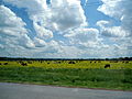 Cows in flowered pasture near Mulberry, AR.jpg 4.000 × 3.000; 3,97 MB
-

-

-

-

-
-

-
 Henry Clay Mills House.JPG 4.928 × 3.264; 10,62 MB
-
 Highway 220 at Uniontown, Arkansas.jpg 2.599 × 1.732; 1,02 MB
-
 Map of Arkansas highlighting Crawford County.svg 1.278 × 1.113; 90 KB
-
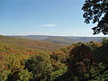
 Mount Gayler June 2020.jpg 2.048 × 1.152; 1,7 MB
-
 Mount Gayler Road Sign June 2020.jpg 2.048 × 1.536; 2,7 MB
-
 Mulberry Home Economics Building, Front View.JPG 4.928 × 3.264; 10,58 MB
-
 Mulberry Home Economics Building, Northeast View.JPG 4.928 × 3.264; 8,26 MB
-
 Mulberry Home Economics Building, South View.JPG 4.928 × 3.264; 8,61 MB
-
 Mulberry Home Economics Building, Southeast View.JPG 4.928 × 3.264; 9,73 MB
-
 Natural Dam, Arkansas 001.jpg 1.658 × 708; 356 KB
-
 Natural Dam, Arkansas 002.jpg 3.455 × 1.944; 908 KB
-
 St. Louis-Texas Line, Frisco, Lancaster, Arkansas (NYPL b12647398-74489).tiff 2.504 × 1.660; 11,9 MB
-

-
 Railroad Bridge In Fort Smith.jpg 900 × 699; 602 KB
-
 Steve Womack visits Leadership Crawford County 01.jpg 680 × 510; 60 KB
-
 Steve Womack visits Leadership Crawford County 02.jpg 2.016 × 1.512; 529 KB
-
 Tennessee Ridge Road Old Historic Building 01.jpg 960 × 1.280; 572 KB
-
 Tennessee Ridge Road Old Historic Building 02.jpg 960 × 1.280; 655 KB
-
 Tennessee Ridge Road Old Historic Building 03.jpg 960 × 1.280; 560 KB
-
 Tennessee Ridge Road Old Historic Building 04.jpg 960 × 1.280; 512 KB
-
 Tennessee Ridge Road Old Historic Building 05.jpg 960 × 1.280; 606 KB
-
 USA Crawford County, Arkansas age pyramid.svg 520 × 600; 7 KB
-
 Liquidambar styraciflua bloom.JPG 3.008 × 2.000; 2,25 MB


