Category:Grade II listed buildings in County Durham
Jump to navigation
Jump to search
Ceremonial counties of England: Bedfordshire · Berkshire · Buckinghamshire · Cambridgeshire · Cheshire · Cornwall · Cumbria · Derbyshire · Devon · Dorset · Durham · East Riding of Yorkshire · East Sussex · Essex · Gloucestershire · Greater London · Greater Manchester · Hampshire · Herefordshire · Hertfordshire · Kent · Lancashire · Leicestershire · Lincolnshire · Merseyside · Norfolk · North Yorkshire · Northamptonshire · Northumberland · Nottinghamshire · Oxfordshire · Rutland · Shropshire · Somerset · South Yorkshire · Staffordshire · Suffolk · Surrey · Tyne and Wear · Warwickshire · West Midlands · West Sussex · West Yorkshire · Wiltshire · Worcestershire
City-counties: Bristol · City of London
Former historic counties: Westmorland ·
Other former counties:
City-counties: Bristol · City of London
Former historic counties: Westmorland ·
Other former counties:
Wikimedia category | |||||
| Upload media | |||||
| Instance of | |||||
|---|---|---|---|---|---|
| |||||
Subcategories
This category has the following 45 subcategories, out of 45 total.
*
C
- Chester-le-Street Viaduct (10 F)
- Weardale Business Centre (3 F)
H
- Hawthorn Dene Viaduct (15 F)
- Fell Close Cottage (2 F)
- Helmington Hall, Hunwick (5 F)
- Hog Hill Tunnel (2 F)
J
L
- Limekiln East of Clarty Lane (6 F)
- Ludworth Tower (7 F)
N
- Neptune statue, Durham (9 F)
- Neville's Cross (cross) (3 F)
O
P
- Park Shops, County Durham (2 F)
- Parkside Farm Dovecote (4 F)
R
- Redhills, Durham (5 F)
S
- Stanhope Market Cross (2 F)
Media in category "Grade II listed buildings in County Durham"
The following 49 files are in this category, out of 49 total.
-
 42 to 44 Market Place, Middleton in Teesdale.jpg 7,066 × 3,846; 9.02 MB
-
 6th Marquess of Londonderry statue - Seaham.jpg 2,292 × 3,056; 1.01 MB
-
 Alwent Mill - geograph.org.uk - 459023.jpg 640 × 480; 81 KB
-
 Alwent Mill. - geograph.org.uk - 148619.jpg 640 × 479; 116 KB
-
 Bank House, Front Street, Wolsingham - geograph.org.uk - 2583422.jpg 1,024 × 769; 205 KB
-
 Barn at Castle Farm - geograph.org.uk - 75419.jpg 640 × 480; 83 KB
-
 Barnard Castle Market Cross - panoramio.jpg 2,103 × 1,424; 1.35 MB
-
 BarnardCastleMarketplace.jpg 640 × 449; 77 KB
-
 Bradley - geograph.org.uk - 1313987.jpg 640 × 480; 99 KB
-
 Brunswick House, 55 Market Place.jpg 4,032 × 3,024; 3.74 MB
-
 Castle Hills, above Wolsingham - geograph.org.uk - 443513.jpg 640 × 480; 69 KB
-
 Coatham Hall - geograph.org.uk - 1745980.jpg 640 × 451; 102 KB
-
 Count’s House - view of portico.jpg 3,437 × 5,155; 9.87 MB
-
 Derwent Oak Farm - geograph.org.uk - 3308666.jpg 4,608 × 3,456; 5.5 MB
-
 Derwentcote Cottage, Hamsterley Mill - geograph.org.uk - 4808812.jpg 4,608 × 3,456; 6.94 MB
-
 Emerson Tomb About 15 Metres East Of Church Of St John, Near South Wall Of Churchyard.jpg 6,000 × 8,000; 16.6 MB
-
 Esh Cross - geograph.org.uk - 76503.jpg 640 × 427; 141 KB
-
 Farm buildings off Whiley Hill road. - geograph.org.uk - 1745875.jpg 640 × 480; 74 KB
-
 Former house and byre south of Ludwell Farmhouse.jpg 4,320 × 3,240; 4.47 MB
-
 Front door, Ludwell Farmhouse, with date.jpg 3,240 × 4,320; 4.63 MB
-
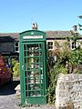 Green Phone Box-Barningham.jpg 1,704 × 2,272; 1.74 MB
-
 Holy well near Wolsingham, Co. Durham.jpg 4,320 × 3,240; 4.82 MB
-
 Interior of holy well well house, near Wolsingham, Co. Durham.jpg 4,320 × 3,240; 3.57 MB
-
 Little Burdon Farm . - geograph.org.uk - 150921.jpg 640 × 479; 65 KB
-
 Little Redgate Farmhouse - geograph.org.uk - 2587245.jpg 1,024 × 768; 221 KB
-
 Malvern House, 7 Front Street, Staindrop.jpg 3,456 × 5,184; 3.14 MB
-
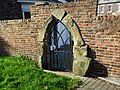 Medieval Arch in wall to west of public gardens.jpg 5,184 × 3,888; 8.19 MB
-
 Mill house at Coatham Mundeville - geograph.org.uk - 1745851.jpg 640 × 480; 104 KB
-
 Mill House from Market Place.jpg 4,032 × 3,024; 2.92 MB
-
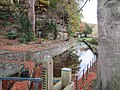 Mill Race at Lintzford Mill (geograph 6683965).jpg 5,184 × 3,888; 877 KB
-
 Norton East signal box.jpg 3,264 × 2,176; 831 KB
-
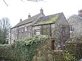
 Old Park - geograph.org.uk - 1313935.jpg 640 × 480; 110 KB
-
 Piercebridge houses (3) (geograph 7319745).jpg 4,320 × 2,430; 2.32 MB
-
 Retaining Wall South Of Stone House.jpg 8,000 × 6,000; 19.49 MB
-
 Seaham - Greystones - 20211010033957.jpg 4,592 × 3,448; 6.2 MB
-

-

-
 Seaham - Police Station - 20210716042447.jpg 4,592 × 3,448; 6.49 MB
-
 Seaham - Seaham War Memorial - 20220826184438.jpg 2,916 × 3,888; 1.99 MB
-
 Shildon Signal Box.jpg 3,120 × 4,160; 4.28 MB
-
 Somerville Tomb About 5 Metres South Of Chancel Of Church Of St John.jpg 6,000 × 8,000; 18.93 MB
-
 St Johns Durham.JPG 1,492 × 2,149; 739 KB
-
 Sunderland - Barclays Bank - 20220826173542.jpg 3,024 × 4,032; 2.87 MB
-
 The tower of St Margaret's, Tanfield - geograph.org.uk - 76491.jpg 640 × 465; 109 KB
-
 Terraced cottage - geograph.org.uk - 1745781.jpg 640 × 480; 85 KB
-
 The gatehouse at Hamsterley Hall Estate - geograph.org.uk - 2421182.jpg 3,264 × 2,448; 2.05 MB
-
 Walworth 039.jpg 3,648 × 2,736; 2.37 MB
-
 Walworth 071.jpg 3,644 × 2,156; 1.72 MB
-


.jpg)


_(geograph_7319745).jpg)


