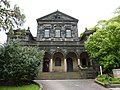
Category:Grade II listed buildings in West Yorkshire
Jump to navigation
Jump to search
Ceremonial counties of England: Bedfordshire · Berkshire · Buckinghamshire · Cambridgeshire · Cheshire · Cornwall · Cumbria · Derbyshire · Devon · Dorset · Durham · East Riding of Yorkshire · East Sussex · Essex · Gloucestershire · Greater London · Greater Manchester · Hampshire · Herefordshire · Hertfordshire · Kent · Lancashire · Leicestershire · Lincolnshire · Merseyside · Norfolk · North Yorkshire · Northamptonshire · Northumberland · Nottinghamshire · Oxfordshire · Rutland · Shropshire · Somerset · South Yorkshire · Staffordshire · Suffolk · Surrey · Tyne and Wear · Warwickshire · West Midlands · West Sussex · West Yorkshire · Wiltshire · Worcestershire
City-counties: Bristol · City of London
Former historic counties: Westmorland ·
Other former counties:
City-counties: Bristol · City of London
Former historic counties: Westmorland ·
Other former counties:
Wikimedia category | |||||
| Upload media | |||||
| Instance of | |||||
|---|---|---|---|---|---|
| |||||
Subcategories
This category has the following 95 subcategories, out of 95 total.
*
1
- 18-24, Beech Hill (3 F)
A
- Albert Mills, Huddersfield (6 F)
B
- Band of Hope Union fountain (9 F)
- Batley Town Hall (4 F)
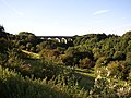
- Beacon Hill viaduct (9 F)
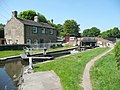
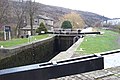
- Bottomley Lock, Rochdale Canal (10 F)
- Brighouse Library (7 F)
- Britannia Mills, Huddersfield (10 F)
C
- Causey Hall (5 F)
- Churn Milk Joan (6 F)
- Cleckheaton Town Hall (12 F)
- Cottingley Town Hall (2 F)
D
- Damart Mills, Bingley (10 F)
- Denby Dale Viaduct (13 F)
- Dobson Locks (59 F)
- Dowley Gap Aqueduct (9 F)
E
- Elland Town Hall (3 F)
F
- Field Locks (21 F)
- Fountain Head Brewery (2 F)
G
- Garden Street Mill (3 F)
- Grave of John Blenkinsop (3 F)
H
- Hebden Bridge signal box (18 F)
- Heptonstall Pinfold (2 F)
- Highburton Cross (6 F)
- Highgate Mills (6 F)
- Hirst Lock (11 F)
- Holmfirth Civic Hall (2 F)
- Holmfirth railway station (4 F)
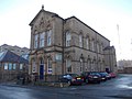
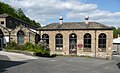
- Huddersfield Town Hall (8 F)
K
- Kirkstall Forge Locks (26 F)
L
- Lawrence Batley Theatre (4 F)
- Leigh House, Leeds (2 F)
- Lobb Mill Lock (4 F)
- Lock 2 (Rochdale Canal) (11 F)
- Lockwood Town Hall (1 F)
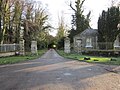
- Lower gatehouse, Castle Carr (4 F)
M
- Midgley Pinfold (3 F)
- Myrtle Grove, Bingley (3 F)
N
- National School, Farsley (3 F)
- Newlay Locks (19 F)
- Nutclough Mill (6 F)
O
P
- Parkwood Mills (25 F)
- Pecket Well Mill (8 F)
- Perseverance Mill, Brighouse (3 F)
- The Picturedrome, Holmfirth (2 F)
R
- Reaps Cross (2 F)
- Rishworth Mills (11 F)
- Rishworth School (3 F)
- Robin Hood's Grave (6 F)
- Roe Head School, Mirfield (3 F)
- Roundhay Castle (14 F)
- Ruins of Castle Carr house (3 F)
S
- Scarbottom aqueduct, Golcar (5 F)
- Shop Lock (Rochdale canal) (8 F)
- Sowerby Bridge Town Hall (12 F)
- Station Street Buildings (5 F)
T
- Te Deum stone (9 F)
- The Arcade, Dewsbury (5 F)
- Titanic Mill (13 F)
W
- White Wells, Ilkley (24 F)
- White Windows, Sowerby (4 F)
Media in category "Grade II listed buildings in West Yorkshire"
The following 200 files are in this category, out of 771 total.
(previous page) (next page)-
 1, Lower School Street.jpg 3,448 × 2,581; 1.41 MB
-
 1-3 Marygate, South side - geograph.org.uk - 1200104.jpg 640 × 480; 293 KB
-
 10 Carlton Street, Halifax (6487863905).jpg 2,553 × 3,083; 4.54 MB
-
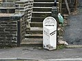
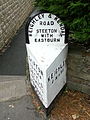
 10 Mile Post, A640 road.jpg 5,184 × 3,888; 5.4 MB
-
 12 Church St.jpg 3,570 × 2,678; 9.87 MB
-
 125, Main Street.jpg 4,032 × 3,024; 3.03 MB
-
 128 Bradford Road - geograph.org.uk - 462938.jpg 352 × 640; 64 KB
-
 14 Church St.jpg 3,726 × 2,766; 9.15 MB
-
 16 Church St.jpg 3,662 × 2,940; 9.96 MB
-
 16-28 Horton Street, Halifax.jpg 4,032 × 3,024; 1.84 MB
-
 164, Town Street.jpg 3,448 × 2,298; 1.18 MB
-
 18 Church St.jpg 3,724 × 2,708; 9.54 MB
-
 19-21 Church st.jpg 2,089 × 2,060; 3.64 MB
-
 2 Calverley Lane, Farley.jpg 640 × 480; 68 KB
-
 2 Miles Post, South Crosland.jpg 445 × 604; 39 KB
-
 2-4 Brook Hill, Baildon (7988902317).jpg 1,727 × 2,590; 3.32 MB
-
 2a Westmorland Street - geograph.org.uk - 1095493.jpg 480 × 640; 224 KB
-
 3, Bondgate.jpg 2,112 × 3,168; 1.4 MB
-
 39-49 Halifax Road, Todmorden.jpg 1,024 × 768; 162 KB
-
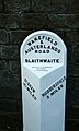
 4 Mile Post, A62 road.jpg 2,000 × 1,479; 986 KB
-
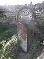
 5 Mile Post, A62 road.jpg 308 × 512; 66 KB
-
 6 Miles Post, A62 road.jpg 480 × 640; 318 KB
-
 6 Miles Post, A640 road.jpg 480 × 640; 396 KB
-
 6-14 Market Street, Hebden Bridge.jpg 1,024 × 768; 211 KB
-
 67FrizinghallRoad.jpg 2,073 × 1,673; 665 KB
-
 7 Miles Post, A62 road.jpg 308 × 512; 75 KB
-
 8 Miles Post, A640 road.jpg 640 × 632; 155 KB
-

-
 A681 Bacup Todmorden Road Mileage Stone - geograph.org.uk - 450836.jpg 640 × 480; 173 KB
-
 Addingham (5621465117).jpg 1,963 × 2,755; 4.47 MB
-
 Addingham Milepost - geograph.org.uk - 1552395.jpg 480 × 640; 90 KB
-
 Allesscholes Guide Post.jpg 2,242 × 3,000; 2.4 MB
-
 Anchor Pit Lock.jpg 2,000 × 1,500; 1.04 MB
-
 Aqueduct Cottage - 1970s - geograph.org.uk - 959244.jpg 640 × 418; 91 KB
-
 Aqueduct Cottage - geograph.org.uk - 957674.jpg 640 × 480; 71 KB
-
 Aqueduct cottage - geograph.org.uk - 957690.jpg 640 × 480; 70 KB
-
 Archway, Albion Mill, Huddersfield.jpg 480 × 640; 104 KB
-
 Archway, Clay House.jpg 2,000 × 1,477; 1.04 MB
-
 Armitage Bridge - mill clocktower - geograph.org.uk - 628776.jpg 489 × 640; 83 KB
-
 Army Careers - Kirkgate - geograph.org.uk - 1701543.jpg 480 × 640; 62 KB
-
 Ash House Farm, Sconce Lane, Bingley - geograph.org.uk - 749384.jpg 640 × 458; 62 KB
-
 Stocks, Market Cross, Cherry Blossom- Baildon (3498404474).jpg 1,396 × 2,162; 2.62 MB
-
 Ball Green, Well Head Lane - geograph.org.uk - 824513.jpg 640 × 480; 290 KB
-
 Balti House Restaurant - Browgate - geograph.org.uk - 1593278.jpg 466 × 640; 99 KB
-
 Bandstand (6396426033).jpg 2,393 × 2,133; 3.75 MB
-
 Bandstand - geograph.org.uk - 319964.jpg 640 × 480; 70 KB
-

-
 Bandstand - Myrtle Park - geograph.org.uk - 420422.jpg 640 × 425; 72 KB
-
 Bank buildings on Bradford Road - geograph.org.uk - 190259.jpg 640 × 480; 95 KB
-
 Bank House - geograph.org.uk - 1025931.jpg 640 × 480; 98 KB
-
 Bar Rouge - Central Street - geograph.org.uk - 1576173.jpg 443 × 640; 104 KB
-
 Barclays Bank - geograph.org.uk - 949546.jpg 640 × 480; 92 KB
-
 Barn 100 yards to north of Blake House.jpg 4,000 × 3,000; 5.28 MB
-
 Barn east of Upper Fold Farmhouse, Thurstonland.jpg 4,000 × 3,000; 5.19 MB
-
 Barn south of Low Hall Farmhouse, Horsforth.jpg 1,280 × 853; 596 KB
-
 Barn To North Of Granary At Stanks Farm.jpg 4,608 × 3,456; 5.8 MB
-

-
 Beaumont Mausoleum, Wilshaw (5760021012).jpg 2,681 × 3,430; 8.49 MB
-
 Beaverbrooks - King Street - geograph.org.uk - 1702066.jpg 640 × 480; 82 KB
-
 BingleySchool.jpg 3,072 × 2,304; 1.61 MB
-
 Birchcliffe Centre - Birchcliffe Road - geograph.org.uk - 1142801.jpg 459 × 640; 262 KB
-
 Birchcliffe Centre, Hebden Bridge.jpg 640 × 480; 170 KB
-

-
 Block, Nortonthorpe Mills.jpg 2,000 × 1,428; 902 KB
-
 Bodington Refectory with Relief Panel.jpg 3,264 × 2,448; 2.18 MB
-
 Bond Street Wakefield - geograph.org.uk - 994515.jpg 640 × 450; 87 KB
-
 Both equal distance - geograph.org.uk - 1117836.jpg 480 × 640; 105 KB
-
 Bottom Viaduct, Hipperholme - geograph.org.uk - 38243.jpg 640 × 480; 128 KB
-
 Boundary marker Meltham - South Crosland (14609827980).jpg 3,328 × 4,031; 11.41 MB
-
 Boundary Stone (2), Holmbridge.jpg 450 × 600; 89 KB
-
 Boundary Stone at Junction of Marsh Lane.jpg 800 × 600; 182 KB
-
 Boundary Stone at NGR SD 887245.jpg 493 × 640; 352 KB
-
 Boundary Stone at NGR SD 897265.jpg 800 × 600; 158 KB
-
 Boundary Stone at NGR SD 943193.jpg 600 × 800; 185 KB
-
 Boundary Stone at NGR SD 945198.jpg 3,640 × 2,676; 7.05 MB
-
 Boundary Stone at SD 996213.jpg 600 × 800; 208 KB
-
 Boundary Stone near Snowgate Head.jpg 800 × 600; 171 KB
-
 Boundary stone No. 4, Batley.jpg 450 × 600; 274 KB
-
 Boundary Stone opposite Burnlee Road.jpg 800 × 600; 149 KB
-
 Boundary Stone, Addingham (5603763429).jpg 2,513 × 3,770; 7.49 MB
-

-

-
 Boundary Stone, Brockholes.jpg 1,536 × 2,560; 1.88 MB
-
 Boundary Stone, Dean Head.jpg 600 × 800; 165 KB
-
 Boundary Stone, Dogley Lane.jpg 600 × 800; 136 KB
-
 Boundary Stone, Flake Moss.jpg 800 × 600; 180 KB
-
 Boundary Stone, Freakfield Road, Hartshead.jpg 2,000 × 1,715; 4.42 MB
-
 Boundary Stone, Hagg Wood.jpg 600 × 450; 369 KB
-
 Boundary Stone, Hall Ing Road.jpg 600 × 800; 229 KB
-
 Boundary Stone, Leeds Road.jpg 1,396 × 2,000; 1.57 MB
-
 Boundary Stone, Mirfield.jpg 600 × 800; 162 KB
-
 Boundary Stone, Oxford Road, Gomersal.jpg 450 × 600; 353 KB
-
 Boundary Stone, Sand Bed Bridge.jpg 480 × 640; 348 KB
-

-
 Boundary stone, Wessenden Head Road - geograph.org.uk - 2774741.jpg 640 × 469; 180 KB
-
 Boundary Stone, Wickleden.jpg 640 × 582; 167 KB
-
 Boundary Stone, Wilshaw Road.jpg 600 × 800; 175 KB
-
 Boundary stone, Woodhead Road, Holme - geograph.org.uk - 1412955.jpg 637 × 640; 201 KB
-
 Bridge Farm Hotel, Swillington Bridge.jpg 640 × 480; 70 KB
-
 Bridge Over Roadway Between Stables To South West Of Harewood House And The Home Farm.jpg 2,639 × 1,979; 1.49 MB
-
 Bridge Street, Lockwood.jpg 640 × 480; 78 KB
-
 Britannia House (8229906243).jpg 2,066 × 2,498; 3.3 MB
-
 British Waterways Building, Dobson Locks.jpg 1,024 × 684; 176 KB
-
-
 Building opposite Gateways, Harewood.jpg 1,920 × 1,337; 719 KB
-
 Burnley Road - geograph.org.uk - 498022.jpg 640 × 480; 86 KB
-
 Butter Cross and Market Hall - geograph.org.uk - 420410.jpg 640 × 309; 57 KB
-
 Caffe Nero - New Street - geograph.org.uk - 1700353.jpg 640 × 511; 86 KB
-
 Canal milepost near West Vale.jpg 600 × 800; 203 KB
-
 Canal Milestone near Lodge Farm.jpg 600 × 800; 176 KB
-
 Canal Milestone, Lingards Wood.jpg 600 × 800; 190 KB
-
 Canal Milestone, Linthwaite.jpg 427 × 640; 91 KB
-

-
 Cantilevered footpath and weir, Halifax.jpg 4,032 × 3,024; 4.56 MB
-
 Caretakers residence, Clarke Hall - geograph.org.uk - 1210422.jpg 640 × 469; 339 KB
-
 Carlton Hall Farmhouse - geograph.org.uk - 1316258.jpg 480 × 640; 342 KB
-
 Carlton Mill, Sowerby Bridge.jpg 683 × 1,024; 140 KB
-
 Carr House and Barn.jpg 2,048 × 1,536; 518 KB
-
 Cart Shed, Swan Bank Farm.jpg 1,998 × 1,494; 1.23 MB
-
 Cartsheds, Lake Yard - geograph.org.uk - 1505792.jpg 640 × 480; 118 KB
-

-
 Castle House Ilkley.jpg 2,490 × 2,215; 5.37 MB
-
 Casual Wear - Cross Church Street - geograph.org.uk - 1702015.jpg 480 × 640; 97 KB
-
 Catherine House - geograph.org.uk - 201061.jpg 640 × 406; 60 KB
-
 Catherine House - geograph.org.uk - 246480.jpg 640 × 480; 117 KB
-
 Cemetery Gates, Batley.jpg 1,280 × 853; 608 KB
-
 Central (Kaye's) College, 70 New North Road, Huddersfield (12485969823).jpg 3,141 × 2,436; 6.4 MB
-
 Charlestown Milestone - geograph.org.uk - 1775491.jpg 3,000 × 4,000; 3.7 MB
-
-
-
 Chimney beside the canal - geograph.org.uk - 1058601.jpg 640 × 480; 167 KB
-
 Chimney for Carlton Mill - geograph.org.uk - 1343983.jpg 479 × 640; 68 KB
-
 Chimney, Oats Royd Mill - geograph.org.uk - 1006658.jpg 424 × 640; 90 KB
-
 Chimney, Platt Mill.jpg 480 × 800; 79 KB
-
 Churchyard Bottom, Heptonstall - geograph.org.uk - 512771.jpg 640 × 527; 101 KB
-
 Clarke Hall mounting blocks - geograph.org.uk - 1210427.jpg 640 × 480; 424 KB
-
 Cleckheaton Library (17205988708).jpg 3,482 × 1,917; 5.06 MB
-
 Cliff Hill - geograph.org.uk - 717845.jpg 640 × 464; 120 KB
-
 Clock, Market Street - geograph.org.uk - 1468223.jpg 480 × 640; 73 KB
-
 Clothiers Home - geograph.org.uk - 856483.jpg 640 × 480; 119 KB
-
 Coach House, Old Vicarage.jpg 1,024 × 768; 157 KB
-
 Coach House, St Ives Estate.jpg 1,024 × 768; 119 KB
-
 Coal house, New Hey Road, Rastrick - geograph.org.uk - 189909.jpg 640 × 480; 110 KB
-
 Cod Father - Cross Church Street - geograph.org.uk - 1702009.jpg 480 × 640; 84 KB
-
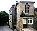 ColneValleyMuseum(RLH).JPG 3,203 × 2,728; 3.99 MB
-
 Commemorative Stone, Perseverance Road.jpg 480 × 640; 125 KB
-
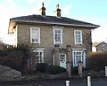
 Commercial Hotel, Huddersfield.jpg 2,448 × 1,624; 1.25 MB
-
 Commercial Mills entrance - geograph.org.uk - 701853.jpg 417 × 640; 98 KB
-
 Commercial Mills, Huddersfield.jpg 1,600 × 1,200; 330 KB
-
 Cooper Bridge Floodgates.jpg 800 × 487; 141 KB
-
 Cooper Bridge Lock - geograph.org.uk - 790497.jpg 640 × 407; 81 KB
-
 Cooper Bridge Lock.jpg 2,000 × 1,500; 1.01 MB
-
 Cottage Opposite Gateways.jpg 3,618 × 2,714; 2.91 MB
-
 Cottages - Crowtrees Lane, Rastrick - geograph.org.uk - 802234.jpg 640 × 419; 45 KB
-
 Court of Requests, Queen Street, Huddersfield (3223559442).jpg 2,404 × 1,964; 3.3 MB
-
 Cowburn Beck Farm - geograph.org.uk - 675860.jpg 640 × 480; 80 KB
-
 Cowlersley Community Centre.jpg 640 × 480; 93 KB
-
 Croft Street, Dewsbury (11390880523).jpg 2,240 × 3,046; 5.19 MB
-
 Cross Bank Methodist Sunday School, Batley.jpg 640 × 480; 56 KB
-
 Cross Socket near Fenny Hall.jpg 480 × 640; 403 KB
-

-
 Dairy at Blake House.jpg 4,000 × 3,000; 5.1 MB
-
 Derelict Building - King Cross Street - geograph.org.uk - 698388.jpg 640 × 485; 53 KB
-
 Derelict farmhouse, Higher Heath - geograph.org.uk - 42164.jpg 640 × 427; 104 KB
-
-
 Dewsbury - north side of Nelson Street - geograph.org.uk - 3085611.jpg 1,600 × 1,216; 586 KB
-
 Dewsbury - Wellington Road - geograph.org.uk - 3085624.jpg 1,600 × 1,222; 664 KB
-
 Dewsbury County Court.jpg 640 × 488; 91 KB
-
 Dewsbury Viaduct, June 2018.jpg 4,032 × 3,024; 2.13 MB
-
 Dixy Chicken - Cross Church Street - geograph.org.uk - 1702021.jpg 480 × 640; 77 KB
-
 Dobroydstables.JPG 3,664 × 2,748; 1.32 MB
-
 Dolphin Court Oulton House.jpg 4,080 × 3,072; 4.47 MB
-
 Dolphin Fountain, Harewood House.jpg 2,048 × 1,536; 1.27 MB
-
 Door in wall of Heptstonstall churchyard.jpg 3,000 × 4,000; 4.71 MB
-
 Double Lock, Lock Street, Dewsbury - geograph.org.uk - 377808.jpg 640 × 480; 128 KB
-
 Drighlington Junior School - Closed - geograph.org.uk - 1146034.jpg 640 × 480; 75 KB
-
 Drill Hall, Halifax.jpg 640 × 460; 56 KB
-
 Drinking Fountain - People's Park - geograph.org.uk - 698405.jpg 640 × 496; 90 KB
-

-
 Drinking Trough, South Crosland.jpg 640 × 427; 103 KB
-
 Dumb Steeple, Grange Moor.jpg 2,428 × 1,942; 1.33 MB
-
 Dumb Steeple, Mirfield (3398893509).jpg 1,607 × 2,250; 3.82 MB
-

-
 Eastburn Milestone.jpg 2,448 × 3,264; 1.35 MB
-

-
 Egypt - geograph.org.uk - 1120561.jpg 640 × 391; 68 KB
-
 Elland Lock - geograph.org.uk - 701351.jpg 640 × 427; 83 KB
-
 Engine House, Nortonthorpe Mills.jpg 2,000 × 1,213; 920 KB
-
 Entrance to Churchyard, Heptonstall.jpg 3,648 × 2,736; 4.05 MB
-
 Entrance to Leventhorpe Hall.jpg 800 × 600; 343 KB
-
 Entrance to Playground, Holme.jpg 1,600 × 1,200; 397 KB
-
 Entrance to Wellesley Barracks - geograph.org.uk - 812830.jpg 640 × 480; 72 KB
-
 Entrance, Birchcliffe Centre.jpg 640 × 480; 193 KB
-
 Entrance, Potterton Hall.jpg 800 × 600; 171 KB
-

-

-
 Exchange Buildings, Huddersfield.jpg 640 × 480; 90 KB
-
 Exchange Mill.jpg 480 × 640; 90 KB
-
 Facade formerly part of Sion School, Halifax bus station.jpg 4,032 × 3,024; 3.01 MB
-
 Facade of Syon Sunday School, Halifax.jpg 1,280 × 853; 322 KB


.jpg)


.jpg)


.jpg)


.jpg)


.jpg)


.jpg)


.jpg)
,_Holmbridge.jpg)


.jpg)


.jpg)


_College,_70_New_North_Road,_Huddersfield_(12485969823).jpg)

,_Addingham_-_geograph.org.uk_-_675649.jpg)


.jpg)


.JPG)


.jpg)


.jpg)


.jpg)


