Category:Grade II listed buildings in Surrey
Jump to navigation
Jump to search
Ceremonial counties of England: Bedfordshire · Berkshire · Buckinghamshire · Cambridgeshire · Cheshire · Cornwall · Cumbria · Derbyshire · Devon · Dorset · Durham · East Riding of Yorkshire · East Sussex · Essex · Gloucestershire · Greater London · Greater Manchester · Hampshire · Herefordshire · Hertfordshire · Kent · Lancashire · Leicestershire · Lincolnshire · Merseyside · Norfolk · North Yorkshire · Northamptonshire · Northumberland · Nottinghamshire · Oxfordshire · Rutland · Shropshire · Somerset · South Yorkshire · Staffordshire · Suffolk · Surrey · Tyne and Wear · Warwickshire · West Midlands · West Sussex · West Yorkshire · Wiltshire · Worcestershire
City-counties: Bristol · City of London
Former historic counties: Westmorland ·
Other former counties:
City-counties: Bristol · City of London
Former historic counties: Westmorland ·
Other former counties:
Wikimedia category | |||||
| Upload media | |||||
| Instance of | |||||
|---|---|---|---|---|---|
| |||||
Subcategories
This category has the following 84 subcategories, out of 84 total.
A
- Ash Museum, Surrey (6 F)
B
- Betchworth Castle (14 F)
- Booker's Tower (6 F)
- Bourne Hall Entrance Arch (12 F)
- Broadwood Tower, Box Hill (12 F)
- Brookwood 1939-1945 Memorial (69 F)
C
- The Celtic Cross on Gibbet Hill (16 F)
- The Clock House, Abinger (8 F)
- Cobham Mill, Surrey (8 F)
- Cumberland Obelisk (9 F)
D
- Drake Family Mausoleum (5 F)
E
- Epsom Clock Tower (18 F)
- Esher Place (9 F)
F
- Friends Meeting House, Capel (4 F)
G
- Godalming railway station (36 F)
- Grave of Henry Morton Stanley (14 F)
H
- Haslemere Town Hall (13 F)
- Haslemere Town Well (16 F)
- The Hautboy, Ockham (10 F)
- Haxted Mill (8 F)
- DMRC Headley Court (14 F)
- Hoffman Kiln (8 F)
J
L
- Leatherhead railway station (43 F)
- Village pump, Leigh, Surrey (10 F)
- Leith Hill Tower (45 F)
- Lodge to Lythe Hill House (6 F)
- Lowfield Heath Windmill (16 F)
M
- Mesylls (5 F)
N
- Norris's Obelisk (6 F)
O
- Ockham Mill (6 F)
P
- Pepperpot, Godalming (23 F)
- Phillips Memorial Cloister (13 F)
R
- Reigate Tunnel (9 F)
- Royal Earlswood Hospital (26 F)
S
- The Sailor's Stone (12 F)
- Sickle Mill (15 F)
- St John's Beaumont School (24 F)
- Staines Old Town Hall (28 F)
T
- New Mill, Tadworth (3 F)
- The Columbarium (8 F)
- The Laboratory at RHS Wisley (27 F)
- The Rodboro Buildings (9 F)
- Thorpe Village Hall, Surrey (2 F)
- Tilford Institute, Tilford (4 F)
- Titsey Place (16 F)
- Tomb Of Guilio Salviati (4 F)
- Tower Garage, Egham (5 F)
- Tunsgate, Guildford (13 F)
U
- Undershaw (4 F)
V
- Village pump, Esher (2 F)
W
- Woking signal box (12 F)
Media in category "Grade II listed buildings in Surrey"
The following 200 files are in this category, out of 416 total.
(previous page) (next page)-
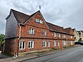
 "Lower House" at Hascombe - geograph.org.uk - 1180281.jpg 640 × 360; 74 KB
-
 "Matthews Place" at Hascombe - geograph.org.uk - 1180277.jpg 640 × 360; 60 KB
-
 1 Park Road, Farnham.jpg 3,024 × 4,032; 2.98 MB
-
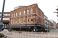
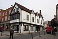
 122-124 High Street, Guildford.jpg 2,304 × 3,456; 2.67 MB
-
 127-129 High Street, Guildford.jpg 2,304 × 3,456; 3.37 MB
-
 138 High Street, Guildford.jpg 2,304 × 3,456; 2.85 MB
-
 14 Petworth Road, Haslemere.jpg 4,000 × 3,000; 3.24 MB
-
 142-144 High Street, Guildford.jpg 2,304 × 3,456; 2.81 MB
-
 16-22 and 22A Petworth Road, Haslemere 01.jpg 4,000 × 3,000; 3.36 MB
-
 16-22 and 22A Petworth Road, Haslemere 02.jpg 4,000 × 3,000; 3.46 MB
-
 16-22 and 22A Petworth Road, Haslemere 03.jpg 4,000 × 3,000; 3.44 MB
-
 16-22 Petworth Road, Haslemere - geograph.org.uk - 3895606.jpg 1,280 × 960; 255 KB
-
 17 High Street, Ewell.jpg 3,839 × 3,839; 7.93 MB
-
 1A Sydenham road.jpg 2,496 × 3,328; 2.31 MB
-
 2 Bridge Street, Leatherhead, Surrey.JPG 2,848 × 4,256; 3.65 MB
-
 20 22 The Street Shalford.jpg 6,100 × 4,575; 6.42 MB
-
 20 Quarry Street, Guildford 2.jpg 2,304 × 3,456; 2.68 MB
-
 20 Quarry Street, Guildford.jpg 5,472 × 3,648; 12.22 MB
-
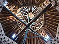 2019-0915Su 1351-34 GS9 ceiling of Pigeon house in Albury Surrey.jpg 4,032 × 3,024; 4.63 MB
-
 22 Rose Hill Dorking.jpg 2,448 × 3,264; 2.51 MB
-
 23 31 Leas Road Warlingham.jpg 4,032 × 2,268; 5.35 MB
-
 23 and 24 Rose Hill Dorking.jpg 3,264 × 2,448; 2.35 MB
-
 25-29 High Street, Guildford.jpg 3,456 × 2,304; 2.7 MB
-
 3 & 4 West Street Dorking.jpg 3,264 × 2,448; 1.85 MB
-
 3 and 4 Rose Hill Dorking.jpg 3,264 × 2,448; 3.24 MB
-
 31, 33, 35 Petworth Road, Haslemere.jpg 4,000 × 3,000; 4.47 MB
-
 31-45 High Street, Guildford.jpg 3,456 × 2,304; 2.72 MB
-
 33 High Street, Caterham on the Hill.jpg 4,032 × 2,268; 4.1 MB
-
 35 - 38 Dene Street Dorking.jpg 3,264 × 2,448; 2.16 MB
-
 4 Quarry Street, Guildford.jpg 2,304 × 3,456; 3.07 MB
-
 41 Dene Street Easter Cottage Dorking.jpg 3,264 × 2,448; 1.56 MB
-
 43 High Street, Haslemere.jpg 4,000 × 3,000; 2.92 MB
-
 43-45 High Street, Guildford.jpg 2,304 × 3,456; 3.72 MB
-
 44 High Street, Haslemere 01.jpg 4,000 × 3,000; 4.31 MB
-
 44 High Street, Haslemere 02.jpg 4,000 × 3,000; 3.06 MB
-
 44, Quarry Street.jpg 3,328 × 2,496; 2.13 MB
-
 46 High Street, Guildford (side).jpg 3,456 × 2,304; 2.72 MB
-
 46 High Street, Guildford.jpg 3,456 × 2,304; 2.47 MB
-
 49 High Street, Godalming.jpg 3,000 × 4,000; 4.9 MB
-
 5&6 West Street Dorking.jpg 3,264 × 2,448; 2.36 MB
-
 54 Quarry Street, Guildford.jpg 2,304 × 3,456; 2.28 MB
-
 58 Quarry Street, Guildford.jpg 2,304 × 3,456; 3.35 MB
-
 63 Dene Street Dorking.jpg 3,264 × 2,448; 1.4 MB
-
 69-73 High Street, Guildford.jpg 3,456 × 2,304; 3.74 MB
-
 7 Bear Lane, Farnham.jpg 4,032 × 3,024; 2.96 MB
-
 7 Park Row, Farnham.jpg 3,024 × 4,032; 3.39 MB
-
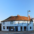
 7 Petworth Road, former White Lion Public House, Haslemere.jpg 4,000 × 3,000; 2.86 MB
-
 7 West Street Dorking.jpg 3,264 × 2,448; 1.67 MB
-
 7, 8 and 9 Deanery Place, Godalming, Surrey.jpg 3,048 × 1,947; 1.18 MB
-
 70 and 71 Dene Street Dorking.jpg 3,264 × 2,448; 1.84 MB
-
 72 High Street, Haslemere.jpg 4,000 × 3,000; 3.11 MB
-
 75-81 High Street, Guildford.jpg 3,456 × 2,304; 3.32 MB
-
 83 High Street, Guildford.jpg 2,304 × 3,456; 3.54 MB
-
 9-17 Park Row, Farnham.jpg 4,032 × 3,024; 2.87 MB
-
 90 High Street, Guildford.jpg 2,304 × 3,456; 2.96 MB
-
 Abinger hammer clock.jpg 567 × 850; 193 KB
-
 Aircraft Factory - Wellington.jpg 3,648 × 2,432; 2.59 MB
-
 Ash Museum, Surrey 01.jpg 4,128 × 3,096; 5.37 MB
-
 Ash Museum, Surrey 02.jpg 4,128 × 3,096; 7.04 MB
-
 Ash Museum, Surrey 03.jpg 4,128 × 3,096; 8.2 MB
-
 Ash Museum, Surrey 04.jpg 3,096 × 4,128; 6.27 MB
-
 Ash Museum, Surrey 05.jpg 4,128 × 3,096; 6.51 MB
-
 Ash, Surrey 01.jpg 4,128 × 3,096; 5.76 MB
-
 Ysgol Gymraeg Ashford Middlesex.GIF 761 × 477; 173 KB
-
 Asylum lodges TQ2848 493.jpg 2,720 × 1,512; 645 KB
-
 Autumn Cottage And Pound Cottage, Chiddingfold.jpg 3,456 × 2,304; 4.25 MB
-
 Barton's Bookshop, 2 Bridge Street, Leatherhead (NHLE Code 1294412) (July 2013) (1).JPG 1,800 × 2,000; 995 KB
-
 Barton's Bookshop, 2 Bridge Street, Leatherhead (NHLE Code 1294412) (July 2013) (2).JPG 1,944 × 2,100; 1.17 MB
-
 Beckhams Cottage, Little Beckhams, Chiddingfold.jpg 3,456 × 2,304; 4.1 MB
-
 Beckhams, Chiddingfold 2.jpg 3,456 × 2,304; 4.34 MB
-
 Bellman Hangar, Brooklands Museum.JPG 4,256 × 2,848; 4.76 MB
-
 Betchworth Forge, The Street, Betchworth (NHLE Code 1190667) (July 2013).JPG 2,000 × 1,800; 1.13 MB
-
 Birch farm house.jpg 4,032 × 3,024; 6.45 MB
-
 Birch house.jpg 4,032 × 3,024; 5.89 MB
-
 Bishopsgate Lodge, East Horsley.jpg 5,184 × 3,456; 8.68 MB
-
 Black Hams, Chiddingfold 2.jpg 3,456 × 2,304; 4.59 MB
-
 Black Hams, Chiddingfold.jpg 5,152 × 3,864; 9.19 MB
-
 Blue Cross charity shop, 10 and 12 Petworth Road, Haslemere 01.jpg 4,000 × 3,000; 3.6 MB
-
 Blue Cross charity shop, 10 and 12 Petworth Road, Haslemere 02.jpg 4,000 × 3,000; 3.37 MB
-
 Botley House, Chiddingfold.jpg 3,456 × 2,304; 4.95 MB
-

-
 Bridge Cottage, Primrose Cottage, Chiddingfold.jpg 3,456 × 2,304; 3.87 MB
-
 Broadoak House - geograph.org.uk - 1879844.jpg 640 × 430; 116 KB
-
 Broadwater Lake Western Path, 2015.jpg 2,048 × 1,536; 3.25 MB
-
 Brockhurst, Chiddingfold.jpg 3,456 × 2,304; 3.56 MB
-
 Brooklands Flight Booking Office.JPG 2,848 × 4,256; 4.54 MB
-
 Brooklands Museum Wellington Hangar, 26 February 2012.jpg 1,024 × 694; 550 KB
-
 Brookwood American Cemetery - geograph.org.uk - 2243206.jpg 1,024 × 768; 266 KB
-
 Brookwood Military Cemetery-The American cemetery-1477.JPG 3,648 × 2,736; 4.12 MB
-
 Brookwood Military Cemetery-The American cemetery-1478.JPG 3,648 × 2,736; 4 MB
-
 Brookwood – 20180219 114232 (39657898154).jpg 4,032 × 3,024; 5.65 MB
-
 Brookwood – 20180219 114248 (25496729067).jpg 4,032 × 2,268; 3.37 MB
-
 Buckland mill.jpg 427 × 640; 118 KB
-
 Buffbeards, Shottermill.jpg 4,128 × 3,096; 6.58 MB
-
 Burrell House, Chiddingfold.jpg 3,456 × 2,304; 2.74 MB
-
 Butter Hill Dorking.jpg 2,448 × 3,264; 2.35 MB
-
 Cafe Rouge 170 High Street Dorking.jpg 3,264 × 2,448; 1.55 MB
-
 Canada House driveway, National Shooting Centre.jpg 4,682 × 3,121; 13.93 MB
-
 Canada House, National Shooting Centre.jpg 5,184 × 3,456; 15.07 MB
-
 Catsprey, Chiddingfold.jpg 3,456 × 2,304; 4.71 MB
-
 Chantry House, Chiddingfold.jpg 3,456 × 2,304; 4.52 MB
-
 Chase Farmhouse, Haslemere.jpg 4,128 × 3,096; 5.63 MB
-
 Cherchefelle - geograph.org.uk - 1042879.jpg 640 × 426; 75 KB
-
 Chest Tomb 40 yards south of Church of All Saints, Banstead, view looking north-east-east.jpg 4,387 × 5,849; 19.18 MB
-
 Chest Tomb 40 yards south of Church of All Saints, Banstead.jpg 4,490 × 6,736; 23.79 MB
-
 Chiddingfold - The Manor House - 20230603102220.jpg 4,000 × 3,000; 3.31 MB
-
 Chiddingfold - The Manor House - 20230603102223.jpg 4,000 × 3,000; 3.41 MB
-
 Church Cottage, Chiddingfold.jpg 4,000 × 3,000; 3.45 MB
-
 Church Hill Gate, Haslemere.jpg 4,000 × 3,000; 3.66 MB
-
 Church Hill House, Haslemere 01.jpg 4,000 × 3,000; 3.37 MB
-
 Church Lane House, Shottermill.jpg 4,128 × 3,096; 8.84 MB
-
 Clarendon House West Street Dorking.jpg 3,264 × 2,448; 1.67 MB
-
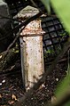
 Coal Post - geograph.org.uk - 2995896.jpg 3,056 × 4,592; 4.73 MB
-
 Coal Tax Post no 135 - geograph.org.uk - 4412422.jpg 530 × 800; 517 KB
-
 Coal Tax Post no 135 - geograph.org.uk - 4412429.jpg 800 × 530; 753 KB
-
 Coal Tax post no 136 - geograph.org.uk - 1836951.jpg 429 × 640; 171 KB
-
 Coal Tax Post no 137 - geograph.org.uk - 1836845.jpg 445 × 640; 124 KB
-
 Coal Tax Post no 138 - geograph.org.uk - 3236400.jpg 425 × 640; 500 KB
-
 Coal Tax Post no 139 - geograph.org.uk - 1839147.jpg 434 × 640; 151 KB
-
 Coal Tax post no 140 - geograph.org.uk - 1839096.jpg 426 × 640; 170 KB
-
 Coal Tax Post no 141 - geograph.org.uk - 4412469.jpg 530 × 800; 678 KB
-
 Coal Tax Post no 141 - geograph.org.uk - 4412470.jpg 800 × 530; 755 KB
-
 Coal Tax Post no 142 - geograph.org.uk - 4412471.jpg 530 × 800; 744 KB
-
 Coal Tax Post no 143 - geograph.org.uk - 1152752.jpg 426 × 640; 117 KB
-
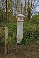
 Coal Tax post on Banstead Heath - geograph.org.uk - 4045305.jpg 4,000 × 3,000; 4.08 MB
-
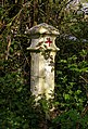
 Coal Tax Post, Queens Park, Reigate 01.jpg 2,112 × 2,816; 1.47 MB
-
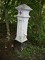 Coal Tax Post, Queens Park, Reigate 02.jpg 2,112 × 2,816; 1.47 MB
-
 Combe Hatch, Chiddingfold.jpg 3,456 × 2,304; 4.64 MB
-

-
 Cotmandene House Dene Street Dorking 2.jpg 3,264 × 2,448; 2.62 MB
-
 Cotmandene House Dene Street Dorking.jpg 2,448 × 3,264; 2.52 MB
-
 Cottage near Burrell House, Chiddingfold.jpg 3,456 × 2,304; 5.06 MB
-
 Cottages, 1-4 The Lane, Thursley.jpg 4,128 × 3,096; 6.19 MB
-
 Court Cottage.jpg 4,032 × 2,268; 4.63 MB
-
 Cyclops Cottage, Chiddingfold.jpg 3,456 × 2,304; 3.95 MB
-
 Davison Vault, Frensham churchyard.jpg 4,128 × 3,096; 7.46 MB
-
 Deans Knowe, Dippenhall.jpg 4,000 × 3,000; 3.96 MB
-
 Demolition at West Park Hospital - geograph.org.uk - 2771810.jpg 756 × 1,024; 161 KB
-
 Diocesan House.jpg 2,779 × 2,410; 1.72 MB
-
 Disused Reservoir.jpg 3,155 × 2,496; 2.64 MB
-
 Dorking Cemetery Lodge, Reigate Road - geograph.org.uk - 1509788.jpg 640 × 427; 80 KB
-
 Douglas Freshfield Grave Brookwood.jpg 3,000 × 4,000; 1.98 MB
-
 Douglas Vickers Grave Brookwood.jpg 3,917 × 2,159; 1.65 MB
-
 Dovecote at Wintershall.jpg 5,152 × 3,864; 4.42 MB
-
 Dovecote by The Refectory, Milford, Surrey 01.jpg 4,000 × 3,000; 3.06 MB
-
 Dovecote by The Refectory, Milford, Surrey 02.jpg 1,270 × 1,372; 1.13 MB
-
 Drinking fountain, Petworth Road, Haslemere 01.jpg 3,000 × 4,000; 5.18 MB
-
 Drinking fountain, Petworth Road, Haslemere 02.jpg 4,000 × 3,000; 5.3 MB
-
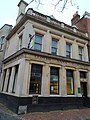
 Dunn And Company, 50-54 High Street, Guildford.jpg 2,304 × 3,456; 3.69 MB
-
 Edwardian Water Tower - geograph.org.uk - 4099584.jpg 1,632 × 918; 641 KB
-
 Ann Boleyn Hotel at The Hythe Staines - panoramio.jpg 3,648 × 2,736; 4.05 MB
-
 Elm Farm House.jpg 4,032 × 2,268; 5.34 MB
-
 Elmbridge - Post At Ngr Tq 11656888 - 20231105152915.jpg 4,000 × 3,000; 4.5 MB
-
 Elmbridge - Post At Ngr Tq 11656888 - 20231105152925.jpg 4,000 × 3,000; 5.1 MB
-
 Englegreenchurch.jpg 1,000 × 575; 446 KB
-

-
 Entrance Walls 160 Yards South Of American Military Chapel.jpg 5,184 × 3,456; 9.87 MB
-
 Esher, St Georges Church, Anchell tomb 2.jpg 4,000 × 2,650; 3.57 MB
-
 Esher, St Georges Church, Anchell tomb.jpg 4,000 × 2,673; 3.67 MB
-
 Esher, St Georges Church, Parker tomb.jpg 4,000 × 2,663; 3 MB
-
 Esher01.JPG 954 × 768; 353 KB
-
 Ewhurst mill.jpg 427 × 640; 104 KB
-
 Exhibition Hut, National Shooting Centre 2.jpg 4,681 × 3,121; 13.51 MB
-
 Exhibition Hut, National Shooting Centre.jpg 4,757 × 3,172; 13.63 MB
-
 Forecourt wall of Church Hill Gate, Haslemere 01.jpg 4,000 × 3,000; 3.23 MB
-
 Forecourt wall of Church Hill Gate, Haslemere 02.jpg 4,000 × 3,000; 3.49 MB
-
 Forecourt wall of Church Hill Gate, Haslemere 03.jpg 4,000 × 3,000; 4.44 MB
-
 Former Aero Control Tower, Brooklands.JPG 4,256 × 2,848; 4.13 MB
-
 Former British School, Bridge Street, Godalming (April 2015).JPG 4,400 × 2,600; 2.44 MB
-
 Former chapel, Hoe Bridge School, Woking 01.jpg 4,128 × 3,096; 6.98 MB
-
 Former chapel, Hoe Bridge School, Woking 02.jpg 4,128 × 3,096; 5.49 MB
-
 Former chapel, Hoe Bridge School, Woking 03.jpg 4,128 × 3,096; 4.74 MB
-
 Former chapel, Hoe Bridge School, Woking 04.jpg 4,128 × 3,096; 4.76 MB
-
 Former Ram Cider House.jpg 2,560 × 1,920; 2.23 MB
-
 Former school - geograph.org.uk - 1268316.jpg 640 × 426; 106 KB
-
 Former Staff of Life pub, Shottermill, Surrey 01.jpg 4,128 × 3,096; 7.15 MB
-
 Former Staff of Life pub, Shottermill, Surrey 02.jpg 4,128 × 3,096; 7.15 MB
-
 Friars Gate, Chiddingfold.jpg 3,456 × 2,304; 4.24 MB
-
 Fulton's Gun Shop, National Shooting Centre.jpg 4,668 × 3,112; 12.23 MB
-
 Garden wall of Town House, Haslemere.jpg 4,000 × 3,000; 3.08 MB
-
 Gas Lamp In Garden Of Remembrance.jpg 4,072 × 3,282; 2.65 MB
-
 Gatekeeper's Cottage, Rectory Lane - geograph.org.uk - 1770698.jpg 640 × 426; 102 KB
-
 Godalming Museum, 107-109 High Street, Godalming, Surrey.jpg 2,309 × 1,732; 736 KB
-
 Godalming railway station, 2020.jpg 5,472 × 3,648; 17.05 MB
-
 Granary at Malthouse Farm, Hambledon, Surrey.jpg 3,000 × 4,000; 3.18 MB
-
 Greenaway, Chiddingfold.jpg 3,456 × 2,304; 4.67 MB
-
 Grove Cottage, Chiddingfold.jpg 3,456 × 2,304; 3.01 MB
-
 Guildford Mill.jpg 850 × 552; 661 KB
-
 Hampton Lodge-geograph-3046413.jpg 640 × 480; 115 KB
-
 Haslemere Museum 01.jpg 4,000 × 3,000; 2.78 MB
-
 Haslemere Museum 02.jpg 4,000 × 3,000; 2.61 MB
-
 Haslemere railway station in Sept 2007 (3).jpg 3,072 × 2,304; 2.82 MB
-
 Haslemere signal box.jpg 850 × 563; 706 KB
-
 Haslemere Signalbox-geograph-2623398-by-N-Chadwick.jpg 640 × 430; 79 KB
-
 Hatch Mill, Mill Lane, Godalming, Surrey.jpg 1,897 × 2,529; 1.25 MB
-
 Hawlands, Chiddingfold 2.jpg 3,456 × 2,304; 5 MB
-

-
 Henri Van Laun Grave 2016.jpg 3,609 × 2,859; 2.84 MB
-
 Hill Cottage, Chiddingfold.jpg 3,456 × 2,304; 4.35 MB
-
 Holdfast Cottage, Haslemere.jpg 4,000 × 3,000; 4.68 MB


.jpg)


_(July_2013)_(1).JPG)
_(July_2013)_(2).JPG)


_(July_2013).JPG)


.jpg)
.jpg)


_(July_2013).JPG)


.JPG)


.jpg)


_(Geograph_Image_2225767_8ebdbdcc).jpg)


