Category:Gulf of Bothnia
Jump to navigation
Jump to search
the northernmost arm of the Baltic Sea   | |||||
| Upload media | |||||
| Instance of | |||||
|---|---|---|---|---|---|
| Part of | |||||
| Location |
| ||||
| Has part(s) | |||||
| Inflows |
| ||||
 | |||||
Deutsch: Der Bottnische Meerbusen ist der nördliche Ausläufer der Ostsee zwischen Schweden und Finnland.
English: The Gulf of Bothnia (Swedish Bottniska viken, Finnish Pohjanlahti) is the northernmost arm of the Baltic Sea between Sweden and Finland.
Suomi: Pohjanlahti Itämereen kuuluva on merialue Suomen ja Ruotsin välissä, Ahvenanmaasta pohjoiseen.
Subcategories
This category has the following 13 subcategories, out of 13 total.
A
B
I
- Inner-Abborrtjärnen (6 F)
K
M
- Maps of the Gulf of Bothnia (20 F)
S
- Sea of Åland (8 F)
T
V
- Väderskär (4 F)
Media in category "Gulf of Bothnia"
The following 36 files are in this category, out of 36 total.
-
 Une vue des côtes de la mer Baltique, Golfe de Bothnie.jpg 1,834 × 2,177; 2.28 MB
-
 2012-03-26 Eiskarte-Ausschnitt Bottnischer Meerbusen.jpg 1,104 × 758; 351 KB
-
 2017-03-22 Eiskarte-Ausschnitt des Bottnischen Meerbusen.jpg 2,432 × 1,640; 938 KB
-
 Alholmens Kraft Power Station.jpg 1,000 × 600; 233 KB
-
 Balesudden-02349-M.jpg 2,100 × 1,256; 2.13 MB
-
 Baltic ice.jpg 4,173 × 4,168; 12.72 MB
-
 Claudia (2005).jpg 2,048 × 1,360; 1.16 MB
-
 Coast-guard-vehicle-1970.jpg 1,920 × 1,448; 357 KB
-
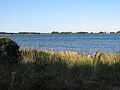
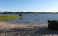 Grönvik simstrand och Grönvikfladan.JPG 3,031 × 1,908; 1.18 MB
-
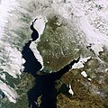
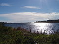
 Gulf of Bothnia (MODIS).jpg 2,739 × 2,224; 3.61 MB
-
 Gulf of Bothnia off Ii.jpg 247 × 124; 4 KB
-
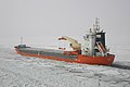
 Gulf of Bothnia pack ice edge broken by Sampo.jpg 4,288 × 2,854; 6.2 MB
-
 Gulf of Bothnia Pitea.jpg 2,048 × 1,536; 1.65 MB
-
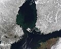
 Gulf of Bothnia satellite.jpg 3,669 × 2,752; 7.08 MB
-
 Holmsund, Sweden, Yogb21.jpg 1,280 × 960; 319 KB
-
 Ice Navigation.jpg 2,048 × 1,360; 1.37 MB
-
 Jäätä Porin edustalla 1.jpg 4,800 × 3,200; 7.29 MB
-
 Jäätä Porin edustalla 2.jpg 4,900 × 2,790; 3.86 MB
-
 Jäätä Porin edustalla 3.jpg 4,900 × 3,235; 7.92 MB
-
 Kalajoki view.jpg 3,840 × 2,160; 2.71 MB
-

-
 Luvian laitakari pano.jpg 10,650 × 1,590; 6.33 MB
-
 No-nb digibok 2015022728004 0017.jpg 3,789 × 3,165; 1.58 MB
-
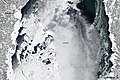
 Oulu, Finland - NASA Earth Observatory.jpg 720 × 480; 179 KB
-
 Panorama from Saltkaret.jpg 39,818 × 1,983; 13.57 MB
-
 Rauma dockyard in summer.jpg 2,592 × 1,944; 2.5 MB
-
 Reila saaristoa.jpg 3,072 × 2,304; 2.09 MB
-
 Sjöbodar i Grönvik på avstånd.JPG 3,072 × 1,748; 1.54 MB
-
 Sjöbodar och simstranden i Grönvik.JPG 3,072 × 1,782; 1.42 MB
-
 Solis Occasus in Sino Bothnico.jpg 1,024 × 683; 181 KB
-
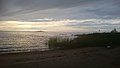
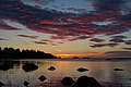
 The sunset of Gulf of Bothnia. (51311315490).jpg 5,184 × 3,456; 3.6 MB
-
 Thick Ice in the Gulf of Bothnia 2010-03-05 lrg.jpg 2,224 × 2,668; 2.19 MB
-
 Thick Ice in the Gulf of Bothnia 2010-03-05.jpg 720 × 480; 101 KB
-
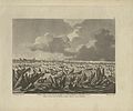
 Travels through Sweden, Finland, and Lapland... Wellcome L0071080.jpg 5,302 × 3,965; 6.49 MB
-
 UPM pulp and paper mills in Jakobstad.jpg 2,048 × 1,536; 632 KB
-
 Vaasa Post glacial rebound marks.JPG 1,280 × 960; 285 KB


.jpg)


.jpg)


.jpg)


.jpg)


