Category:Heiligenstadt in Oberfranken
Navigatsiya qismiga oʻtish
Qidirish qismiga oʻtish
market municipality of Germany in the district of Bamberg, Bavaria  .svg)  | |||||
| Fayl yuklash | |||||
| Bu konsepsiyaning alohida holati |
| ||||
|---|---|---|---|---|---|
| Qismi |
| ||||
| Location | Bamberg, Upper Franconia, Bavariya, Germaniya | ||||
| Aholisi |
| ||||
| Hudud |
| ||||
| Dengiz sathidan balandligi |
| ||||
| rasmiy vebsayti | |||||
 | |||||
Ostturkumlar
Quyida ushbu turkumga kiruvchi 14 ta ostturkumdan 14 tasi koʻrsatilgan.
B
C
E
M
N
„Heiligenstadt in Oberfranken“ turkumidagi sahifalar
Bu turkumda faqat bitta sahifa mavjud.
„Heiligenstadt in Oberfranken“ turkumidagi fayllar
Quyida ushbu turkumga kiruvchi 100 ta fayldan 100 tasi koʻrsatilgan.
-
 Aus dem Ort verlegte Kapelle - panoramio.jpg 1 443 × 1 472; 604 KB
-
 Blick nach Herzogenreuth - panoramio.jpg 1 392 × 1 383; 386 KB
-
 Blick nach Hohenpölz - panoramio.jpg 1 245 × 1 342; 396 KB
-
 Blick vom Altenberg.jpg 3 968 × 2 232; 3,9 MB
-
 Damwild - panoramio.jpg 1 457 × 1 498; 547 KB
-
 Damwildgehege - panoramio.jpg 1 369 × 1 342; 405 KB
-
 Das Damwild bei Geisfeld gibt es nicht mehr. - panoramio.jpg 1 226 × 1 238; 368 KB
-
-
 Der markante Kirchturm von Hohenpölz - panoramio.jpg 1 548 × 1 502; 371 KB
-
 Digitales Orthofoto von Heiligenstadt in Oberfranken (Bayerische Vermessungsverwaltung).tif 35 000 × 27 500; 1,95 GB
-
 Eisereshaus - panoramio.jpg 2 152 × 1 920; 541 KB
-
 Evangelische Kirche - panoramio (6).jpg 1 764 × 1 908; 305 KB
-
 Feldkapelle - panoramio (1).jpg 1 987 × 1 917; 743 KB
-
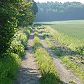 Feldweg - panoramio (10).jpg 1 499 × 1 487; 511 KB
-
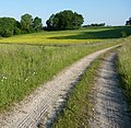
 Feldweg - panoramio (7).jpg 1 419 × 1 410; 501 KB
-
 Feldweg - panoramio (8).jpg 1 407 × 1 380; 407 KB
-
 Feldweg - panoramio (9).jpg 1 663 × 1 627; 709 KB
-
 Feuerwehrhaus - panoramio (1).jpg 1 975 × 1 914; 514 KB
-
 Flurbereinigungsweg - panoramio (5).jpg 1 160 × 1 148; 312 KB
-
 Flurbereinigungsweg - panoramio (6).jpg 1 380 × 1 358; 369 KB
-
 Fraenkischer Theatesommer.jpg 1 993 × 1 314; 428 KB
-
 Fußweg im Trockental oberhalb der Leinleiterquelle - panoramio.jpg 1 397 × 1 426; 523 KB
-
 Fußweg zur Leinleiterquelle - panoramio.jpg 1 260 × 1 297; 518 KB
-
 Gedenkkreuz für Ferdinand Estenfelder - panoramio.jpg 1 764 × 1 801; 759 KB
-
 Geisdorf - panoramio (1).jpg 1 747 × 1 691; 500 KB
-
 Geisdorf - panoramio (2).jpg 1 706 × 1 709; 493 KB
-
 Gewerbegebiet Heiligenstadt 01.jpg 2 932 × 1 209; 502 KB
-
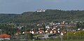
 Greifenstein und Heiligenstadt 01.jpg 2 534 × 2 961; 1,13 MB
-
 Greifenstein und Heiligenstadt 02.jpg 3 423 × 1 684; 815 KB
-
 Grüezi in Hohenpölz - panoramio.jpg 1 624 × 1 575; 526 KB
-
 Hangschutt-Karstquelle.JPG 1 800 × 1 200; 2,48 MB
-
 Hasen bewaffnet euch und schießt zurück - panoramio.jpg 1 795 × 1 728; 915 KB
-
 Haus in Herzogenreuth - panoramio.jpg 1 272 × 1 314; 309 KB
-
 Heiligenstadt 01.jpg 3 432 × 1 555; 708 KB
-
 Heiligenstadt Brunnen.jpg 3 000 × 4 000; 4,73 MB
-
 Heiligenstadt i. Ofr., Marktplatz Kriegerdenkmal, 001.jpg 3 264 × 4 928; 13,14 MB
-
 Heiligenstadt in Oberfranken - geo.hlipp.de - 13927.jpg 480 × 640; 66 KB
-
 Heiligenstadt in Oberfranken Luftbild-20220731-RM-120643.jpg 5 204 × 2 588; 9,08 MB
-
 Heiligenstadt in Oberfranken Osterbrunnen-20070411-RM-092801.jpg 3 136 × 2 352; 7,39 MB
-
 Heiligenstadt in Oberfranken Osterbrunnen-20070411-RM-092848.jpg 2 281 × 2 573; 3,82 MB
-
 Heiligenstadt in Oberfranken Panorama Greifenstein 001.JPG 6 130 × 1 532; 1,53 MB
-
 Heiligenstadt kirchen greifenstein.jpg 2 560 × 1 920; 3,91 MB
-
 Heiligenstadt Luftbild-20230928-RM-171935.jpg 5 272 × 3 948; 13,01 MB
-
 Heiligenstadt OFr 1168 Haldenstat.jpg 226 × 122; 8 KB
-
 Heiligenstadt pavillon.jpg 3 648 × 2 736; 3,5 MB
-
 Heiligenstadt Schild.jpg 1 347 × 1 483; 500 KB
-
 Heiligenstadt und Greifenstein 1814.jpg 1 663 × 908; 540 KB
-
 Heiligenstadt vom Pavillon.jpg 2 560 × 1 920; 2,82 MB
-
 Heiligenstadt vom seigelstein.jpg 2 800 × 2 100; 2,63 MB
-
 Heiligenstadt Wanderweg.jpg 4 000 × 3 000; 5,5 MB
-
 HeiligenstadtFelsen.JPG 1 717 × 2 016; 1,03 MB
-
 HeiligenstadtGreifenstein.jpg 298 × 459; 43 KB
-
 HeiligenstadtKatholischeKirche.JPG 1 468 × 2 113; 626 KB
-
 HeiligenstadtLeinleiter.JPG 1 768 × 2 232; 1,39 MB
-
 HeiligenstadtLeinleiterbach.JPG 1 220 × 1 516; 597 KB
-
 HeiligenstadtOfr2000.jpg 431 × 322; 39 KB
-
 HeiligenstadtPanorama2005.jpg 1 848 × 2 103; 949 KB
-
 HeiligenstadtRichtungPavillon.JPG 1 684 × 1 851; 713 KB
-
 Heiligenstädter Hof - panoramio - Immanuel Giel.jpg 1 709 × 1 803; 432 KB
-
 Heiligenstädter Hof - panoramio.jpg 1 612 × 1 679; 490 KB
-
 Herzhaueser Greifenstein.jpg 2 404 × 1 588; 819 KB
-
 Historische Linde - panoramio.jpg 1 275 × 1 335; 470 KB
-
 Hohenpölz - panoramio (4).jpg 2 030 × 1 908; 673 KB
-
 Hotel Heiligenstadter Hof - panoramio - Hatti1 (1).jpg 3 008 × 2 000; 1,46 MB
-
 Hotel Heiligenstadter Hof - panoramio - Hatti1.jpg 3 008 × 2 000; 1,57 MB
-
 Hotel Heiligenstadter Hof - panoramio.jpg 3 262 × 2 174; 1,47 MB
-
 Hügelgräber - panoramio (1).jpg 1 548 × 1 609; 618 KB
-
 Hügelgräber - panoramio.jpg 1 679 × 1 676; 728 KB
-
 Katholische Kirche und Schloss Greifenstein - panoramio.jpg 1 740 × 1 691; 385 KB
-
 Kirchberg Fenster Heiligenstadt OFr.jpg 1 210 × 1 553; 249 KB
-
 Kirchberg in Hohenpölz - panoramio (1).jpg 2 005 × 1 911; 399 KB
-
 Kirchberg in Hohenpölz - panoramio.jpg 1 941 × 1 920; 791 KB
-
 Kirche und Feuerwehrhaus - panoramio.jpg 1 639 × 1 697; 549 KB
-
 Kirchturm - panoramio (10).jpg 1 630 × 1 603; 373 KB
-
 Knackstedt & Näther Stereoskopie 1009 Heiligenstadt in der fränk. Schweiz.jpg 3 376 × 2 207; 6,29 MB
-
 Laurentiuskirche Hohenpölz - panoramio.jpg 1 947 × 1 798; 512 KB
-
 Leichenhaus - panoramio (1).jpg 1 694 × 1 755; 737 KB
-
 Leinleiter-Bach - panoramio (1).jpg 1 311 × 1 196; 316 KB
-
 Leinleiter-Bach - panoramio.jpg 1 271 × 1 149; 303 KB
-
 Leinleiterquelle - Abfluss - panoramio.jpg 2 272 × 1 704; 932 KB
-
 Lämmlein's Ruh - panoramio.jpg 4 608 × 3 456; 10,75 MB
-
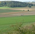
 Maschinenhalle bei Huppendorf - panoramio.jpg 1 441 × 1 346; 453 KB
-
 Muh - panoramio.jpg 1 688 × 1 725; 547 KB
-
 Muh^ Muh - panoramio.jpg 1 218 × 1 197; 317 KB
-
 Ostern in Heiligenstadt 2007.jpg 1 674 × 1 483; 630 KB
-
 Pavillon Heiligenstadt 01.jpg 3 291 × 2 084; 930 KB
-
 Pavillon im Kreisverkehr - panoramio.jpg 2 262 × 1 592; 423 KB
-
 Rathaus Heiligenstadt - panoramio.jpg 3 264 × 2 448; 2,07 MB
-
 Reisigkurve - panoramio.jpg 1 377 × 1 395; 424 KB
-
 Reste vom Johannisfeuer - panoramio.jpg 1 801 × 1 825; 863 KB
-
 RROF Marktplatz Heiligenstadt.jpg 5 184 × 3 888; 8,17 MB
-
 Schlauchtrockenturm der Freiwilligen Feuerwehr - panoramio.jpg 2 173 × 1 920; 349 KB
-
 Schnecke Heiligenstadt.jpg 1 487 × 1 226; 421 KB
-
 Schwarzenhaus - panoramio.jpg 2 018 × 1 920; 666 KB
-
 Seeberei - panoramio.jpg 1 960 × 1 920; 805 KB
-
 Skyline von Hohenpölz - panoramio.jpg 1 364 × 1 310; 405 KB
-
 Stadion Heiligenstadt 01.jpg 3 416 × 1 603; 815 KB
-
 Steinquelle - panoramio.jpg 1 024 × 1 365; 421 KB
-
 Trockental nördlich der Leinleiterquelle - panoramio.jpg 2 272 × 1 704; 960 KB
-
 Weg nach Laibarös - panoramio (2).jpg 1 954 × 1 902; 717 KB


.jpg)
.jpg)
.jpg)
.jpg)
.jpg)
.jpg)
.jpg)
.jpg)
.jpg)


.jpg)
.jpg)


.jpg)
.jpg)


.jpg)


.jpg)


.jpg)


.jpg)
.jpg)


.jpg)