Category:Wattendorf
Jump to navigation
Jump to search
municipality of Germany     | |||||
| Upload media | |||||
| Instance of |
| ||||
|---|---|---|---|---|---|
| Part of |
| ||||
| Location | Bamberg, Upper Franconia, Bavaria, Germany | ||||
| Head of government |
| ||||
| Population |
| ||||
| Area |
| ||||
| Elevation above sea level |
| ||||
| official website | |||||
 | |||||
Subcategories
This category has the following 4 subcategories, out of 4 total.
C
Media in category "Wattendorf"
The following 13 files are in this category, out of 13 total.
-
 DEU Wattendorf COA.svg 542 × 594; 70 KB
-
 Digitales Orthofoto von Wattendorf (Bayerische Vermessungsverwaltung).tif 22,500 × 20,000; 676.67 MB
-
 Wappen Wattendorf.png 116 × 126; 19 KB
-
 Wattendorf im Landkreis Bamberg.png 961 × 690; 16 KB
-
 Wattendorf Kreuzgruppe Hauptstraße.JPG 4,896 × 3,264; 7.43 MB
-
 Wattendorf Luftbild-20210531-RM-172400.jpg 5,170 × 3,493; 8.82 MB
-
 Wattendorf Luftbild-20210531-RM-172635.jpg 5,464 × 3,500; 8.81 MB
-
 WATTENDORF nieder.png 480 × 360; 5 KB
-
 WATTENDORF nieder.svg 512 × 427; 21 KB
-
 Wattendorf Steinbruch-20210531-RM-172536.jpg 5,464 × 3,640; 11.33 MB
-
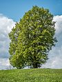 Wattendorf-Linden-5164082-PS.jpg 3,456 × 4,608; 9.93 MB
-
 Wattendorf-Marter-5164081.jpg 3,428 × 4,570; 9.25 MB
-
 Wattendorf.png 336 × 242; 14 KB


