Category:Strullendorf
Jump to navigation
Jump to search
municipality of Germany    | |||||
| Upload media | |||||
| Instance of |
| ||||
|---|---|---|---|---|---|
| Part of |
| ||||
| Location | Bamberg, Upper Franconia, Bavaria, Germany | ||||
| Head of government |
| ||||
| Population |
| ||||
| Area |
| ||||
| Elevation above sea level |
| ||||
| official website | |||||
 | |||||
Subcategories
This category has the following 6 subcategories, out of 6 total.
Media in category "Strullendorf"
The following 49 files are in this category, out of 49 total.
-
 DEU Strullendorf COA.svg 512 × 559; 36 KB
-
 Wappen Strullendorf.png 936 × 1,040; 559 KB
-
 D-4-71-195-104 Austragshaus (1).jpg 3,054 × 2,928; 1.81 MB
-
 D-4-71-195-104 Wohnstallhaus, Amlingstadter Straße 10 (Wernsdorf).jpg 3,379 × 3,054; 3.17 MB
-
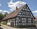
 D-4-71-195-105 Wohnhaus.jpg 3,582 × 3,426; 3.26 MB
-
 D-4-71-195-106 Gasthaus.jpg 4,584 × 3,276; 3.64 MB
-
 D-4-71-195-107 Bauernhaus.jpg 5,508 × 3,887; 5.42 MB
-
 D-4-71-195-110 Austragshaus.jpg 2,052 × 1,266; 861 KB
-
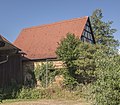
 D-4-71-195-111 Scheune.jpg 3,882 × 3,666; 3.55 MB
-
 D-4-71-195-112 Wohnstallhaus.jpg 3,864 × 3,228; 3.33 MB
-
 D-4-71-195-113 Verwalterhaus (schlechtes Bild).jpg 6,000 × 4,000; 4 MB
-
 D-4-71-195-114 Ehem. Wasserschloss.jpg 4,218 × 3,419; 3.51 MB
-
 D-4-71-195-127 Kruzifix.jpg 1,536 × 3,584; 2.09 MB
-
 D-4-71-195-131 Schuppen.jpg 4,998 × 3,366; 3.22 MB
-
 D-4-71-195-134 Bauernhaus.jpg 3,948 × 3,414; 3.41 MB
-
 D-4-71-195-135 Scheune.jpg 3,612 × 3,761; 3.41 MB
-
 D-4-71-195-23 Bauernhof, Amelungenstraße 9, Amlingstadt.jpg 4,160 × 3,279; 3.55 MB
-
 D-4-71-195-24 Gasthaus (1).jpg 3,648 × 3,227; 2.59 MB
-
 D-4-71-195-25 Wohnstallhaus, Amelungenstraße 16 (Strullendorf).jpg 4,434 × 3,563; 3.3 MB
-
 D-4-71-195-26 Bauernhof.jpg 4,638 × 3,065; 2.48 MB
-
 D-4-71-195-27 Gasthaus.jpg 5,382 × 3,738; 4.82 MB
-
 D-4-71-195-28 Bauernhaus.jpg 5,118 × 3,707; 3.91 MB
-
 D-4-71-195-29 Bauernhof (schlechtes Bild).jpg 3,204 × 3,131; 1.3 MB
-
 D-4-71-195-30 Mühle.jpg 2,286 × 1,860; 1.31 MB
-
 D-4-71-195-32 Pfarrhof.jpg 6,000 × 4,000; 5.24 MB
-
 D-4-71-195-71 Bauernhaus (1).jpg 4,380 × 3,444; 3.77 MB
-
 D-4-71-195-71 Scheune.jpg 1,872 × 1,476; 927 KB
-
 D-4-71-195-77 Bauernhaus.jpg 4,584 × 4,000; 4.46 MB
-
 D-4-71-195-78 Bauernhaus.jpg 4,548 × 3,959; 5.32 MB
-
 D-4-71-195-78 Scheune.jpg 5,142 × 3,858; 4.84 MB
-
 D-4-71-195-79 Bauernhaus, Lindenplatz 6 (Strullendorf).jpg 4,392 × 3,408; 4.45 MB
-
 D-4-71-195-79 Scheune.jpg 2,778 × 2,436; 2.36 MB
-
 D-4-71-195-80 Bauernhaus.jpg 4,704 × 3,857; 6.15 MB
-
 D-4-71-195-99 Bildstock.jpg 2,992 × 4,528; 4.49 MB
-
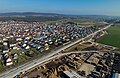
 Digitales Orthofoto von Strullendorf (Bayerische Vermessungsverwaltung).tif 32,500 × 22,500; 1.14 GB
-
 Eisenbahnstrecke-Strullendorf-Hirschhaid P5022754.jpg 4,608 × 3,456; 10.48 MB
-
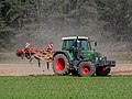 Fendt 412 Vario-20200919-RM-152547.jpg 5,184 × 3,888; 9.2 MB
-
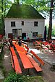
 Schwanenkeller Sülze Bratkartoffeln.JPG 2,304 × 3,456; 397 KB
-
 Schwanenkeller.JPG 2,304 × 3,456; 387 KB
-
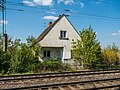
 Strullendorf Bahnhof Neubau-20230529-RM-151711.jpg 5,184 × 3,888; 11.52 MB
-
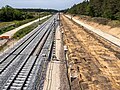
 Strullendorf Bahnlinie Nürnberg-Bamberg-20160502-RM-104813.jpg 4,608 × 3,456; 8.61 MB
-
 Strullendorf Bahnstrecke Nürnberg–Bamberg-20230301-RM-152259.jpg 5,272 × 3,565; 8.79 MB
-
 Strullendorf Bahnstrecke Nürnberg–Bamberg-20230301-RM-152304.jpg 5,272 × 3,407; 8.96 MB
-
 Strullendorf im Landkreis Bamberg.png 961 × 690; 16 KB
-
 Strullendorf Obere Steigerwaldbahn-20230301-RM-152044.jpg 5,242 × 3,926; 10.02 MB
-
 Strullendorf S-Bahn Neubaustrecke-20230528-RM-174944.jpg 4,243 × 3,083; 6.48 MB
-
 Strullendorf StLaurentius Gedenktafel.jpg 3,072 × 2,304; 2.15 MB
-
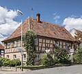
 Strullendorf, Alte Heerstraße 2-001.jpg 4,928 × 3,264; 8.8 MB
-
 Strullendorf.png 338 × 242; 15 KB

.jpg)
.jpg)


.jpg)


.jpg)
.jpg)


.jpg)


.jpg)


.jpg)


