Category:Inverclyde
Hopp til navigering
Hopp til søk

Council areas (municipalities) of Scotland: Aberdeen · Aberdeenshire · Angus · Argyll and Bute · Clackmannanshire · Dumfries and Galloway · Dundee · East Ayrshire · East Dunbartonshire · East Lothian · East Renfrewshire · Edinburgh · Falkirk · Fife · Glasgow · Highland · Inverclyde · Midlothian · Moray · North Ayrshire · North Lanarkshire · Outer Hebrides · Orkney Islands · Perth and Kinross · Renfrewshire · Scottish Borders · Shetland Islands · South Ayrshire · South Lanarkshire · Stirling · West Dunbartonshire · West Lothian
Hovedartikkel på Wikipedia: Inverclyde.
council area used for local government in Scotland  Seu del Consell d'Inverclyde a la ciutat de Greenock  | |||||
| Last opp mediefiler | |||||
| Forekomst av | |||||
|---|---|---|---|---|---|
| Del av |
| ||||
| Plassering | Skottland | ||||
| Hovedstad | |||||
| Folketall |
| ||||
| Areal |
| ||||
| Forskjellig fra | |||||
| offisielt nettsted | |||||
 | |||||
Underkategorier
Denne kategorien har følgende 26 underkategorier, av totalt 26.
*
A
- Aerial photographs of Inverclyde (4 filer)
B
C
G
H
I
N
- Night in Inverclyde (27 filer)
P
- Playgrounds in Inverclyde (3 filer)
S
T
V
Filer i kategorien «Inverclyde»
Følgende 200 filer er i denne kategorien, av totalt 349.
(forrige side) (neste side)-
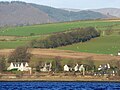 Ardoch - geograph.org.uk - 5257276.jpg 640 × 480; 129 KB
-
 Arran from Bute - geograph.org.uk - 4058601.jpg 640 × 381; 122 KB
-
 Arran from Lunderston Bay - geograph.org.uk - 3502338.jpg 640 × 349; 100 KB
-
 Arran from Lunderston Bay - geograph.org.uk - 3502355.jpg 640 × 336; 91 KB
-
 Arran from Lunderston Bay - geograph.org.uk - 3502366.jpg 640 × 355; 96 KB
-
 Arran from Lunderston Bay - geograph.org.uk - 4058588.jpg 640 × 387; 163 KB
-
 Arran from Lunderston Bay - geograph.org.uk - 4058591.jpg 640 × 321; 107 KB
-
 Arran from Lunderston Bay - geograph.org.uk - 4058626.jpg 640 × 349; 139 KB
-
 Arran from Lunderston Bay - geograph.org.uk - 4249155.jpg 640 × 357; 72 KB
-
 Auchentiber from across Devol Moor - geograph.org.uk - 3335173.jpg 640 × 480; 47 KB
-
 Basalt dyke at Lunderston Bay - geograph.org.uk - 5022164.jpg 640 × 422; 167 KB
-
 Basalt dyke at Lunderston Bay - geograph.org.uk - 5022175.jpg 640 × 480; 197 KB
-
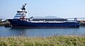
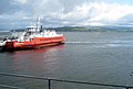
 Battler passing Port Glasgow - geograph.org.uk - 3770181.jpg 640 × 255; 71 KB
-
 Beach hut at Lunderston Bay - geograph.org.uk - 3659908.jpg 640 × 480; 195 KB
-
 Beach hut at Lunderston Bay - geograph.org.uk - 4058100.jpg 640 × 335; 128 KB
-
 Beach huts by Cloch Lighthouse - geograph.org.uk - 3455315.jpg 640 × 480; 248 KB
-
 Beach huts by Cloch Lighthouse - geograph.org.uk - 3455317.jpg 640 × 480; 238 KB
-
 Beach huts by Cloch Lighthouse - geograph.org.uk - 3455318.jpg 640 × 480; 228 KB
-
 Bedrock at Lunderston Bay - geograph.org.uk - 5022158.jpg 640 × 480; 180 KB
-
 Bedrock at Lunderston Bay - geograph.org.uk - 5022178.jpg 640 × 421; 151 KB
-
 Bedrock at Lunderston Bay - geograph.org.uk - 5878444.jpg 1 024 × 768; 358 KB
-
 Ben Bowie from Port Glasgow - geograph.org.uk - 3358298.jpg 480 × 640; 110 KB
-
 Bike & Bens from Old Largs Road - panoramio.jpg 1 280 × 960; 815 KB
-
 Biter passing Port Glasgow - geograph.org.uk - 3770185.jpg 640 × 356; 120 KB
-
 Bogston - geograph.org.uk - 6266062.jpg 1 024 × 520; 245 KB
-
 Bollard at James Watt Dock - geograph.org.uk - 6137561.jpg 1 024 × 768; 336 KB
-
-
 Bruiser passing Port Glasgow - geograph.org.uk - 3770177.jpg 640 × 334; 108 KB
-
 Building site at James Watt Dock - geograph.org.uk - 6137570.jpg 1 024 × 462; 168 KB
-
 Building site at James Watt Dock - geograph.org.uk - 6265892.jpg 1 024 × 711; 242 KB
-
 Buoy 24 and Dumbarton Rock - geograph.org.uk - 6310988.jpg 1 024 × 430; 167 KB
-
 Buoy 24 and Dumbarton Rock - geograph.org.uk - 6310992.jpg 1 024 × 300; 119 KB
-
 Burgia approaching Port Glasgow - geograph.org.uk - 4825727.jpg 640 × 480; 70 KB
-
 Cameron on the Clyde - geograph.org.uk - 5253337.jpg 640 × 480; 137 KB
-
 Cardross and Cardross Crematorium - geograph.org.uk - 5257279.jpg 640 × 423; 135 KB
-
 Cardross and the Clyde - geograph.org.uk - 5258370.jpg 640 × 431; 136 KB
-
 Cardross and the Clyde - geograph.org.uk - 5259424.jpg 640 × 418; 141 KB
-

-

-
 Cats Castle - geograph.org.uk - 5257271.jpg 640 × 480; 163 KB
-
 Ceona Amazon detail - geograph.org.uk - 5141804.jpg 1 200 × 1 600; 351 KB
-
 Coastal path at Lunderston Bay - geograph.org.uk - 2466066.jpg 640 × 480; 144 KB
-
 Coastal path at Lunderston Bay - geograph.org.uk - 4249157.jpg 640 × 480; 191 KB
-
 Coastal path at Lunderston Bay - geograph.org.uk - 4249159.jpg 527 × 640; 179 KB
-
 Coastal path signs at Bogstom - geograph.org.uk - 6266058.jpg 768 × 1 024; 477 KB
-
 Coastline near the Black Rocks - geograph.org.uk - 3493368.jpg 1 920 × 1 280; 1,68 MB
-
 Coat of Arms Inverclyde.svg 461 × 735; 268 KB
-
 Cockle Bank and the Arrochar Alps - geograph.org.uk - 4647492.jpg 640 × 376; 68 KB
-
 Crew Parade - geograph.org.uk - 2502836.jpg 462 × 640; 89 KB
-
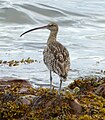 Curlew at Lunderston Bay - geograph.org.uk - 5484303.jpg 561 × 640; 164 KB
-
 Curlew at Lunderston Bay - geograph.org.uk - 5484304.jpg 640 × 480; 150 KB
-
 Cycle Route 75 at Lunderston Bay - geograph.org.uk - 3560646.jpg 1 920 × 1 280; 1,7 MB
-
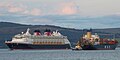 Disney Magic and MSC Mailn off Greenock - geograph.org.uk - 5907075.jpg 1 024 × 509; 163 KB
-

-
 Douglas Rae Road - geograph.org.uk - 6265888.jpg 1 024 × 697; 260 KB
-
 Douglas Rae Road - geograph.org.uk - 6265890.jpg 1 024 × 449; 151 KB
-
 Dumbarton Rock from Parklea - geograph.org.uk - 5255285.jpg 640 × 426; 143 KB
-
 Dunoon Pier - geograph.org.uk - 2466130.jpg 640 × 392; 97 KB
-
 Dunoon Pier - geograph.org.uk - 4963177.jpg 640 × 407; 153 KB
-
 Dusk at Western Ferries car park Mc Inroys Point - geograph.org.uk - 2691060.jpg 2 560 × 1 920; 1,85 MB
-
 East Hamilton Street - geograph.org.uk - 6265886.jpg 1 024 × 486; 126 KB
-
 East Hamilton Street - geograph.org.uk - 6265894.jpg 1 024 × 496; 150 KB
-
 Finlaystone Burn - geograph.org.uk - 3034174.jpg 640 × 377; 79 KB
-
 Finlaystone Point - geograph.org.uk - 5196403.jpg 640 × 299; 68 KB
-
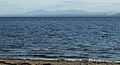
 Firth of Clyde - geograph.org.uk - 3493366.jpg 1 920 × 1 280; 1,28 MB
-
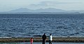
 Firth of Clyde from the Black Rocks - geograph.org.uk - 2856429.jpg 640 × 480; 89 KB
-
 Footpath at Lunderston Bay - geograph.org.uk - 3502313.jpg 640 × 480; 158 KB
-
 Footpath at Lunderston Bay - geograph.org.uk - 3560680.jpg 1 920 × 1 280; 1,86 MB
-
 Footpath to Inverkip - geograph.org.uk - 3560650.jpg 1 920 × 1 280; 1,68 MB
-
 Footpath to Inverkip - geograph.org.uk - 3560674.jpg 1 920 × 1 280; 1,63 MB
-
 Footpath to Lunderston Bay - geograph.org.uk - 4249187.jpg 480 × 640; 228 KB
-
 Footpath-Cycle Route 75 at Lunderston Bay - geograph.org.uk - 3493350.jpg 1 920 × 1 280; 1,6 MB
-
 Footpath-Cycle Route 75 at Lunderston Bay - geograph.org.uk - 3493364.jpg 1 920 × 1 280; 1,46 MB
-
 Footpath-Cycle Route 75 towards Gourock - geograph.org.uk - 3493347.jpg 1 920 × 1 280; 1,62 MB
-
 Footpath-Cycle Route 75 towards Gourock - geograph.org.uk - 3493359.jpg 1 920 × 1 280; 1,87 MB
-
 Former Glen shipyard - geograph.org.uk - 3358291.jpg 640 × 404; 124 KB
-
 Former Kingston shipyard - geograph.org.uk - 3358253.jpg 640 × 392; 112 KB
-
 Former Kingston shipyard site - geograph.org.uk - 5142125.jpg 640 × 480; 146 KB
-
 Gantock lighthouse - geograph.org.uk - 4963181.jpg 640 × 407; 159 KB
-
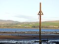
 Gas pipeline marker - geograph.org.uk - 3659903.jpg 480 × 640; 194 KB
-
 Gas pipeline marker - geograph.org.uk - 5468718.jpg 640 × 480; 149 KB
-
 Great Harbour and the Firth of Clyde - geograph.org.uk - 5146731.jpg 640 × 480; 107 KB
-
 Great Harbour Bailey bridge - geograph.org.uk - 6137579.jpg 1 024 × 398; 141 KB
-
 Great Harbour bridge - geograph.org.uk - 4959585.jpg 640 × 322; 69 KB
-
 Great Harbour, Greenock - geograph.org.uk - 5874315.jpg 1 600 × 1 044; 400 KB
-
 Greenock from Port Glasgow - geograph.org.uk - 3050369.jpg 640 × 374; 119 KB
-
 High tide line at Finlaystone Burn - geograph.org.uk - 5258088.jpg 640 × 480; 178 KB
-
 HMS Defender approaching Greenock - geograph.org.uk - 3770156.jpg 640 × 385; 112 KB
-
 Igneous rock beside the Tinker's Well - geograph.org.uk - 5907783.jpg 1 600 × 1 200; 482 KB
-
 Inchgreen drydock - geograph.org.uk - 4396655.jpg 640 × 395; 112 KB
-
 Inchgreen drydock buildings - geograph.org.uk - 6266044.jpg 1 024 × 485; 174 KB
-
 Inchgreen drydock buildings - geograph.org.uk - 6266051.jpg 1 024 × 768; 261 KB
-
 Inchgreen drydock entrance - geograph.org.uk - 6266047.jpg 1 024 × 530; 192 KB
-
 Inchgreen drydock office building - geograph.org.uk - 6266040.jpg 1 024 × 701; 291 KB
-
 Inverclyde boundary sign - geograph.org.uk - 3190767.jpg 640 × 480; 113 KB
-
 Inverclyde Council 1977.svg 360 × 185; 2 KB
-
 Inverclyde waterfront - geograph.org.uk - 4826545.jpg 640 × 401; 113 KB
-
 Inverclyde waterfront - geograph.org.uk - 4832492.jpg 640 × 321; 89 KB
-
 Inverclyde waterfront - geograph.org.uk - 4832493.jpg 640 × 418; 121 KB
-
 Inverclyde waterfront - geograph.org.uk - 4832495.jpg 640 × 376; 86 KB
-
 Inverclyde waterfront - geograph.org.uk - 4832496.jpg 640 × 321; 80 KB
-
 Inverkip from Innellan - geograph.org.uk - 3086547.jpg 640 × 265; 53 KB
-
 Inverkip Power Station - geograph.org.uk - 5290738.jpg 4 320 × 3 240; 2,91 MB
-
 James Watt Dock - geograph.org.uk - 6137542.jpg 1 024 × 768; 294 KB
-
 James Watt Dock Marina - geograph.org.uk - 5921430.jpg 1 024 × 768; 312 KB
-
 James Watt Dock Marina - geograph.org.uk - 5921437.jpg 1 024 × 768; 309 KB
-
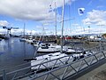 James Watt Dock Marina - geograph.org.uk - 5921438.jpg 1 024 × 768; 299 KB
-
 James Watt Dock sugar sheds - geograph.org.uk - 6137537.jpg 1 024 × 504; 215 KB
-
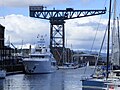
 James Watt Dock Titan crane - geograph.org.uk - 6137558.jpg 1 024 × 768; 300 KB
-
 James Watt Marina - geograph.org.uk - 5112923.jpg 640 × 427; 67 KB
-
 Jigging in the Rigging - geograph.org.uk - 2502506.jpg 417 × 640; 106 KB
-
-
 Kingdom of Fife at Greenock - geograph.org.uk - 2216437.jpg 640 × 480; 109 KB
-
 Kingdom of Fife at the Great Harbour - geograph.org.uk - 3585227.jpg 640 × 480; 103 KB
-
 Kirn from Lunderston Bay - geograph.org.uk - 4963199.jpg 640 × 480; 153 KB
-
 Kirn from Lunderston Bay - geograph.org.uk - 4963200.jpg 640 × 440; 121 KB
-
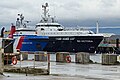
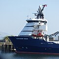
 Kommandor Susan at Greenock - geograph.org.uk - 6137553.jpg 1 024 × 556; 203 KB
-
 Kommandor Susan at Greenock - geograph.org.uk - 6137555.jpg 1 024 × 1 023; 266 KB
-
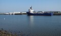 Kommandor Susan at Greenock - geograph.org.uk - 6264662.jpg 1 024 × 612; 176 KB
-
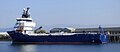 Kommandor Susan at Greenock - geograph.org.uk - 6264663.jpg 1 024 × 446; 122 KB
-
 Leapmoor Forest Path - geograph.org.uk - 3560678.jpg 1 920 × 1 280; 1,59 MB
-
 Louds Island at the Great Harbour - geograph.org.uk - 3190816.jpg 640 × 480; 106 KB
-
 Lunderston Bay - geograph.org.uk - 5022177.jpg 640 × 480; 192 KB
-
 Lunderston Bay - geograph.org.uk - 5022180.jpg 640 × 415; 169 KB
-
 Lunderston Bay - geograph.org.uk - 5022198.jpg 640 × 480; 138 KB
-
 Lunderston Bay - geograph.org.uk - 5288861.jpg 4 253 × 3 146; 1,27 MB
-
 Lunderston Bay - geograph.org.uk - 5288908.jpg 3 009 × 2 250; 635 KB
-
 Lunderston Bay - geograph.org.uk - 5587095.jpg 1 024 × 768; 155 KB
-
 Lunderston Bay - geograph.org.uk - 5607724.jpg 1 024 × 768; 92 KB
-
 Lunderston Bay - geograph.org.uk - 5607736.jpg 1 024 × 768; 172 KB
-
 Lunderston Bay - geograph.org.uk - 6225646.jpg 1 024 × 784; 539 KB
-
 Lunderston Bay - geograph.org.uk - 6225648.jpg 1 024 × 768; 316 KB
-
 Lunderston Bay - geograph.org.uk - 6225649.jpg 1 024 × 768; 348 KB
-
 Lunderston Bay - geograph.org.uk - 6305996.jpg 1 024 × 768; 369 KB
-
 Lunderston Bay - geograph.org.uk - 6305999.jpg 1 024 × 768; 332 KB
-
 Lunderston Bay - geograph.org.uk - 6306001.jpg 1 024 × 768; 307 KB
-

-

-
 Mary Elizabeth off Greenock - geograph.org.uk - 3054479.jpg 640 × 303; 48 KB
-
 Mathernock Battery - geograph.org.uk - 4969343.jpg 640 × 480; 131 KB
-
 Mathernock Battery - geograph.org.uk - 4969360.jpg 640 × 480; 148 KB
-
 Mathernock Battery - geograph.org.uk - 4969447.jpg 640 × 480; 186 KB
-
 Mathernock Battery - geograph.org.uk - 4969448.jpg 640 × 480; 189 KB
-
 Mathernock Battery - geograph.org.uk - 4970817.jpg 640 × 480; 142 KB
-
 Mathernock Battery accommodation camp - geograph.org.uk - 4969336.jpg 640 × 480; 181 KB
-
 Mathernock Battery accommodation camp - geograph.org.uk - 4969373.jpg 640 × 480; 176 KB
-
 Mathernock Battery accommodation camp - geograph.org.uk - 4969417.jpg 640 × 480; 152 KB
-
 Mathernock Battery accommodation camp - geograph.org.uk - 4969419.jpg 640 × 480; 163 KB
-
 Mathernock Battery accommodation camp - geograph.org.uk - 4969421.jpg 640 × 480; 154 KB
-
 Mathernock Battery accommodation camp - geograph.org.uk - 4969424.jpg 640 × 480; 153 KB
-
 Mathernock Battery accommodation camp - geograph.org.uk - 4969425.jpg 640 × 480; 170 KB
-
 Mathernock Battery accommodation camp - geograph.org.uk - 4969429.jpg 640 × 480; 177 KB
-
 Mathernock Battery accommodation camp - geograph.org.uk - 4969430.jpg 640 × 480; 171 KB
-
 Mathernock Battery accommodation camp - geograph.org.uk - 4969440.jpg 640 × 480; 156 KB
-
 Mathernock Battery accommodation camp - geograph.org.uk - 4969442.jpg 640 × 480; 207 KB
-
 Mathernock Battery accommodation camp - geograph.org.uk - 4969443.jpg 640 × 480; 180 KB
-
 Mathernock Battery accommodation camp - geograph.org.uk - 4969445.jpg 640 × 480; 176 KB
-
 McInroy's Point , Ferry Terminal - geograph.org.uk - 2323617.jpg 3 188 × 2 385; 1,65 MB
-
 McInroy's Point ferry Terminal - geograph.org.uk - 2419139.jpg 640 × 430; 66 KB
-
 McInroys Point ferry terminal - geograph.org.uk - 2465486.jpg 640 × 346; 87 KB
-

-

-

-

-

-

-
-

-

-
-

-

-

-

-
-
-
-

-
-
-
-

-
-
-
-

-

-

-

-

-

-

-
-

-

-

-

-

-
 Memorial benches Lunderston Bay - geograph.org.uk - 6306003.jpg 1 024 × 768; 516 KB
-
 Mist on the Clyde at Port Glasgow - geograph.org.uk - 5627290.jpg 640 × 480; 95 KB


