Category:Isles of Scilly
Bước tới điều hướng
Bước tới tìm kiếm
Brezhoneg: Inizi Sillan eo anv un enezeg eus Kernev-Veur lec'hiet da 28 milmor e Su-mervent Land's End.
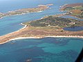
English: The Isles of Scilly are a group of islands 28 miles SSW of Land's End in Cornwall.
Français : Les îles Scilly, anciennement Sorlingues, (Angleterre: Isles of Scilly), forment un archipel situé à l'extrèmité ouest de la Manche, au point de rencontre de celle-ci avec l'océan Atlantique et au sud-ouest de la péninsule de Cornouailles. Elles s'étendent sur une superficie de 16,33 km².
Slovenščina: Otoki Scilly so otoška skupina 45 kilometrov severoseverozahodno od rta Land's End v Cornwallu.
archipelago and local government district off the south-westernmost point of mainland Britain    | |||||
| Tải lên phương tiện | |||||
| Là một |
| ||||
|---|---|---|---|---|---|
| Một phần của | |||||
| Vị trí | Cornwall, South West England, Anh | ||||
| Tọa lạc trong hoặc bên cạnh thủy vực | |||||
| Trung tâm hành chính | |||||
| Cơ quan lập pháp |
| ||||
| Gồm có | |||||
| Xếp hạng di sản | |||||
| Dân số |
| ||||
| Diện tích |
| ||||
| Cao độ so với mực nước biển |
| ||||
| Khác với | |||||
| trang chủ chính thức | |||||
 | |||||
Thể loại con
Thể loại này có 14 thể loại con sau, trên tổng số 14 thể loại con.
Tập tin trong thể loại “Isles of Scilly”
140 tập tin sau nằm trong thể loại này, trong tổng số 140 tập tin.
-
 Baner ynysek Syllan.svg 1.000×600; 1 kB
-
-
 Augustus Smith c. 1826.jpg 740×866; 295 kB
-
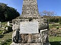 Augustus Smith Memorial, Old Town Churchyard (Closeup).jpg 4.032×3.024; 6,52 MB
-
 Augustus Smith Memorial, Old Town Churchyard.jpg 3.024×4.032; 3,13 MB
-
 Bar Point St Mary's Scilly - geograph.org.uk - 6203750.jpg 640×409; 41 kB
-
 Biggal rock - geograph.org.uk - 5397634.jpg 3.264×2.448; 2,01 MB
-
 Biggal rock - geograph.org.uk - 5777312.jpg 5.472×3.648; 4,76 MB
-
 Bishop Rock Lighthouse - geograph.org.uk - 2733399.jpg 768×1.024; 117 kB
-
 Bishop Rock Lighthouse - geograph.org.uk - 5326520.jpg 2.048×1.360; 1,41 MB
-
 Black Rock in the distance - geograph.org.uk - 5142267.jpg 3.648×2.432; 2,95 MB
-
 Broad Ledge and Yellow Ledge - geograph.org.uk - 2372663.jpg 640×480; 72 kB
-
 Camber Rock - geograph.org.uk - 3446249.jpg 2.592×1.944; 1,09 MB
-
 Camber Rocks - geograph.org.uk - 5142277.jpg 2.793×1.862; 1,02 MB
-
 Camber Rocks - geograph.org.uk - 5142284.jpg 3.648×2.432; 3,13 MB
-
 Chimney Rocks from the South - geograph.org.uk - 3665773.jpg 640×290; 46 kB
-
 Cliff on Hanjague - geograph.org.uk - 2366233.jpg 480×640; 74 kB
-

-
 Council of the Isles of Scilly composition.svg 360×185; 1 kB
-

-

-

-
 Creeb - geograph.org.uk - 2365706.jpg 640×480; 70 kB
-
 Creeb and Halangy Down - geograph.org.uk - 2368141.jpg 640×480; 59 kB
-
 Crow Rock - geograph.org.uk - 1968569.jpg 640×426; 70 kB
-

-
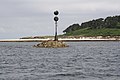
 Crow Rock marker - geograph.org.uk - 3451503.jpg 1.478×1.103; 573 kB
-
 Crow Rock Marker, Isles of Scilly - geograph.org.uk - 3400208.jpg 4.000×1.666; 5,61 MB
-
 Didley's Point - geograph.org.uk - 5142272.jpg 3.648×2.432; 3,03 MB
-
 Dive boat - geograph.org.uk - 2379753.jpg 640×480; 71 kB
-

-
 Eastern gap in Men-a-Vaur - geograph.org.uk - 5142323.jpg 3.648×2.432; 2,84 MB
-
 England Isles of Scilly Council 2021.svg 360×185; 2 kB
-
 Five Islands Academy.jpg 4.032×3.024; 2,74 MB
-
 Flag of the Isles of Scilly Steamship Company.svg 900×600; 3 kB
-
 Ganilly Bar, Scilly - geograph.org.uk - 2603901.jpg 640×180; 44 kB
-
 Golden Ball from the north - geograph.org.uk - 5142331.jpg 3.648×2.432; 2,81 MB
-
 Gorregan - geograph.org.uk - 3139912.jpg 640×427; 59 kB
-
 Great Cheese Rock - geograph.org.uk - 1968804.jpg 640×426; 62 kB
-

-
 Great Crebawethan - geograph.org.uk - 6418644.jpg 1.600×1.009; 492 kB
-
 Great Rag Ledge - geograph.org.uk - 2366395.jpg 640×480; 46 kB
-
 Great Rag Ledge - geograph.org.uk - 3095480.jpg 2.592×1.936; 895 kB
-

-
 Great Smith Rock, north west of St Agnes - geograph.org.uk - 2733402.jpg 1.024×768; 164 kB
-
 Great Wingletang - geograph.org.uk - 3145523.jpg 640×417; 70 kB
-
 Green Island - geograph.org.uk - 6142788.jpg 3.648×2.432; 1,88 MB
-
 Hanjague - geograph.org.uk - 2366224.jpg 640×480; 63 kB
-
 Hanjague from the East - geograph.org.uk - 3665790.jpg 640×407; 89 kB
-
 Hanjague from the South - geograph.org.uk - 3665784.jpg 640×384; 100 kB
-

-

-
 Hulman Rock - geograph.org.uk - 3095477.jpg 2.592×1.936; 1,24 MB
-
 Isles of Scilly Health and Wellbeing Centre.jpg 4.032×3.024; 2,27 MB
-
 Isles of Scilly, UK (ASTER).jpg 852×868; 93 kB
-
 ISS065-E-93698 - View of England.jpg 5.568×3.712; 8,63 MB
-
 Iss065e093698.jpg 720×480; 159 kB
-
 Jacky's Rock - geograph.org.uk - 3145456.jpg 1.024×683; 138 kB
-
Jer-Seurlîngue.ogg 1,4 s; 16 kB
-
 Postcard - Wreck of S.S. Lady Charlotte - C. J. King.jpg 1.600×964; 230 kB
-

-

-
 Little cheese rock - geograph.org.uk - 3450340.jpg 2.592×1.936; 2,01 MB
-
 Little Cheese Rock - geograph.org.uk - 3450349.jpg 1.882×1.406; 1,84 MB
-
 Little Cheese Rock at low tide - geograph.org.uk - 3450355.jpg 2.592×1.936; 2,02 MB
-
 Little Maiden Bower - geograph.org.uk - 5397628.jpg 3.264×2.448; 2,35 MB
-
-
 Melledgan - geograph.org.uk - 3135104.jpg 640×427; 46 kB
-
 Men A Vaur Isles of Scilly by Kernow Skies.jpg 3.960×2.970; 1,86 MB
-
 Men A Vaur looking down Isles of Scilly by Kernow Skies.jpg 3.960×2.970; 3,56 MB
-
 Men-a-vaur - geograph.org.uk - 3446264.jpg 2.438×1.815; 777 kB
-
 Men-a-Vaur - geograph.org.uk - 5142328.jpg 3.648×2.432; 2,87 MB
-
 Men-a-Vaur from the north-west - geograph.org.uk - 3650434.jpg 640×480; 132 kB
-
 Mincarlo - geograph.org.uk - 1963463.jpg 640×426; 74 kB
-
 Mincarlo from the east - geograph.org.uk - 3650441.jpg 640×303; 63 kB
-
 Minmanueth Rocks off Annet - geograph.org.uk - 3668599.jpg 1.280×328; 150 kB
-
 Mouls - geograph.org.uk - 2366212.jpg 640×480; 56 kB
-
 Mouls - geograph.org.uk - 2379769.jpg 640×480; 57 kB
-
 Mouls, from the East - geograph.org.uk - 3665794.jpg 640×306; 69 kB
-
-
 Nautical chaos - geograph.org.uk - 3446778.jpg 2.592×1.936; 1,49 MB
-
 Near Spanish Ledges - Scillies - geograph.org.uk - 34757.jpg 640×425; 87 kB
-
 Nut Rock - geograph.org.uk - 1965333.jpg 640×426; 75 kB
-
 Nut Rock - geograph.org.uk - 2174963.jpg 640×480; 44 kB
-
 Nut Rock - geograph.org.uk - 3446772.jpg 2.592×1.936; 1,97 MB
-

-
 Old Grimsby beach 2 Isles of Scilly by Kernow Skies.jpg 4.000×3.000; 5,13 MB
-
 Old Grimsby Beach Isles of Scilly by Kernow Skies.jpg 3.960×2.970; 2,55 MB
-
 Old Grimsby Tresco, holiday cottages Isles of Scilly by Kernow Skies.jpg 3.960×2.970; 3,32 MB
-
 Old Woman's House - geograph.org.uk - 2366247.jpg 640×480; 57 kB
-
 Outer Colvel Rock - geograph.org.uk - 2172445.jpg 640×480; 82 kB
-
 Passing Stoney Island, Isles of Scilly - geograph.org.uk - 3396621.jpg 4.000×1.925; 6,11 MB
-
 Porth Arlo beach, St Marys, Scilly.jpg 4.000×2.805; 2,24 MB
-
 Proposed flags of the Isles of Scilly 2rd place.svg 938×469; 4 kB
-
 Proposed flags of the Isles of Scilly 3rd place.svg 938×469; 5 kB
-
 Proposed flags of the Isles of Scilly 4th place.svg 938×469; 7 kB
-
 Proposed flags of the Isles of Scilly 5th place.svg 938×469; 9 kB
-
 Proposed flags of the Isles of Scilly 6th place.svg 938×469; 10 kB
-
 Proposed flags of the Isles of Scilly 7th place.svg 938×469; 11 kB
-
 Proposed flags of the Isles of Scilly 8th place.svg 938×469; 11 kB
-
 Proposed flags of the Isles of Scilly 9th place.svg 938×469; 11 kB
-
 Radio Times - 1928-03-11 - page 22 (lower).jpg 516×316; 34 kB
-

-

-

-
 Ruined Cottage on Rosevear - geograph.org.uk - 3145399.jpg 640×427; 79 kB
-
 Sailing past Halangy Down - geograph.org.uk - 6447974.jpg 1.250×1.600; 529 kB
-
 ScillonianCross.svg 1.000×500; 695 byte
-
 Scillonian Cross.png 599×301; 3 kB
-
 Scilly Rock - geograph.org.uk - 1960925.jpg 640×426; 67 kB
-
 Scilly Rock - geograph.org.uk - 2315950.jpg 640×480; 68 kB
-
 Scilly Rock - geograph.org.uk - 5395946.jpg 3.264×2.448; 2,55 MB
-

-
 Seals on Scilly Rock - geograph.org.uk - 1960927.jpg 640×426; 153 kB
-
 Shag Rocks from the South - geograph.org.uk - 3665782.jpg 640×328; 65 kB
-
 Shags on Great Wingletang - geograph.org.uk - 3145531.jpg 640×427; 64 kB
-
 Shags on Mincarlo - geograph.org.uk - 1963466.jpg 640×426; 144 kB
-
 Shipman Head - geograph.org.uk - 2315538.jpg 640×480; 63 kB
-
 Soldier Beetles on Wild Carrot (2969661170).jpg 2.593×1.608; 1,05 MB
-
 Southward Well Point and Samson - geograph.org.uk - 3446763.jpg 2.592×1.936; 1,88 MB
-
 St Marys Scilly 2021.jpg 3.840×2.160; 1,63 MB
-
 Swimming with seals - geograph.org.uk - 2379751.jpg 640×480; 80 kB
-
 Swimming with seals - geograph.org.uk - 2379755.jpg 640×480; 83 kB
-
 The Cow - geograph.org.uk - 1947310.jpg 640×426; 54 kB
-
 The end of South Cuckoo - geograph.org.uk - 5395950.jpg 4.631×3.087; 3,1 MB
-
 The gap between Scilly Rock and South Cuckoo - geograph.org.uk - 5395954.jpg 4.871×3.002; 3,9 MB
-
 The Gilstone, Western Rocks - geograph.org.uk - 2733397.jpg 1.024×768; 135 kB
-
 The Haycocks - geograph.org.uk - 2315561.jpg 640×480; 53 kB
-
 The Mare - geograph.org.uk - 2366421.jpg 640×480; 51 kB
-
 The marker on Crow Rock - geograph.org.uk - 5142256.jpg 2.441×1.627; 989 kB
-
 The north end of St Helen's - geograph.org.uk - 5142321.jpg 3.648×2.432; 2,79 MB
-
 The Northern end of Mincarlo - geograph.org.uk - 2923329.jpg 3.072×2.304; 2,87 MB
-
 The remains of Ennor Castle (Isles of Scilly).jpg 4.032×3.024; 1,6 MB
-
 The Southern tip of Mincarlo - geograph.org.uk - 2923324.jpg 3.072×2.304; 2,54 MB
-
 The Southernmost point of Southward Well Point - geograph.org.uk - 2923340.jpg 3.072×2.304; 2,92 MB
-
 Trenemene - geograph.org.uk - 3141058.jpg 640×427; 67 kB
-
 Wally the Walrus in St Mary’s Harbour.jpg 3.024×4.032; 1,19 MB
-
 A week in the Isles of Scilly (IA weekinislesofsci00nortiala).pdf 839 × 1.258, 228 trang; 19,25 MB
-

-
 Yellow Ledge - geograph.org.uk - 6142785.jpg 3.648×2.432; 2,09 MB


.jpg)


.jpg)


.jpg)


.jpg)


.jpg)


