Category:Manawatū-Whanganui Region
Vai alla navigazione
Vai alla ricerca
Regions of New Zealand: Auckland · Bay of Plenty · Canterbury · Gisborne · Hawke's Bay · Manawatu-Whanganui · Marlborough · Nelson · Otago · Northland · Southland · Taranaki · Tasman · Waikato · Wellington · West Coast
Outlying islands, territories and dependencies: Antipodes Islands · Auckland Islands · Bounty Islands · Chatham Islands · Kermadec Islands · Snares Islands · Three Kings Islands · Tokelau – Territory with specific status: Ross Dependency
Associated countries: Cook Islands · Niue
Outlying islands, territories and dependencies: Antipodes Islands · Auckland Islands · Bounty Islands · Chatham Islands · Kermadec Islands · Snares Islands · Three Kings Islands · Tokelau – Territory with specific status: Ross Dependency
Associated countries: Cook Islands · Niue
regione neozelandese .JPG)  | |||||
| Carica un file multimediale | |||||
| Istanza di | |||||
|---|---|---|---|---|---|
| Luogo | Nuova Zelanda | ||||
| Capitale | |||||
| Data di fondazione o creazione |
| ||||
| Popolazione |
| ||||
| Superficie |
| ||||
| sito web ufficiale | |||||
 | |||||
Sottocategorie
Questa categoria contiene le 41 sottocategorie indicate di seguito, su un totale di 41.
*
C
E
G
H
- Hapuawhenua Viaduct (5 F)
K
M
N
- Ngāti Apa (2 F)
O
P
R
S
T
- Taonui (1 F)
- Tararua Wind Farm (3 F)
- Taringamotu (8 F)
- Te Apiti Wind Farm (24 F)
- Te Rere Hau Wind Farm (3 F)
W
- Waikune Prison (2 F)
File nella categoria "Manawatū-Whanganui Region"
Questa categoria contiene 94 file, indicati di seguito, su un totale di 94.
-
 058 Panorama overlooking camp from West.jpg 5 924 × 1 648; 1,82 MB
-
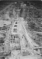
 071- The Crown descends.JPG 1 152 × 864; 119 KB
-
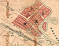 19090223 Hīhītahi map.jpg 2 283 × 1 776; 1,63 MB
-
 19100908 Turangarere tram.jpg 977 × 786; 353 KB
-
 19110427 Hīhītahi station.jpg 970 × 433; 192 KB
-
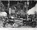
 19190508 Gardner's sawmill.jpg 980 × 419; 206 KB
-
 A Scenic View of Mount Ruapehu in Winter - panoramio.jpg 1 991 × 1 328; 643 KB
-
 Alongside the Whanganui.JPG 2 816 × 2 112; 995 KB
-
 Antiques sales and Upholsterer - panoramio.jpg 2 816 × 1 880; 2,25 MB
-
 Arapeti dam construction.jpg 1 555 × 2 207; 411 KB
-
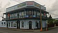 Ashhurst's Commercial Tavern.JPG 2 135 × 1 213; 492 KB
-
 Awahuri Road, Manawatu (20985445134).jpg 3 569 × 4 897; 2,14 MB
-
 Awahuri Road, Manawatu (21610718836).jpg 5 129 × 3 715; 2,13 MB
-

-
 Broom near Ngaurukehu NIMT in 2010.jpg 2 556 × 1 697; 1,6 MB
-
 Bruce Herbert and ^, Tangarakau, Taranaki, 1969 - Flickr - PhillipC.jpg 1 799 × 1 199; 830 KB
-
 Bruce Park Memorial 11.JPG 2 910 × 3 968; 2,74 MB
-
 Charles Monro.jpg 3 024 × 4 032; 2,76 MB
-
 Desert Rocks (142194731).jpeg 1 936 × 1 936; 1,16 MB
-
 Distant Ruapehu - View From Sledge Track (52130229926).jpg 6 140 × 3 268; 15,62 MB
-
 Down The Scree (137818091).jpeg 2 048 × 1 152; 803 KB
-
 EF30163+Overlander NearWaiouru 22March2003 JChristianson.jpg 800 × 583; 117 KB
-
En-nz-Wanganui.ogg 0,7 s; 9 KB
-
 Farmland, Manawatu Scenic Route, New Zealand.jpg 4 032 × 3 024; 6,44 MB
-
 Flaxes (Phormium) near Manawatu River.jpg 1 024 × 768; 321 KB
-
 Flickr - brewbooks - Stump and rocks at Paloma Gardens.jpg 2 592 × 1 944; 1,76 MB
-

-
 Forgotten World Highway - asfaltka zmizela - panoramio.jpg 1 536 × 2 048; 2,07 MB
-
 Forgotten World Highway Building.jpg 1 664 × 2 496; 2,71 MB
-
 Forgotten World Highway Landscape.jpg 2 496 × 1 664; 1,8 MB
-
 House with a view... (50476225472).jpg 6 240 × 3 538; 21,64 MB
-
 JA1271 approaching Longburn.jpg 3 088 × 2 052; 1,07 MB
-
 Kakariki 30-8-1942 Survey SN215 photo 21.png 2 363 × 1 345; 3,17 MB
-
 Kakariki railway bridge after 1897 flood.jpg 2 262 × 1 452; 1,59 MB
-
 Kakariki railway bridge.jpg 8 984 × 2 448; 5,62 MB
-
 Kakatahi, Manawatu-Whanganui.jpg 3 904 × 2 316; 1,86 MB
-
 Kohuratahi Valley, Taranaki, New Zealand, 1968 - Flickr - PhillipC.jpg 1 800 × 1 200; 672 KB
-
 Krajina na Forgotten World HWY - panoramio (1).jpg 2 048 × 1 536; 1,37 MB
-
 Krajina na Forgotten World HWY - panoramio (2).jpg 2 048 × 1 536; 1,28 MB
-
 Krajina na Forgotten World HWY - panoramio (3).jpg 2 048 × 1 536; 1,3 MB
-
 Krajina na Forgotten World HWY - panoramio.jpg 2 048 × 1 536; 1,38 MB
-
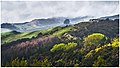
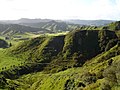
 Landscape in Manawatu-Wanganui Region.jpg 3 028 × 1 520; 3,38 MB
-
 Makerua railway station.jpg 864 × 546; 133 KB
-
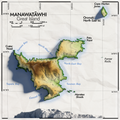 Manawatawhi great island map.png 3 240 × 3 240; 14,97 MB
-

-
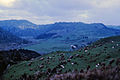
 Manawatu Plains, New Zealand, 22nd. Nov. 2010 - Flickr - PhillipC.jpg 3 654 × 2 579; 1,26 MB
-
 ManawatuRU.jpg 851 × 1 002; 212 KB
-
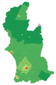 ManawatuWanganuiRegionPopulationDensity.png 1 051 × 1 587; 157 KB
-
 Manawatū-Whanganui within North Island 2023.png 784 × 918; 101 KB
-
 Mangatepopo stream and native plants (6708759973).jpg 4 000 × 3 000; 6,35 MB
-
 Marae Whanganui River.jpg 2 816 × 2 112; 2,38 MB
-
 Mataroa 1908.jpg 1 000 × 690; 192 KB
-
 Mataroa 1911.jpg 1 000 × 546; 212 KB
-
 Michaela Drummond -World Champion.jpg 3 264 × 2 448; 1,7 MB
-
 MRUlogo.jpg 180 × 211; 28 KB
-
 Ngaurukehu map Sheet N132 1970.jpg 1 095 × 1 031; 480 KB
-
 Northern Explorer near Waiouru.JPG 4 000 × 3 000; 3,52 MB
-
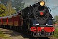
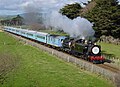
 NZR AB class.JPG 2 592 × 1 944; 1,97 MB
-
 Ohakune from the Air - Helicopter - panoramio.jpg 2 160 × 1 440; 1,32 MB
-
 Ohakune Mountain Road, Mount Ruapehu, through snow-covered bush.jpg 1 024 × 768; 287 KB
-
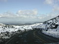 Ohakune Mountain Road, Mount Ruapehu.jpg 1 024 × 768; 370 KB
-
 Ongarue School.JPG 2 056 × 1 317; 685 KB
-
 Ongarue, King Country, New Zealand, 9 July 2011 - Flickr - PhillipC (1).jpg 4 288 × 2 848; 3,73 MB
-
 Ongarue, King Country, New Zealand, 9 July 2011 - Flickr - PhillipC.jpg 4 288 × 2 848; 1,62 MB
-
 Paddock - panoramio (2).jpg 4 928 × 1 275; 4,03 MB
-
 Paddock - panoramio (3).jpg 14 154 × 4 667; 20,8 MB
-
 Paraweka Marae.jpg 960 × 640; 91 KB
-
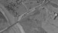
 Part of 1956 one inch map sheet N92.jpg 1 717 × 787; 787 KB
-
 Photo 2-08-15 3 34 00 pm.jpg 2 448 × 3 264; 2,04 MB
-
 Pohangina Methodist Church.JPG 3 248 × 2 155; 930 KB
-
 Pohangina Valley Sunrise - Flickr - Geoff J Mckay.jpg 6 144 × 2 345; 6,05 MB
-
 Portable Loo (142161131).jpeg 1 936 × 1 936; 876 KB
-
 Position of ManawatuWanganui.png 405 × 590; 7 KB
-
 Proposed Flag of Palmerston North.png 4 999 × 3 096; 187 KB
-
 Sheep, New Zealand.jpg 1 740 × 1 691; 1,63 MB
-
 Side-tank steam locomotive "Manawatu", 0-6-0 type, 1910. ATLIB 278141.png 6 417 × 4 636; 17,32 MB
-
 Sky in Palmerston North, 25 July 2012.JPG 4 288 × 3 216; 3,75 MB
-
 St.Andrews Combined Church and hall, Bainesse, Manawatu.JPG 1 930 × 1 408; 702 KB
-
 State Insurance Building, Palmerston North, at dusk - panoramio.jpg 1 280 × 960; 289 KB
-
 Tapiskwan Sipi-87.jpg 1 920 × 1 080; 831 KB
-
 Tararua wind farm wind turbines over Manawatu Gorge.jpg 1 024 × 768; 362 KB
-
 Tararua wind farm wind turbines.jpg 1 024 × 768; 418 KB
-
 Tararua wind farm.jpg 2 064 × 826; 288 KB
-
 The Pyramid House at Kaiwhaiki - panoramio.jpg 2 784 × 1 856; 2,27 MB
-
 VallieSexyBackCombinedweb.jpg 2 546 × 3 833; 2,64 MB
-
 View of Windmills from Palmerston North - panoramio.jpg 2 832 × 2 128; 1,1 MB
-
 View of Windmills from Palmerston North 2 - panoramio.jpg 2 832 × 2 128; 1,09 MB
-
 View of Windmills from Palmerston North 3 - panoramio.jpg 2 832 × 2 128; 1,08 MB
-
 Vinegar Hill banner.jpg 2 800 × 400; 454 KB
-
 WAB 794 train near Woodville.jpg 800 × 582; 119 KB
-
 Welcome to Tangimoana Sign.jpg 2 048 × 1 536; 957 KB
-
 Whanganui NP.svg 442 × 600; 150 KB
-
 Wilson's mill, Wharuakura (21044023944).jpg 6 451 × 4 726; 2,63 MB
-
 Wilson's mill, Wharuakura (21671362291).jpg 6 435 × 4 704; 2,89 MB


.jpg)
.jpg)


.jpeg)
.jpg)
.jpeg)


_near_Manawatu_River.jpg)


.jpg)


.jpg)
.jpg)
.jpg)


.jpg)


.jpg)


.jpg)


.jpeg)


.jpg)
.jpg)
.jpg)
.jpg)