Category:Waikato Region
Jump to navigation
Jump to search
Regions of New Zealand: Auckland · Bay of Plenty · Canterbury · Gisborne · Hawke's Bay · Manawatu-Whanganui · Marlborough · Nelson · Otago · Northland · Southland · Taranaki · Tasman · Waikato · Wellington · West Coast
Outlying islands, territories and dependencies: Antipodes Islands · Auckland Islands · Bounty Islands · Chatham Islands · Kermadec Islands · Snares Islands · Three Kings Islands · Tokelau – Territory with specific status: Ross Dependency
Associated countries: Cook Islands · Niue
Outlying islands, territories and dependencies: Antipodes Islands · Auckland Islands · Bounty Islands · Chatham Islands · Kermadec Islands · Snares Islands · Three Kings Islands · Tokelau – Territory with specific status: Ross Dependency
Associated countries: Cook Islands · Niue
region in New Zealand's North Island   | |||||
| Upload media | |||||
| Instance of | |||||
|---|---|---|---|---|---|
| Location | New Zealand | ||||
| Capital | |||||
| Head of government | |||||
| Population |
| ||||
| Area |
| ||||
| Different from | |||||
| official website | |||||
 | |||||
Subcategories
This category has the following 45 subcategories, out of 45 total.
- Streets in the Waikato Region (14 F)
!
- Quality images of Waikato Region (57 F)
*
+
A
- Aotea Harbour (10 F)
- Atiamuri Dam (1 F)
B
C
- Cemeteries in Waikato Region (3 F)
D
H
I
K
- Kopakorahi (2 F)
M
- Mokai (3 F)
N
O
P
- Pirongia Forest Park (12 F)
- Postcards of Waikato Region (7 F)
R
S
T
- Te Iringa Lagoon (2 F)
W
Media in category "Waikato Region"
The following 200 files are in this category, out of 217 total.
(previous page) (next page)-
 19-9-12 Ngaruawahia Point bandstand, Waipa and Waikato from bridge.JPG 6,745 × 2,838; 4.68 MB
-
 A Beautiful Road View Near Hamilton NZ - panoramio.jpg 2,106 × 1,404; 968 KB
-
 After wet weather a waterfall forms on this cliff - panoramio.jpg 4,000 × 3,000; 4.45 MB
-
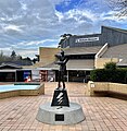
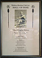 Allan (Jack) Horan Waikato Rowing Hall Of Fame.jpg 2,497 × 3,466; 2.95 MB
-
 Almost to the Center of the Scorpian Lollipop (15257808829).jpg 3,264 × 2,448; 1.56 MB
-
 Anchor Butter (10430114503).jpg 7,008 × 2,819; 7.98 MB
-
 Angles and Convergence (15240527857).jpg 3,232 × 2,424; 2.09 MB
-
 Anti-Dog (15432679361).jpg 3,213 × 2,410; 3.11 MB
-
 Aotea (8240325006).jpg 3,888 × 2,592; 1.7 MB
-
 Aotea Harbour and Pirongia.JPG 4,000 × 3,000; 2.97 MB
-
 Aotea Harbour and Taranaki from Houchens Rd.jpg 12,209 × 2,692; 9.44 MB
-
 Are You Talking to Me? (15191237697).jpg 3,264 × 2,448; 2.5 MB
-
 At Waikato University (15240282009).jpg 3,264 × 2,448; 1.86 MB
-
 Auckland.arp.750pix.jpg 1,144 × 988; 147 KB
-
 Awakino tunnel.jpg 450 × 600; 82 KB
-
 Balloon leader (3419433113).jpg 1,200 × 1,800; 256 KB
-
 Black Water Rafting Tickets - 2013.04 - panoramio.jpg 3,226 × 2,419; 2.71 MB
-
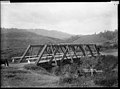
 Bridge over upper Pakoka River.jpg 3,000 × 4,000; 6.25 MB
-
 Bright green tree - Waikato.jpg 2,592 × 1,944; 2 MB
-
 Calfetaria in New Zealand 1.jpg 1,600 × 1,200; 451 KB
-
 Calfetaria in New Zealand 2.jpg 1,600 × 1,200; 390 KB
-
 Cambridge Co-operative Dairy Co, Hautapu, between 1923-1928 (3057756510).jpg 6,470 × 1,258; 2.83 MB
-
 Camera Club Comp 2 - Jun 09 (3798855831).jpg 1,800 × 1,200; 372 KB
-
 Cap badge Waikato Regiment.png 2,323 × 2,596; 5.48 MB
-
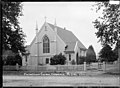
 Christ's Church, Ngakuru.JPG 4,082 × 2,720; 6.81 MB
-
 Cloud at sunset.jpg 4,032 × 3,024; 3.06 MB
-
 Clouds backed up against Mount Tauhara.jpg 1,024 × 768; 253 KB
-
 Coal bins and screens at the Pukemiro Coal Mine, Waikato ATLIB 239785.png 5,134 × 3,754; 12.62 MB
-
 Colossal Mushrooms (15372918885).jpg 1,632 × 1,224; 808 KB
-
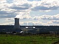
 Cooling tower of Ohaaki Geothermal power station (6941577024).jpg 2,592 × 1,728; 449 KB
-
 Coromandel.arp.375pix.jpg 570 × 404; 38 KB
-
 Ctenoplectron fasciatum.jpg 720 × 509; 43 KB
-
 Derelict Farm Building (15106816310).jpg 6,000 × 4,000; 7.55 MB
-
 Easter orchid (Earina autumnalis) (cropped).jpg 1,318 × 1,818; 936 KB
-
 Easter orchid (Earina autumnalis).jpg 3,003 × 2,982; 2.86 MB
-
 Edmond Hillary Walkway - 2013.04 - panoramio.jpg 3,264 × 2,448; 1.63 MB
-
 Ellis and Burnand location diagram.jpg 678 × 1,312; 123 KB
-
 Entrance to the Pukemiro Coal Mine, Waikato ATLIB 239788.png 5,144 × 3,774; 10.6 MB
-
 Farm Water Tower In Field.jpg 1,600 × 1,200; 1.18 MB
-
 Flanked by Te Iringa.jpg 480 × 640; 52 KB
-
 Fluted limestone, lower Pakoka River valley.JPG 3,456 × 2,592; 4.06 MB
-
 Footstep (83224159).jpeg 2,048 × 1,365; 680 KB
-
 From the Hamilton local George Brewery (15240317659).jpg 3,264 × 2,448; 1.7 MB
-
 Geothermal.Electricity.NZ.Ohaaki.png 1,424 × 422; 120 KB
-
 Geothermal.Electricity.NZ.Poihipi.png 2,854 × 422; 203 KB
-
 Goats cheese souffle.jpg 4,032 × 3,024; 3.65 MB
-
 HamiltonUrbanArea.png 1,015 × 1,929; 245 KB
-
 Hapuakohe Track to Maungakawa.jpg 2,560 × 1,920; 1.29 MB
-
 Hinuera Rail Accident - August 12 1958 (20353131022).jpg 2,562 × 3,924; 1.92 MB
-
 Historic photo of Rewi, Ngati Maniopoto.jpg 923 × 1,154; 405 KB
-
 HMS Curacao Rangiriri curacoa memorial (cropped).jpg 478 × 414; 76 KB
-
 Idyll With Substation And Bridge.jpg 1,600 × 1,200; 1.36 MB
-
 Instructions from William Symonds to John Whiteley (16329643632).jpg 10,887 × 6,136; 8.23 MB
-
 Into the fog at Orakei Korako (4840411954).jpg 3,000 × 4,000; 826 KB
-
 It's Been 10 Years Since I Was Around Here - (15412803316).jpg 2,208 × 1,656; 968 KB
-
 It's Cat O'Clock (15421503696).jpg 3,264 × 2,448; 3.69 MB
-
 Italian Gardens (15377735265).jpg 3,264 × 2,448; 2.76 MB
-
 Jimmy Looked Hungrier Than Usual (15240300839).jpg 3,264 × 2,448; 3.21 MB
-
 Kaipaki Church, Ohaupo (2).JPG 3,945 × 2,628; 5.87 MB
-
 Kaipaki Church, Ohaupo.JPG 4,203 × 2,800; 6.34 MB
-
 Karioi ridges from summit.jpg 5,008 × 1,729; 3.33 MB
-
 Kawhia Congregational Church - Photograph taken by Jonathan Ltd (21677189492).jpg 4,689 × 6,435; 6.36 MB
-
 Kawhia, Waikato region - Photograph taken by Jonathan Ltd (20879756533).jpg 6,444 × 4,717; 3.46 MB
-
 Kawhia, Waikato region - Photograph taken by Jonathan Ltd (21474430798).jpg 6,440 × 4,714; 3.52 MB
-
 Kopuatai bog.tif 862 × 646; 964 KB
-
 Lake Disappear from Plateau Rd when empty.JPG 2,271 × 1,530; 1.51 MB
-
 Lake Karapiro Panorama - Dec 2020.jpg 32,556 × 3,788; 24.21 MB
-
 Letter From Matutaera Potatau, Ngaruawahia (14516805050).jpg 2,605 × 4,099; 7.4 MB
-
 Lifeguard (83880813).jpeg 2,048 × 1,366; 560 KB
-
 Lily pad cafe 2.jpg 4,128 × 3,096; 8.01 MB
-
 Lily pad cafe.jpg 4,128 × 3,096; 8.04 MB
-
 Lily pad garden art cafe.jpg 4,128 × 3,096; 8.11 MB
-
 Lily pad oven.jpg 4,128 × 3,096; 5.5 MB
-
-
 Lower Pakoka River in flood.JPG 3,456 × 2,592; 4.31 MB
-
 Lush humid forest (Unsplash).jpg 5,184 × 3,456; 11.59 MB
-
 MahinarangiHouse.JPG 640 × 480; 137 KB
-
 Map of Maungatautari.JPG 865 × 759; 201 KB
-
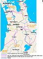
 Map of Waikato (9260492158).jpg 4,171 × 6,563; 1.85 MB
-
 Mapara Forest, North Island (8604874615).jpg 4,608 × 3,456; 2.94 MB
-
 Meadow (84553769).jpeg 2,048 × 1,365; 1.03 MB
-
 Mercer Cheese, Waikato, New Zealand, 9 July 2011 - Flickr - PhillipC.jpg 4,288 × 2,848; 1.72 MB
-
 Moanatuatua.tif 865 × 649; 901 KB
-
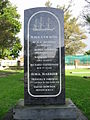
 Mokenaplaque.jpg 719 × 470; 116 KB
-
 MOOC Plotting (15240495817).jpg 2,994 × 2,138; 1.4 MB
-
 Morrinsville waterfall.jpg 5,494 × 3,187; 8 MB
-
 Motoring in vicinity of Meremere Hill (21661296386).jpg 6,479 × 4,704; 5.09 MB
-
 Music (84010669).jpeg 2,048 × 1,365; 1.92 MB
-
 Nephrolepis cordifolia spreading in New Zealand - 2.jpg 2,756 × 1,104; 783 KB
-
 New Zealand Fantail.jpg 1,205 × 1,802; 339 KB
-
 New Zealand snow.jpg 4,608 × 3,456; 3.35 MB
-
 Ngarua Community Church.JPG 4,142 × 2,761; 6.35 MB
-
 Ngatea water gardens - panoramio.jpg 2,560 × 1,920; 1.49 MB
-
 Nibbles! Tiny Sandwiches! (15403992206).jpg 3,264 × 2,448; 1.98 MB
-
 Nigel Introducing Some Yabbo From America (15240458678).jpg 2,464 × 1,847; 1.19 MB
-
 Nigel's Vinyl (15444215222).jpg 3,264 × 2,448; 2.21 MB
-
 Nineteen Seventy Two (194812005).jpeg 2,048 × 1,365; 338 KB
-
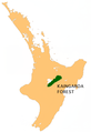 NZ-Kaingaroa F.png 405 × 590; 117 KB
-
 NZ-L Waikare.png 501 × 728; 149 KB
-
 Ocean Beach, Kawhia.jpg 4,896 × 3,264; 4.86 MB
-
 Ocean Calling (167254055).jpeg 2,048 × 1,318; 841 KB
-
 Ohaaki geothermal power station.jpg 1,280 × 960; 369 KB
-
 Oparau Bridge, Kawhia (21666018955).jpg 6,396 × 4,726; 3.66 MB
-
 Oparau River, Kawhia (20966622953).jpg 6,462 × 4,702; 4.02 MB
-
 Oparau River, Kawhia (21452790760).jpg 4,715 × 6,485; 5.79 MB
-
 Opotoru River in the lower part of its valley.JPG 2,560 × 1,920; 2.46 MB
-
 Opotoru valley.JPG 4,874 × 2,463; 3.28 MB
-
 Ostriches on Waikato farm 2.jpg 1,210 × 1,741; 766 KB
-
 Ostriches on Waikato farm.jpg 2,066 × 1,604; 1.1 MB
-
 Otorohanga, Waikato ATLIB 312070.png 5,032 × 3,766; 13.56 MB
-
 Pakihi Stream re-emerges.JPG 4,000 × 3,000; 6.42 MB
-
 Pakihi Stream runs into sinkhole.JPG 4,000 × 3,000; 6.06 MB
-
 Pakoka River above Bridal Veil.JPG 4,000 × 3,000; 2.38 MB
-
 Pakoka River and limestone arch.JPG 4,000 × 3,000; 3.84 MB
-
 Pakoka River estuary and Aotea Harbour.JPG 2,048 × 1,536; 667 KB
-
 Pakoka River estuary.JPG 4,000 × 3,000; 3.64 MB
-
 Pakoka River limestone cliff.JPG 2,048 × 1,536; 1.31 MB
-
 Pakoka valley and Bridal Veil Falls.JPG 3,456 × 2,592; 4.14 MB
-
 Paromalia nigricollis.jpg 370 × 749; 61 KB
-
 Piako2.jpg 1,280 × 960; 303 KB
-
 Position of Waikato Region.png 405 × 590; 7 KB
-
 Props (15240295609).jpg 3,175 × 2,381; 1.51 MB
-
 Public transport in Waikato 2.jpg 2,227 × 3,948; 6.05 MB
-
 Public transport in Waikato.jpg 1,028 × 1,402; 357 KB
-
 Pukeatua War Memorial Church (2).JPG 4,592 × 3,056; 5.17 MB
-
 Pukeatua War Memorial Church.JPG 4,592 × 3,056; 5.74 MB
-
 Punui River close to Kihikihi.jpg 2,048 × 1,536; 2.59 MB
-
 Purple Water (140578985).jpeg 2,048 × 1,154; 457 KB
-
 Raglan and Opotoru Creek.jpg 12,214 × 2,941; 7.19 MB
-
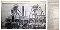 Ralph Mine Disaster (1914) (20477185083).jpg 5,446 × 2,748; 2.61 MB
-
 Rangiriri curacoa memorial.jpg 1,200 × 1,600; 737 KB
-
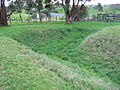
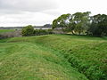 Rangiriri trenches.jpg 1,600 × 1,200; 680 KB
-
 Rangiriri.jpg 1,600 × 1,200; 1.04 MB
-
 Riff Raff Statue, Waikato Museum, Hamilto.jpg 2,370 × 2,424; 1.74 MB
-
 Riria - Claims at Pukewhau (27992514512).jpg 2,992 × 2,322; 1.78 MB
-
 River on Pirongia.JPG 2,448 × 3,264; 2.21 MB
-
 River-facing panorama from historic site of Meremere Pā.jpg 5,984 × 896; 2.47 MB
-
 Rolling Hills (193365237).jpeg 2,048 × 1,307; 689 KB
-
 Ruapuke Beach from south.JPG 4,000 × 3,000; 4.98 MB
-
 Ruapuke from Karioi.JPG 3,172 × 1,926; 3.56 MB
-
 Rural Property For Sale - panoramio.jpg 3,072 × 2,304; 1.7 MB
-
 Ruru.png 459 × 398; 10 KB
-
 Sand dune lake Te Horea.jpg 1,185 × 623; 428 KB
-
 Seared tuna appetizer.jpg 3,024 × 4,032; 3.04 MB
-
 Signature of William Hobson after stroke (detail) (16267052385).jpg 1,742 × 1,209; 581 KB
-
 Snails At Dawn (147353683).jpeg 2,048 × 1,365; 643 KB
-
 St Davids Church, Waharoa.JPG 3,126 × 2,085; 5.61 MB
-
 State Hwy 3, North Island - panoramio.jpg 3,798 × 2,134; 1.61 MB
-
 Steam pipelines towards Wairakei geothermal power station.jpg 1,024 × 768; 285 KB
-
 Surfer 1 (83489563).jpeg 2,048 × 1,366; 470 KB
-
 Surfer 2 (84698079).jpeg 2,048 × 1,365; 300 KB
-
 Swamp Harrier eggs in nest.jpg 600 × 400; 113 KB
-
 Taharoa ironsand symbol.jpg 884 × 660; 140 KB
-
 Tarore's grave.jpg 3,456 × 5,184; 4.23 MB
-
 Taupiri.jpg 540 × 380; 178 KB
-
 Taupo Cycle Challenge 03.jpg 1,600 × 1,200; 1.39 MB
-
 Taupo.jpg 16,765 × 1,024; 10.41 MB
-
 Tawatahi River and Te Teko Is..jpg 1,420 × 573; 221 KB
-
 Tawatahi River and Te Teko Island, Whaingaroa Harbour.jpg 635 × 179; 40 KB
-
 Te Kawa hill and Kakepuku from air looking west.jpg 1,903 × 2,392; 893 KB
-
 Te Mihi Separator Pad.jpg 4,416 × 1,280; 1.42 MB
-
 Te Poi Memorial Hall.jpg 640 × 480; 171 KB
-
 Te Rore bridge over Waipa River.JPG 4,000 × 3,000; 3.61 MB
-
 Te Toto Gorge.jpg 3,000 × 4,000; 4.85 MB
-
 TeAroha-view.jpg 600 × 450; 81 KB
-
 The beach near Raglan, NZ (15435967865).jpg 3,264 × 2,448; 1.77 MB
-
 The Green Dragon Inn, Hobbiton, New Zealand (Unsplash).jpg 4,800 × 3,000; 3.8 MB
-
 The gunboat pioneer at meremere.jpg 1,176 × 648; 207 KB
-
 The repulse of the royal navy storming party rangiriri pa.jpg 1,764 × 1,092; 637 KB
-
 Thelymitra4Full - cropped.jpg 1,800 × 2,500; 4.89 MB
-
 Thelymitra4Full.jpg 5,184 × 3,456; 15.06 MB
-
 Thermal Explorer Hwy, North Island - panoramio.jpg 2,048 × 1,150; 631 KB
-
 Thursday in the Waikato (51153639677).jpg 6,000 × 4,000; 14.77 MB
-
 To the beach (2035963213).jpg 3,872 × 2,592; 5.2 MB
-
 Tokaanu Power Station.jpg 2,048 × 1,536; 3.32 MB
-
 Top of Pakihi River valley.JPG 4,000 × 3,000; 3.44 MB
-
 Touch down! (16234542126).jpg 1,800 × 1,200; 498 KB
-
 Touchdown - nearly (28437221754).jpg 1,800 × 1,200; 676 KB
-
 Tree daisies (Olearia rani) in bloom on Mount Karioi.JPG 4,000 × 3,000; 3.97 MB
-
 Treeline (6708989995).jpg 4,000 × 3,000; 3.71 MB
-
 Trinity Presbyterian Church at Cambridge, c 1915-1920 (4572424365).jpg 6,420 × 4,687; 10.62 MB
-
 Trunk of tallest kahikatea, Pirongia Forest.jpg 3,264 × 4,896; 6.36 MB
-
 View from the south-eastern side of the lake.jpg 3,072 × 2,304; 3.08 MB
-
 Waerenga, Waikato (21476216269).jpg 5,538 × 3,550; 1.58 MB
-
 Waikato Countryside (5206315726).jpg 1,080 × 864; 311 KB
-
 Waikato hills 3.jpg 4,128 × 3,096; 5.56 MB
-
 Waikato hills mist.jpg 2,926 × 1,940; 998 KB
-
 Waikato hills.jpg 2,048 × 1,536; 669 KB
-
 Waikato Planes (5366307240).jpg 900 × 900; 535 KB
-
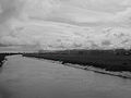
 Waikato River mouth.jpg 3,264 × 2,448; 6.79 MB
-
 Waikato-Manukau Sheet, The Treaty of Waitangi (12195657724).jpg 1,020 × 1,246; 161 KB
-
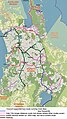
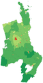 WaikatoRegionPopulationDensity.png 1,015 × 1,929; 234 KB
-
 Wairakei Terrace.jpg 3,264 × 2,448; 2.46 MB
-
 Wairere Stream, Kaimai Ranges (14260357831).jpg 3,487 × 5,208; 14.51 MB
-
 Waitetuna arm of Whaingaroa Harbour.JPG 4,000 × 3,000; 3.14 MB
-
 Waitetuna River about 3km from the harbour.JPG 4,000 × 3,000; 4.37 MB
-
 Waitetuna valley from Plateau Rd.jpg 5,473 × 1,464; 1.04 MB
-
 Waitetuna, New Zealand - panoramio (1).jpg 3,000 × 4,000; 3.6 MB
-
 Waitetuna, New Zealand - panoramio (2).jpg 3,000 × 4,000; 4.56 MB
-
 Waitetuna, New Zealand - panoramio.jpg 3,368 × 2,622; 2.88 MB


_Horan_Waikato_Rowing_Hall_Of_Fame.jpg)
.jpg)
.jpg)
.jpg)
.jpg)

.jpg)
.jpg)


.jpg)


.jpg)


.jpg)
.jpg)


.jpg)
_(cropped).jpg)
.jpg)


.jpeg)
.jpg)


.jpg)

.jpg)

.jpg)
.jpg)
.jpg)
.jpg)
.jpg)
.jpg)
.JPG)

.jpg)
.jpg)
.jpg)
.jpg)
.jpeg)


.jpg)

.jpg)


.jpg)
.jpg)
.jpeg)


.jpg)

.jpg)
.jpeg)


.jpg)
.jpg)
.jpg)
.jpeg)


.jpeg)

.jpg)
.jpg)
.jpg)


.jpg)
.JPG)


.jpeg)
_(20477185083).jpg)


.jpg)

.jpeg)


_(16267052385).jpg)
.jpeg)


.jpeg)
.jpeg)


.jpg)
.jpg)


.jpg)
.jpg)


.jpg)
.jpg)
_in_bloom_on_Mount_Karioi.JPG)
.jpg)
.jpg)


.jpg)
.jpg)


.jpg)

.jpg)


.jpg)


.jpg)
.jpg)

.jpg)
.jpg)