Category:Maps of Georgetown County, South Carolina
Jump to navigation
Jump to search
Counties of South Carolina: Abbeville · Aiken · Allendale · Anderson · Bamberg · Barnwell · Beaufort · Berkeley · Calhoun · Charleston · Cherokee · Chester · Chesterfield · Clarendon · Colleton · Darlington · Dillon · Dorchester · Edgefield · Fairfield · Florence · Georgetown · Greenville · Greenwood · Hampton · Horry · Jasper · Kershaw · Lancaster · Laurens · Lee · Lexington · Marion · Marlboro · McCormick · Newberry · Oconee · Orangeburg · Pickens · Richland · Saluda · Spartanburg · Sumter · Union · Williamsburg · York

Wikimedia category | |||||
| Upload media | |||||
| Instance of | |||||
|---|---|---|---|---|---|
| Category combines topics | |||||
| Georgetown County | |||||
county in South Carolina, United States   | |||||
| Instance of | |||||
| Location | South Carolina | ||||
| Capital | |||||
| Inception |
| ||||
| Population |
| ||||
| Area |
| ||||
| official website | |||||
 | |||||
Media in category "Maps of Georgetown County, South Carolina"
The following 6 files are in this category, out of 6 total.
-
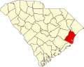 Map of South Carolina highlighting Georgetown County.svg 4,419 × 3,522; 103 KB
-

-

-

-

-
 Georgetown County South Carolina incorporated and unincorporated areas.svg 954 × 741; 4.56 MB


