Category:Maps of Midlothian
Jump to navigation
Jump to search
Traditional counties (shires) of Scotland: Aberdeenshire · Angus · Argyll ≈ Argyllshire · Ayrshire · Banffshire · Berwickshire · Buteshire · Caithness · Clackmannanshire · Cromartyshire · Dumbartonshire · Dumfriesshire · East Lothian · Fife · Inverness-shire · Kincardineshire · Kinross-shire · Kirkcudbrightshire · Lanarkshire · Midlothian · Moray · Nairnshire · the Orkney Islands ≈ Orkney Islands · Peeblesshire · Perthshire · Renfrewshire · Ross-shire · Roxburghshire · Selkirkshire · the Shetland Islands ≈ Shetland Islands · Stirlingshire · Sutherland · West Lothian · Wigtownshire
Council areas (municipalities) of Scotland: Aberdeen · Aberdeenshire · Angus · Argyll and Bute · Clackmannanshire · Dumfries and Galloway · Dundee · East Ayrshire · East Dunbartonshire · East Lothian · East Renfrewshire · Edinburgh · Falkirk · Fife · Glasgow · Highland · Inverclyde · Midlothian · Moray · North Ayrshire · North Lanarkshire · Outer Hebrides · Orkney Islands · Perth and Kinross · Renfrewshire · Scottish Borders · Shetland Islands · South Ayrshire · South Lanarkshire · Stirling · West Dunbartonshire · West Lothian
Wikimedia category | |||||
| Upload media | |||||
| Instance of | |||||
|---|---|---|---|---|---|
| Category combines topics | |||||
| Midlothian | |||||
council area of Scotland    | |||||
| Instance of | |||||
| Location |
| ||||
| Capital | |||||
| Population |
| ||||
| Area |
| ||||
| Different from | |||||
| official website | |||||
 | |||||
Subcategories
This category has the following 3 subcategories, out of 3 total.
W
- Wards of Midlothian (10 F)
Media in category "Maps of Midlothian"
The following 33 files are in this category, out of 33 total.
-
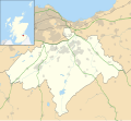
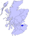 Midlothian council.PNG 2,733 × 3,411; 208 KB
-
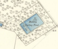 Malleny Curling Pond near Balerno.png 327 × 274; 129 KB
-

-
 Map of Sheriffhall Park & Ride (OSM standard, zoom 15).jpg 872 × 726; 87 KB
-
 Map of Sheriffhall Park & Ride (OSM standard, zoom 17).jpg 576 × 464; 137 KB
-
 Map of Straiton Park & Ride (OSM standard, zoom 15).jpg 674 × 564; 55 KB
-
 Map of Straiton Park & Ride (OSM standard, zoom 17).jpg 582 × 572; 163 KB
-
 Midlothian - British Isles.svg 1,250 × 1,835; 1,002 KB
-
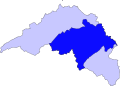
 Midlothian Brit Isles Sect 2.svg 915 × 841; 1,004 KB
-
 Midlothian Brit Isles Sect 3.svg 939 × 677; 940 KB
-
 Midlothian Brit Isles Sect 4.svg 627 × 643; 938 KB
-
 Midlothian Council election 1999.svg 463 × 349; 145 KB
-
 Midlothian Council election 2003.svg 463 × 349; 145 KB
-
 Midlothian Council election 2007.svg 1,425 × 1,313; 827 KB
-
 Midlothian Council election 2012.svg 1,425 × 1,313; 830 KB
-
 Midlothian District Council election 1980.svg 463 × 348; 371 KB
-
 Midlothian District Council election 1988.svg 463 × 348; 369 KB
-
 Midlothian District Council election 1992.svg 463 × 348; 371 KB
-
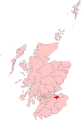
 Midlothian in Scotland.svg 1,128 × 1,483; 1.57 MB
-
 Midlothian ScottishParliamentConstituency.PNG 478 × 276; 6 KB
-
 Midlothian towns.gif 300 × 240; 19 KB
-
 Midlothian UK blank map.svg 1,425 × 1,313; 704 KB
-
 Midlothian UK location map.svg 1,425 × 1,313; 796 KB
-
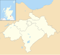
 Midlothian UK parish map (blank).svg 1,425 × 1,313; 858 KB
-
 Midlothian UK relief location map.jpg 2,005 × 1,846; 329 KB
-
 Midlothian UK ward map (blank).svg 1,425 × 1,313; 813 KB
-
 Midlothian UK ward map 2017 (blank).svg 1,425 × 1,313; 790 KB
-
 Midlothian.svg 595 × 842; 55 KB
-
 MidlothianBrit2.GIF 608 × 604; 13 KB
-
 MidlothianBrit2.PNG 608 × 604; 20 KB
-
 MidlothianConstituency.svg 278 × 412; 336 KB
-
 MidLothianTraditional.png 420 × 520; 12 KB
-
 Modern & Historic Midlothian.svg 696 × 499; 81 KB

.png)
.jpg)
.jpg)
.jpg)
.jpg)


.svg)
.svg)
.svg)