Category:Maps of Oceania
Jump to navigation
Jump to search
Temperate regions: North America · South America · Africa · Europe · Asia · Oceania – Polar regions: Antarctica · Arctic – Other regions: Afro-Eurasia · Eurasia
Wikimedia category | |||||
| Upload media | |||||
| Instance of | |||||
|---|---|---|---|---|---|
| Category combines topics | |||||
 | |||||
Subcategories
This category has the following 64 subcategories, out of 64 total.
!
*
- DEM maps of Oceania (2 F)
+
A
- Atlas of Oceania (39 P, 8 F)
B
C
D
E
- ECHO Situation Maps of Oceania (empty)
G
- Geomorphological maps of Oceania (empty)
H
J
K
L
M
- Maps of Asia-Pacific (23 F)
N
O
P
R
S
- Sea level maps of Oceania (2 F)
- Slope maps of Oceania (2 F)
T
W
Media in category "Maps of Oceania"
The following 127 files are in this category, out of 127 total.
-
 800px-Oceanie2.png 778 × 498; 68 KB
-

-
 Alkoholersterwerbsalter in Ozeanien.png 2,000 × 1,428; 126 KB
-
 Asia y Oceanía españolas.png 863 × 628; 56 KB
-
 Australasian strewnfield.jpg 1,584 × 1,472; 197 KB
-
 Australia and Oceania Rus.jpg 2,873 × 1,969; 664 KB
-
 Australie-Occidentale française.png 447 × 236; 49 KB
-
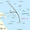 Battle of Santa Cruz map-ar.jpg 800 × 799; 105 KB
-
-
 Carta politica dell'Oceania.jpg 1,147 × 687; 202 KB
-
 Carte de la Communauté du Pacifique (ZEE bleu sombre).jpg 2,730 × 1,989; 472 KB
-
 Carte synthétiques des migrations en Océanie.jpg 2,730 × 2,076; 1.25 MB
-
 Continente Oceanía.png 1,110 × 626; 175 KB
-

-
 Dymaxion Projection Oceania.png 2,560 × 2,560; 911 KB
-
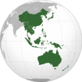 East Asia, Southeast Asia and the Pacific.png 2,044 × 2,048; 576 KB
-
 EEZ Oceania.svg 385 × 215; 201 KB
-
 EEZs Pacific.png 863 × 624; 56 KB
-
 Etats membres du FDIP.png 699 × 600; 93 KB
-
 Fer de Lance carte.JPG 352 × 295; 9 KB
-
 FIBA Oceanian Basketball Championships countries.PNG 442 × 347; 7 KB
-
 Geographic Areas Reference Manual Figure 7-2.png 679 × 580; 333 KB
-
 German Pacific (loyal).svg 780 × 500; 148 KB
-
 German Pacific.svg 780 × 500; 148 KB
-
 Kaart Oceanie.jpg 3,347 × 2,247; 2.54 MB
-
 Karte der Kirchenprovinz Agaña.png 986 × 641; 73 KB
-
 Karte Kirchenprovinzen und Diözesen in Ozeanien - es.png 2,302 × 1,127; 232 KB
-
 Karte Kirchenprovinzen und Diözesen in Ozeanien.png 2,302 × 1,127; 230 KB
-
 Kleinschmidt-Forschungsaufenthalte-Ozeanien PDF.pdf 1,735 × 495; 3.81 MB
-
 Kleinschmidt-Forschungsaufenthalte-Ozeanien PNG.png 3,472 × 992; 3.26 MB
-
 Literal translation of country names.jpg 4,500 × 3,172; 1.49 MB
-
 Location of the island Kapingamarangi.png 800 × 520; 62 KB
-
 LocationRussianempire (21st century).png 300 × 190; 14 KB
-
 Mal map.jpg 543 × 314; 61 KB
-
 Map of Near and Remote Oceania and location of Efate Island, Vanuatu.tif 2,309 × 1,472; 913 KB
-
 Map of Oceania country codes.png 2,000 × 1,000; 117 KB
-
 Map of Oceania no boundaries.png 2,000 × 1,000; 101 KB
-
 Map of Oceania-Pacific wide.svg 700 × 245; 694 KB
-
 Map of Oceanian Ecoregions.svg 5,759 × 3,372; 10.35 MB
-
 Map of oldest companies in Oceania; February 2020.png 1,200 × 1,331; 166 KB
-
 Map of Pacific Oceania member nations.svg 749 × 479; 240 KB
-
 Map of the Exclusive Economic Zones of the Pacific Ocean.png 3,067 × 1,678; 719 KB
-
 Map of the Territorial Waters of the Atlantic and Indian Ocean.png 2,919 × 1,676; 588 KB
-
 Mapa oceania.svg 800 × 520; 157 KB
-
 Micronesia map.gif 634 × 324; 25 KB
-
 Migracionfloraoceania.svg 4,376 × 3,070; 781 KB
-
 Mir reentry map.svg 428 × 377; 89 KB
-
 Mural - mapa central - Oceanía este.jpg 2,560 × 1,440; 1.59 MB
-
 Mural - mapa central - Oceanía oeste.jpg 2,560 × 1,440; 1.5 MB
-
 Nauru - DPLA - 1c744fa83bc11976202e84294e1e0cf8.jpg 2,560 × 3,278; 5.29 MB
-
 Oceania - acque territoriali.png 1,088 × 606; 201 KB
-
 Oceania Administrative Divisions with Full Names in Spanish.svg 952 × 610; 159 KB
-
 Oceania blank.svg 800 × 520; 161 KB
-
 Oceania by % of forest cover.png 6,300 × 5,250; 1.37 MB
-
 Oceania centered.svg 791 × 790; 79 KB
-
 Oceania continents.svg 800 × 520; 122 KB
-
 Oceania countries map for painting.png 600 × 384; 11 KB
-
 Oceania full blank map.svg 4,376 × 3,070; 777 KB
-
 Oceania grey map with country codes.svg 800 × 520; 119 KB
-
 Oceania grey map.svg 800 × 520; 107 KB
-
 Oceania ISO 3166-1 - Bulgarian.svg 800 × 520; 181 KB
-
 Oceania ISO 3166-1 - Macedonian.png 778 × 498; 70 KB
-
 Oceania ISO 3166-1 - Tonga 2.jpg 780 × 500; 178 KB
-
 Oceania ISO 3166-1 - Tonga 3.jpg 780 × 500; 190 KB
-
 Oceania ISO 3166-1 - Tonga.jpg 876 × 500; 195 KB
-
 Oceania ISO 3166-1.svg 780 × 500; 146 KB
-
 Oceania mk.svg 780 × 499; 319 KB
-
 Oceania Political Map (EEZ based).png 1,347 × 834; 51 KB
-
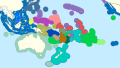
 Oceania regions map (cs).png 1,319 × 980; 748 KB
-
 Oceania regions map (ja).png 3,584 × 2,628; 2.34 MB
-
 Oceania regions map pt.svg 3,584 × 2,628; 6.48 MB
-
 Oceania rus.svg 800 × 520; 176 KB
-
 Oceania satellite.jpg 1,670 × 957; 111 KB
-
 Oceania stub.jpg 343 × 305; 10 KB
-
 Oceania Tennis Federation members.svg 780 × 500; 241 KB
-
 Oceania UN Geoscheme - Map of Melanesia uk.png 823 × 466; 89 KB
-
 Oceania UN Geoscheme - Map of Micronesia uk.png 872 × 424; 58 KB
-
 Oceania UN Geoscheme - Map of Polynesia uk.png 1,220 × 1,104; 128 KB
-
 Oceania UN Geoscheme - Map with Zones.svg 900 × 520; 520 KB
-
 Oceania UN Geoscheme Regions mk.svg 900 × 520; 370 KB
-
 Oceania UN Geoscheme Regions uk.png 2,000 × 1,156; 232 KB
-
 Oceania UN Geoscheme Regions with no text.svg 900 × 520; 527 KB
-
 Oceania UN Geoscheme Regions with Zones and ISO3166 labels.svg 900 × 520; 523 KB
-
 Oceania UN Geoscheme Regions with Zones and no text.svg 900 × 520; 526 KB
-
 Oceania UN Geoscheme Regions with Zones uk.png 2,000 × 1,156; 297 KB
-
 Oceania UN Geoscheme Regions.svg 900 × 520; 128 KB
-
 Oceania without Asian country codes.jpg 794 × 514; 220 KB
-
 Oceania World Heritage sites.svg 831 × 497; 41 KB
-
 Oceania С.jpg 7,864 × 4,883; 1.34 MB
-
 Oceania, broad (orthographic projection).svg 541 × 541; 284 KB
-
 LGBT Flag map of Oceania.png 2,000 × 1,183; 83 KB
-
 Oceania, narrow (orthographic projection).svg 541 × 541; 307 KB
-
 Oceanias Regions- Macedonian.png 552 × 350; 17 KB
-
 Oceanias Regions.png 552 × 350; 20 KB
-
 Oceanie2-empty.png 1,950 × 1,250; 197 KB
-
 Oceanie2.svg 800 × 520; 240 KB
-
 Oceaniefrenchwikiversion.svg 800 × 520; 239 KB
-
 Oceanies-Fr.jpg 773 × 582; 177 KB
-
 Oceanië map.jpg 943 × 657; 138 KB
-
 Pacific Basin Human Geography Cultural Zones.jpg 800 × 600; 70 KB
-
 Pacific Basin Human Geography Migrations.jpg 800 × 600; 68 KB
-
 Pacific Culture Areas AR.svg 1,024 × 720; 709 KB
-
 Pacific Culture Areas.svg 1,024 × 720; 862 KB
-
 Pacific islands map and Hawaii.PNG 358 × 245; 7 KB
-
 Pacific Islands.png 596 × 329; 15 KB
-
 Pacific Ocean laea Oceanian countries map.jpg 1,165 × 1,070; 542 KB
-
 Pacific Region Base Map.png 1,335 × 876; 303 KB
-
 Pacifique.jpg 1,274 × 1,775; 289 KB
-
 Papua-Neuguinea-Pos.png 330 × 228; 15 KB
-
 Para-Micronésie.png 725 × 475; 20 KB
-
 Pouzolzia australis distribution.png 7,598 × 4,747; 835 KB
-
 Prostitution in Oceania.png 887 × 663; 77 KB
-
 Regulation of electronic cigarettes Oceania.svg 483 × 546; 478 KB
-
 Smith's small-headed sea snake.png 549 × 421; 354 KB
-
 South Pacific Whale sanctuaries.PNG 600 × 411; 17 KB
-
 South Seas Banner.jpg 4,045 × 578; 1.02 MB
-
 SPC 2010 Pacific.png 1,142 × 841; 65 KB
-
 Territorial waters Oceania.png 1,088 × 606; 191 KB
-

-
 THEP Регионы Океании.PNG 800 × 520; 123 KB
-
 Tonga and its borders (cropped).png 417 × 354; 50 KB
-
 Topographical map of the Antipodes Islands be.png 1,243 × 981; 162 KB
-
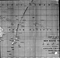
 United States Pacific change 1889-05-29.png 2,046 × 1,321; 219 KB
-
 United States Pacific change 1911-07-17.png 2,046 × 1,321; 230 KB
-
 White World Map(Americas-centered) Blank.png 2,424 × 1,176; 155 KB
-
 Žralůček okatý.jpg 874 × 632; 257 KB
-
 Арнольд Гельріґель. Тисяча і один острів. №2. 1929.jpg 658 × 531; 260 KB


_(1886)_(20426119428).jpg)

.jpg)


.svg)


.png)


.png)
.png)
.png)


.svg)

.svg)


_organized_knowledge_in_story_and_picture_(1917)_(14742105086).jpg)

.png)


_Blank.png)