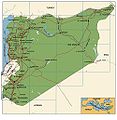
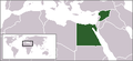
Category:Maps of Syria
跳转到导航
跳转到搜索
亚洲国家:阿富汗 · 阿拉伯联合酋长国 · 阿曼 · 阿塞拜疆‡ · 埃及‡ · 巴基斯坦 · 巴林 · 不丹 · 朝鲜民主主义人民共和国 · 大韩民国 · 东帝汶 · 俄罗斯‡ · 菲律宾 · 格鲁吉亚‡ · 哈萨克斯坦‡ · 吉尔吉斯斯坦 · 柬埔寨 · 卡塔尔 · 科威特 · 老挝 · 黎巴嫩 · 马尔代夫 · 马来西亚 · 蒙古国 · 孟加拉国 · 缅甸 · 尼泊尔 · 日本 · 塞浦路斯‡ · 沙特阿拉伯 · 斯里兰卡 · 塔吉克斯坦 · 泰国 · 土耳其‡ · 土库曼斯坦 · 文莱达鲁萨兰国 · 乌兹别克斯坦 · 新加坡 · 叙利亚 · 亚美尼亚‡ · 也门 · 伊拉克 · 伊朗 · 以色列 · 印度 · 印度尼西亚‡ · 约旦 · 越南 · 中华人民共和国
有限承认:巴勒斯坦 · 阿布哈兹‡ · 北塞浦路斯土耳其共和国‡ · 南奥塞梯‡ · 中华民国 – 其他地区:澳门 · 香港 · 阿克罗蒂里和泽凯利亚‡ · 英属印度洋领地
‡:部分位于亚洲
有限承认:巴勒斯坦 · 阿布哈兹‡ · 北塞浦路斯土耳其共和国‡ · 南奥塞梯‡ · 中华民国 – 其他地区:澳门 · 香港 · 阿克罗蒂里和泽凯利亚‡ · 英属印度洋领地
‡:部分位于亚洲
- Maps are also available as part of the
 Wikimedia Atlas of the World project in the Atlas of Syria. It is an organized and commented collection of geographical, political and historical maps of Syria.
维基媒体分类 | |||||
| 上传媒体 | |||||
| 隶属于 | |||||
|---|---|---|---|---|---|
| 分类结合话题 | |||||
 | |||||
子分类
本分类有以下35个子分类,共有35个子分类。
- Maps of Homs (11 F)
- Maps of Tadmur (2 F)
- Maps of Hama (2 F)
- Maps of Raqqa (8 F)
*
A
B
- Maps of borders of Syria (5 F)
- Blank maps of Syria (8 F)
C
- CIA World Factbook maps of Syria (21 F)
D
E
- ECHO Daily Maps of Syria (7 F)
F
G
H
L
- Linguistic maps of Syria (4 F)
- Location maps of Syria (16 F)
M
- Maps of Quneitra Governorate (26 F)
O
- OpenStreetMap maps of Syria (22 F)
P
S
T
W
Ù
分类“Maps of Syria”中的媒体文件
以下183个文件属于本分类,共183个文件。
-
 Region between the seas in the Middle East.png 636 × 470;347 KB
-
 0000030 carte de la syrie.jpg 328 × 352;31 KB
-

-
-

-
-
 1951 CIA map of Syria – principal Arab and Kurdish tribes, 1951 (margins cropped).jpg 5,260 × 4,244;3.79 MB
-

-
 1951 CIA map of Syria – principal Arab and Kurdish tribes, 1951.jpg 5,868 × 4,776;2.5 MB
-
 2004 Syria Reference Poster (30849226626).jpg 7,887 × 7,881;35.16 MB
-
 2011 CIA Syria country profile map (key).png 1,514 × 1,682;4.67 MB
-
 2011 CIA Syria country profile map.png 5,984 × 6,020;67 MB
-
 2011 CIA Syria country profile.png 11,774 × 7,839;179.43 MB
-
 2011 CIA Syria country profile.tif 11,774 × 7,839;264.09 MB
-
 2011 Syria and eastern United States size comparison by the CIA.png 1,210 × 1,224;2.62 MB
-

-

-
-

-

-
 2011 Syria ethnoreligious distribution by the CIA (map key).png 539 × 750;728 KB
-
 2011 Syria ethnoreligious distribution by the CIA (Syrian Kurdistan detail).png 1,911 × 699;2.45 MB
-

-
 2011 Syria ethnoreligious distribution by the CIA.png 1,962 × 1,991;7.35 MB
-
 2011 Syria Golan Heights by the CIA (map key).png 390 × 181;126 KB
-
 2011 Syria Golan Heights by the CIA.png 1,977 × 1,991;7.58 MB
-
 2011 Syria location map by the CIA.png 1,220 × 1,224;2.78 MB
-
 2011 Syria oil and gas infrastructure by the CIA (inset map).png 740 × 691;990 KB
-
 2011 Syria oil and gas infrastructure by the CIA (map key).png 457 × 604;499 KB
-
 2011 Syria oil and gas infrastructure by the CIA.png 1,967 × 1,991;7.33 MB
-
 2011 Syria population density by the CIA (map key).png 347 × 397;253 KB
-
 2011 Syria population density by the CIA.png 1,967 × 1,980;7.39 MB
-
 2011 Syria protests de.svg 922 × 762;662 KB
-
 2011 Syria protests-he.svg 922 × 762;419 KB
-
 2011 Syria protests-it.svg 922 × 762;289 KB
-
 2011 Syria protests-ko.svg 1,219 × 1,009;121 KB
-
 2011 Syria protests-ru.svg 865 × 713;167 KB
-
 2011 Syria protests.png 922 × 760;163 KB
-
 2011 Syria protests.svg 922 × 762;287 KB
-

-
 Airports in Syria.svg 922 × 762;248 KB
-
 Al-qaim-area ar.svg 429 × 328;450 KB
-
 Al-qaim-area.svg 429 × 328;415 KB
-
 ALEPPO GOVERNORATE GEOGRAPHY.jpg 1,224 × 864;143 KB
-
 Atlas of ancient and classical geography (1909) (14595742398).jpg 3,500 × 2,302;1.78 MB
-
 Ayn al-Arab location map.png 725 × 599;86 KB
-
 Battle Latakia he.JPG 598 × 525;33 KB
-
 Beirut-Damaskus Streckenkarte.JPG 1,166 × 714;490 KB
-
 Bishri.png 600 × 500;48 KB
-
 C+B-Damascus-Map.PNG 734 × 527;212 KB
-
 Caliph Abu Bakr's empire at its peak2-mohammad adil rais.PNG 1,196 × 580;44 KB
-
 Cilicië, Cyprus, Syrië en de Fenicische kust in de oudheid.png 865 × 856;978 KB
-
 CountriesRecognizingSNC.png 800 × 411;74 KB
-
 Damascus Governorate.svg 771 × 696;22 KB
-
 Damascus SPOT 1363.jpg 500 × 500;134 KB
-
 Dier ezzor map.jpg 400 × 304;20 KB
-
 Dust over Syria and Iraq 2010-02-22 lrg.jpg 3,400 × 2,400;1.37 MB
-
 Dust over Syria and Iraq 2010-02-22.jpg 720 × 480;292 KB
-
 ECDM 20210204 Syria Floods IDPs.pdf 2,479 × 1,754;962 KB
-
 ECHO Syria Editable A4 Landscape v2.png 1,123 × 794;274 KB
-
 Eisenbahnstrecken Syrien2.png 960 × 720;33 KB
-
 FLII Syria.png 1,244 × 897;127 KB
-
 Frappes2018syrie.jpg 726 × 633;34 KB
-
 Geo siria ghab.png 1,026 × 1,214;1.91 MB
-
 Golan Heights relief v2-ar.png 758 × 871;1,010 KB
-
 Golan Heights relief v2.png 758 × 871;923 KB
-
 Greatersyriapic.png 800 × 566;342 KB
-
 Großsyrien SSNP.png 1,000 × 600;135 KB
-
 Guvernoráty - sýrie.png 725 × 599;91 KB
-
 Hama Governorate.svg 771 × 696;22 KB
-
 Haziran 2012 vurulan Türk uçağının rotası.png 464 × 466;37 KB
-
 Hims Gap sat.jpg 1,280 × 720;161 KB
-
 Homeland of M34.jpg 951 × 712;78 KB
-
 Idlib Zone im Syrischen Bürgerkrieg.png 2,000 × 1,654;1.02 MB
-
 JordanRiver-ar.png 474 × 599;60 KB
-
 Karte Tote Städte in Syrien He.png 1,042 × 1,500;2.17 MB
-
 Karte Tote Städte in Syrien.png 1,042 × 1,500;2.22 MB
-
 KarteSyrien As-Suwaida.png 330 × 354;35 KB
-
 Khabur.png 1,048 × 800;120 KB
-
 Khabur2.png 1,048 × 800;132 KB
-
 Khareetasureea.JPG 1,000 × 1,028;385 KB
-
 KingdomOfEmesa-ar.png 800 × 968;105 KB
-
 Koppen-Geiger Map SYR present.svg 1,473 × 850;709 KB
-
 LocationUnitedArabRepublic.png 250 × 115;20 KB
-
 LocationUnitedArabRepublic2.png 250 × 115;20 KB
-
 Manbij (OSM).png 983 × 575;345 KB
-
 Manbij, Eufrat (OSM).png 981 × 570;233 KB
-
 Mandate of Syria.JPG 681 × 668;23 KB
-

-
 Map of Roman Syria.jpg 523 × 460;317 KB
-
 Map of Syria in Hebrew.png 326 × 350;25 KB
-
 Map Of Syria With ISO-3166-2 Country Code.png 400 × 357;15 KB
-
 Map of Syria with muhafazat.png 672 × 594;17 KB
-
 Map Syria and Middle East.png 750 × 750;117 KB
-
 Map-Althaala-of-Alswada.jpg 2,639 × 1,866;489 KB
-
 Map300616.png 4,501 × 3,439;1.98 MB
-
 MiddleEast A2003031 0820 250m without lines.jpg 2,200 × 2,800;1.7 MB
-
 MiddleEast.A2003031.0820.250m.jpg 2,200 × 2,800;1.19 MB
-
 Near east lrg.jpg 2,987 × 3,967;2.62 MB
-
 Northen Syria.svg 2,506 × 770;1.22 MB
-
 Northwest Syria Map (Terrain).jpg 740 × 901;240 KB
-
 Opposition Forces Territory.jpg 3,300 × 2,550;1.68 MB
-
 Osmanlı borçlarını ödeyen ülkeler.png 4,252 × 3,403;1.02 MB
-

-

-

-
 PAT - Syria.gif 975 × 860;300 KB
-
 PLATEAUS OF SYRIA.jpg 734 × 489;73 KB
-
 Pnghgdd.jpg 750 × 601;93 KB
-
 Putzger Kleinasien.jpg 5,385 × 3,539;11.89 MB
-
 Qusayr map.svg 800 × 500;488 KB
-
 Revendications EIIL.png 2,000 × 1,528;508 KB
-
 Revendications Etat islamique d'Irak.png 2,000 × 1,528;509 KB
-
 SASH D016 Topographical map of syria.jpg 2,394 × 3,896;3.16 MB
-
 Satellite image of Syria in May 2003.jpg 2,489 × 2,264;599 KB
-
 SatSyria.jpg 660 × 600;75 KB
-
 Shebaa Farms-ar.jpg 800 × 1,220;337 KB
-
 Shebaa Farms.jpg 800 × 1,220;169 KB
-
 Siria Nord ovest Cia.png 871 × 701;1.11 MB
-
 Somalia Syria Locator.png 2,312 × 1,284;263 KB
-
 Syria (orthographic projection) disputed.svg 553 × 553;277 KB
-
 Syria (orthographic projection) uncontrolled highlighted.svg 553 × 553;467 KB
-
 Syria (orthographic projection).svg 553 × 553;290 KB
-
 Syria (SUGGESTED).svg 983 × 813;12.12 MB
-
 Syria 2004 CIA map Jabal al-Druze.jpg 760 × 570;353 KB
-
 Syria 2004 CIA map-2010-07-09.JPG 1,004 × 720;127 KB
-
 Syria and Lebanon - DPLA - c87ba284854837569695b9c2c6191d6b.jpg 7,990 × 6,312;3.08 MB
-
 Syria and Lebanon - DPLA - d015f9a2b9600421c0a5d7b8363e4521.jpg 4,000 × 4,234;1.55 MB
-
 Syria and Lebanon - DPLA - f1395a4ba02d025d1d5c076909fe128a.jpg 8,064 × 6,287;2.91 MB
-
 Syria and localization.png 250 × 207;22 KB
-
 Syria Base Map.png 1,118 × 702;287 KB
-
 Syria between 1930 - 1938.png 700 × 580;198 KB
-
 Syria cathedral 2019.svg 936 × 778;1.77 MB
-
 Syria Crop Land Map.jpg 287 × 213;17 KB
-
 Syria disputed w1 countrymap.svg 1,000 × 1,000;23 KB
-
 Syria Ethno-religious composition-ar.png 899 × 769;374 KB
-
 Syria Ethno-religious composition..jpg 899 × 769;356 KB
-
 Syria Ethnoreligious Map.png 1,778 × 1,500;373 KB
-
 Syria Gate.png 3,000 × 2,000;350 KB
-
 Syria location map road overlay.svg 922 × 762;66 KB
-
 Syria location map2.svg 922 × 807;189 KB
-
 Syria location map3.svg 922 × 807;288 KB
-
 Syria location map4.png 2,500 × 2,066;475 KB
-
 Syria map- Hard-to-reach and beseiged areas as of 6 May 2014 (14005556290).jpg 1,647 × 1,281;495 KB
-
 Syria Oil Map.gif 649 × 820;70 KB
-
 Syria outline map.png 660 × 600;7 KB
-
 Syria Political Governorates Map 1976.jpg 994 × 863;240 KB
-
 Syria Religion.png 2,029 × 1,873;232 KB
-
 Syria war.png 2,468 × 2,072;1,011 KB
-
 Syria, Lebanon, Palestine, Transjordan, and Iraq - DPLA - 28336af6e429df936579b3f0a9c01982.jpg 11,794 × 8,165;11.05 MB
-
 Syria-blank-governoratesروژاوا.png 630 × 248;8 KB
-
 Syria-clip-ua.png 474 × 412;14 KB
-
 Syria-Iraq location map.svg 4,485 × 3,428;959 KB
-
 Syria-Iraq-Lebanon location map.svg 4,485 × 3,428;972 KB
-
 Syria-Religion-Map.jpg 815 × 734;85 KB
-
 Syria.A2002158.0810.250m.jpg 1,200 × 1,600;217 KB
-
 Syria.A2010269.0800.250m.jpg 4,400 × 3,400;1.4 MB
-
 SyriaForAll.jpg 623 × 507;21 KB
-
 Syrian and a part of Asia Minor.jpg 2,419 × 3,742;1.29 MB
-
 Syrian arc 1.jpg 300 × 318;33 KB
-
 Syrian Civil War-zh-cn.svg 1,000 × 827;845 KB
-
 Syrian Kurdish Area Map.gif 725 × 600;30 KB
-
 Syrian Military Units 11-13 February 2012, Az Zabadani, Syria.jpg 800 × 618;159 KB
-
 Syrian revolution 2011 map.jpg 924 × 857;353 KB
-

-
 Syrie revendications.png 328 × 352;14 KB
-
 Sýrie guvernoráty.png 725 × 599;91 KB
-
 The situation in hasaka.svg 600 × 407;92 KB
-
 The Syrian opposition within Syria.png 1,239 × 1,016;175 KB
-
 Tirbaspi.jpg 640 × 278;43 KB
-
 Topo Map Syria.png 1,354 × 638;1.4 MB
-
 Turkish Northern Syria 4.svg 922 × 762;287 KB
-
 Turkish Northern Syria3.svg 922 × 762;287 KB
-
 Un-syria.png 3,092 × 2,367;2.21 MB
-
 Ввс-2015.jpg 873 × 768;359 KB
-
 Карта Малой Азии.png 8,500 × 4,137;3.76 MB
-
 סוריה-עין דארה.jpg 722 × 597;26 KB
-
 الخريطة السورية 2014-02-10 02-29.jpg 261 × 242;14 KB
-
 خريطة سريغس.png 600 × 312;16 KB
-
 خريطة سوريا.png 280 × 231;22 KB
-
 فرق عمل المنتدى السوري.png 1,300 × 792;204 KB
-
 موقع سويدان جزيرة.png 458 × 344;181 KB
-
 敘利亞古蹟176.jpg 3,008 × 2,000;2.5 MB


.jpg)
.jpg)
.jpg)
.jpg)
.jpg)

.jpg)
.png)


.png)
.png)
.png)
.png)
.png)
.png)
.png)

.png)


.png)
.png)

.png)


_(16765601541).jpg)


_(14595742398).jpg)


.png)
.png)


.jpg)


_(14586930258).jpg)
_(14770454371).jpg)
_(14597994328).jpg)


_disputed.svg)
_uncontrolled_highlighted.svg)
.svg)
.svg)


.jpg)


.jpg)
.png)